
'Izbat Salman - Want a permit for private land? First divide the family land among the heirs.
We tried very hard to obtain the schedule of checkpoint openings during the olive harvest but were unsuccessful. We nevertheless decided to embark on our shift, knowing we won’t arrive when they’re open.
11:00 Eliyahu checkpoint. Only one truck waits at the entrance to the inspection area. As usual, a security man arrives to chase us away and demand to see what I photographed. I hadn’t photographed, and we continue to ‘Azzun.
No military vehicle at the entrance to ‘Azzun. We deliver parcels to A.’s house for his store and continue south.
11:30 Thulth. We visit M.’s home, from whom we’d bought bottles of olive oil. He now has 15 dunums and his wife has 50. The Israeli government expropriated 6000 dunums from him and other residents as part of the occupation.
Checkpoint 1262 is seasonal. It opens three times a year – for plowing, for the almond and carob harvests, and for the olive harvest.
The couple has nine children, but only the elderly parents have permits to access the lands. Their son the merchant, who has a permit to enter Israel and do business there, doesn’t have a permit to reach the family’s land.
This year there are very few olives on the trees, and they completed the harvest in a few days.
M. worked many years in Israel driving a bulldozer and knows the country very well, and the roads he paved. One day he was told he’d been blacklisted. The blacklisting was lifted four years later but he hasn’t worked again in Israel.
We continue south to Bet Amin, checkpoint 1524, that doesn’t open.
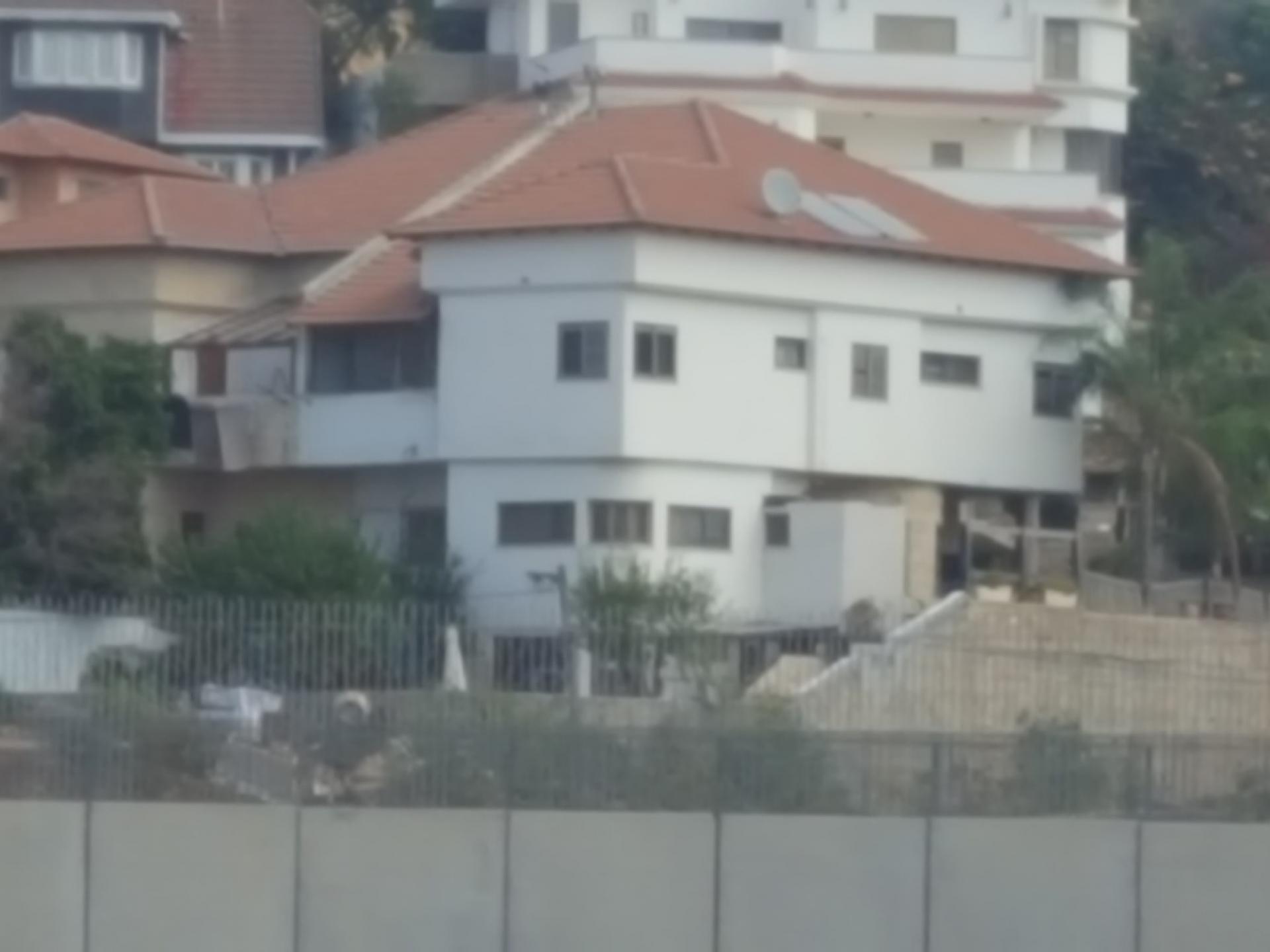
The villas of Sha’arei Tikva fill the area up to the wall.
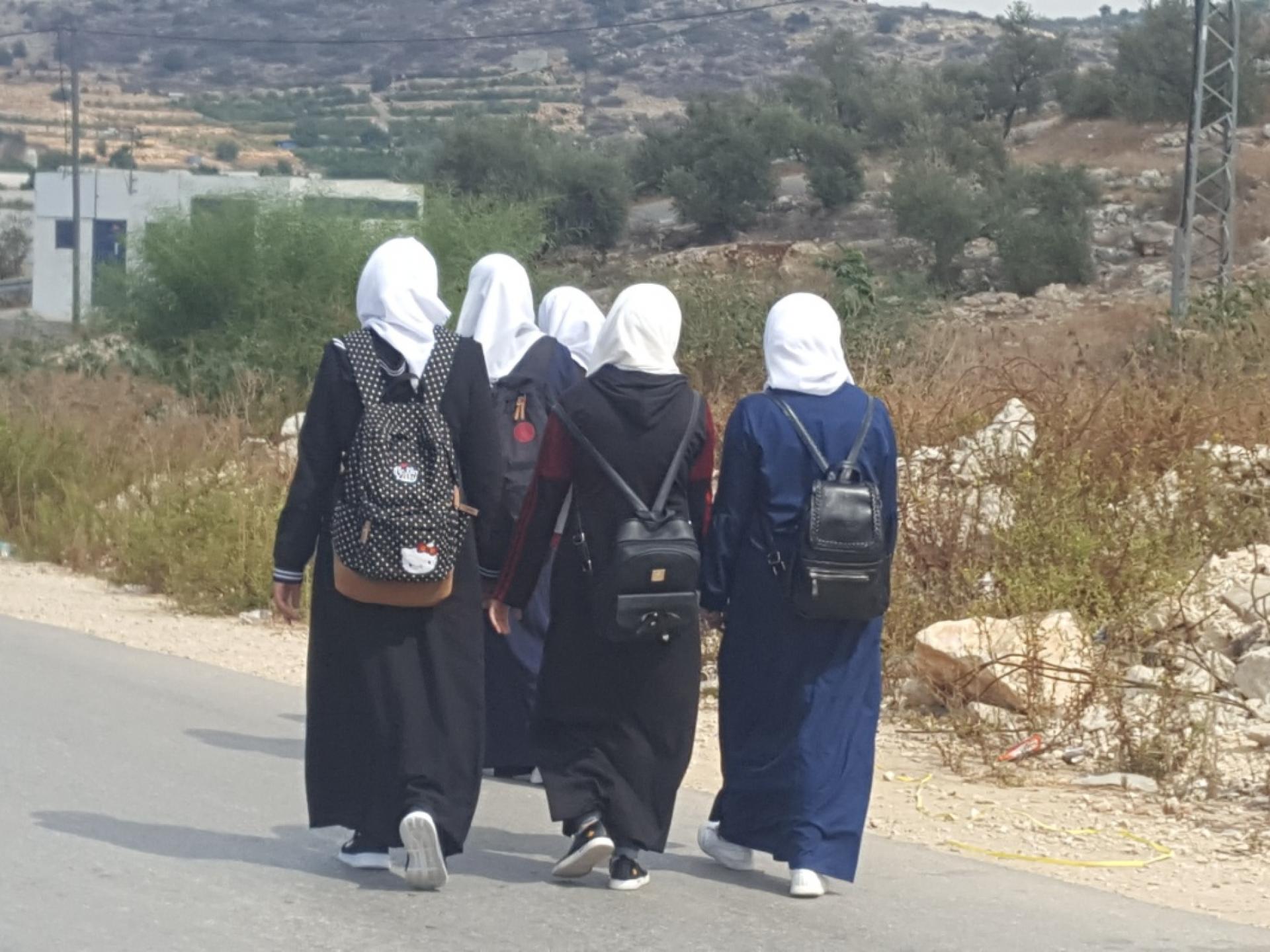
Pupils from the longstanding school between ‘Azzun ‘Atma and Beit Amin returning home after school.
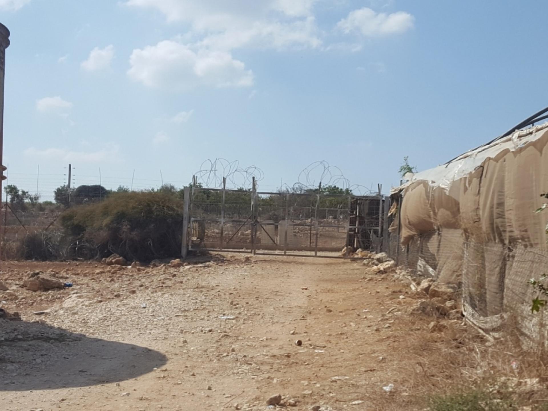
We descend to the dirt road to Abu Salman checkpoint (1419)
We go to the municipal building even though we haven’t made an appointment. We’re welcomed.
There are two agricultural checkpoints/gates at Abu Salman.
One, 1419, is open from 06:50 to 07:00 and from 17:05 to 17:15.
The other, 1447, is open from 06:00 to 06:40, from 12:45 to 13:00 and from 16:40 to 17:00.
A few restrictions were lifted for the olive harvest.
They have no problems with the army. They see military vehicles driving on the other side of the wall. Many Abu Salman residents work in Israel. It’s important to them to be able to continue making a living, and they want only to live in peace.
We’re familiar with their main problem – the demand to divide the family land among the heirs.
A Palestinian from the small village of Al Mudwar joins the conversation. He’s the chairman of a Palestinian agricultural organization. They grow za’atar and olives. About 25 people work in Israel, crossing through the Eyal checkpoint.
There are no walls or fences between them and their land.
Many of the village young people are enrolled in higher education, engineering and medicine, and of course they’re very proud of them.

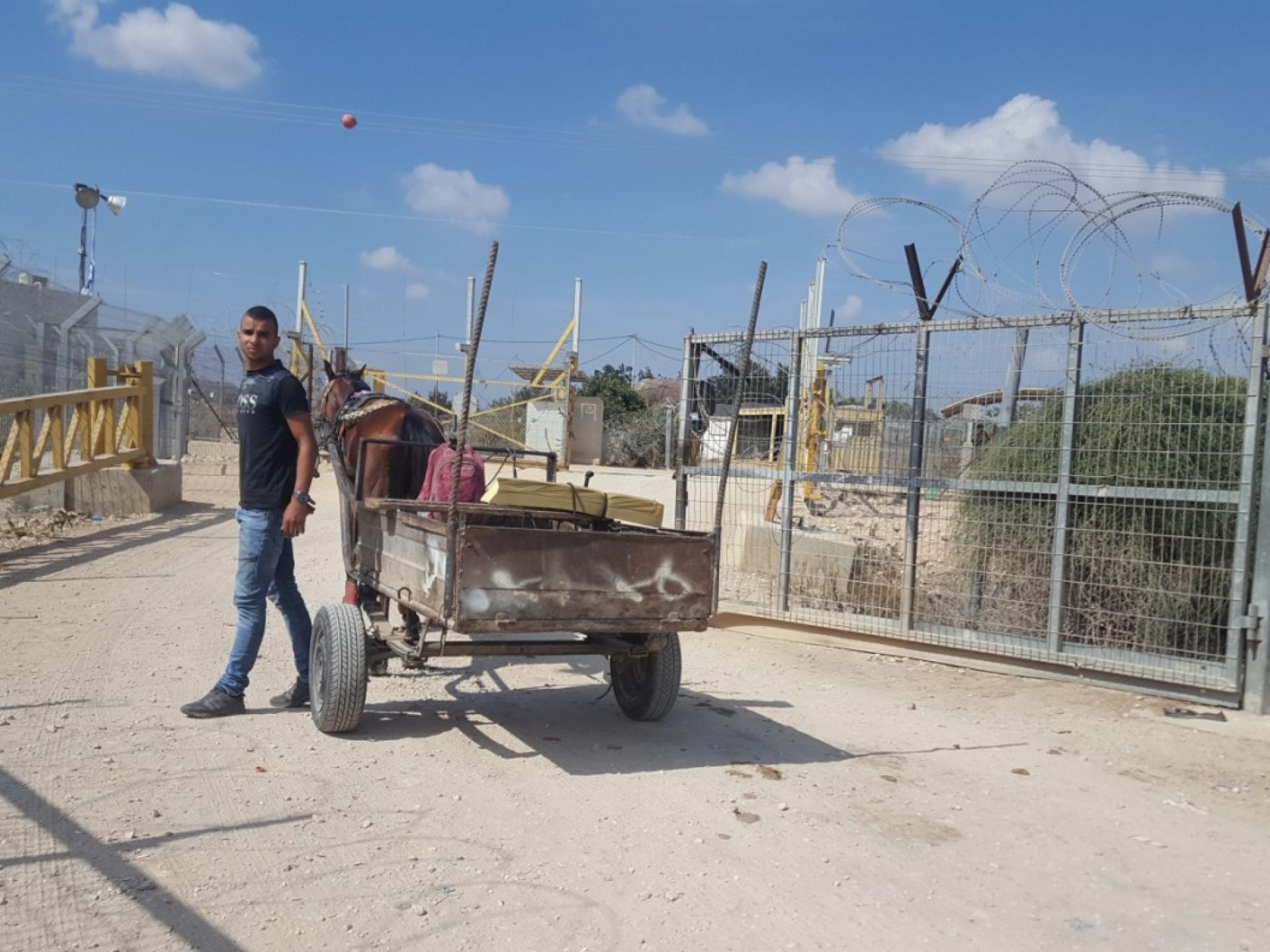
In the background of the checkpoint are the villas of Nirit, a small community in the Sharon region.
Opposite the checkpoint we get on a dirt road to the small village of Jaloud, which doesn’t appear on most maps.
We try find a Palestinian we’d met more than a year ago. We were impressed by him and by his fluency in Hebrew and decided at that time to return to interview him. He’s hospitalized; his daughter-in-law gave us his phone number.
We continue to Habla checkpoint (1393), from the Palestinian side.
Here too MPs warn us not to photograph. But it’s impossible without at least one photo…
We didn’t reach two checkpoints this time – Ras Tira north (1327) and Ras Tira east (1265). We’ll get to them during our next shift.
'Izbet Jal'ud / Abu Salman North (1419)
See all reports for this place-
Abu Salman is an agricultural checkpoint at the separation wall in the village of Jal'oud between the Abu Salman checkpoint and the Hablaa checkpoint. It is open only for 15 minutes twice a day and is used by farmers Abu Salman and Izbat Jal'oud to reach their lands in the seam area north of the Oranit settlement.
-
Eliyahu CP (109) / Crossing
See all reports for this place-
Eliyahu CP (109) / Crossing This checkpoint, also known as the Fruit Crossing, is one of the main checkpoints between Israel and the West Bank. It is located on Route 55 between Alfei Menashe and the turn to Qalqilya and Zufin, more than 4 km east of the Green Line, in the separation fence, which separates Qalqilya from its lands to the south, thus leaving Alfei Menashe West of the fence - the Seam Zone. This checkpoint, a few kilometers across the Green Line, is intended for "Israeli settlement in the West Bank and the population of the Seam Zone." It is managed by a civil company. Palestinians with a special permit for their lands in the seam area are also allowed to pass through it, on foot, and sometimes by car.
-
Habla CP (1393)
See all reports for this place-
Habla CP (1393)
The Habla checkpoint (1393) was established on the lands of the residents of Qalqilya, on the short road that
connected it for centuries to the nearby town of Habla. The separation barrier intersects this road twice and cut off the residents of Qalqilya from their lands in the seam zone.(between the fence and the green line).
There is a passage under Road 55 that connects Qalqilya to the sabotage This agricultural barrier is used by the farmers and nursery owners established along Road 55 from the Green Line and on both sides of the kurkar road leading to the checkpoint.
This agricultural checkpoint serves the residents of Arab a-Ramadin al-Janoubi (detached from the West Bank), who pass through it to the West Bank and back to their homes. The opening hours (3 times a day) of this agricultural checkpoint are longer than usual, about an hour (recently shortened to 45 minutes), and are coordinated with the transportation hours of a-Ramadin children studying in the occupied in the West Bank. Nina SebaAug-18-2025Habla: The gate is in the process of closing
-
Kufr Thulth
See all reports for this place-
Kufr Thulth is located in the western part of the West Bank, in the Qalqiliya district. According to archeological evidence, this village was inhabited as early as the Early Bronze Age. Findings have been dated there to Hellenistic, Roman, and Byzantine times. The village is situated on road 446, south of the Palestinian town of Azoun and north of Qanah River. It numbers 5,606 inhabitants as of 2017.
After the signing of the Oslo Accords, the built-up southern part of the village was categorized as Area B, comprising about 11% of its area, but nearly all of its farmland is classified as Area C.
Israel has confiscated 367 dunams of the village lands, and the area of neighboring village Arab Al Hula, in order to construct the settler-colonies of Karnei Shomron, Ginot Shomron, Ma’ale Shomron, and Immanuel, as well as the Separation Fence (splitting the village itself), and prevented villagers to access their farmlands lying near the settler-colonies. The authorities declared the area a nature reserve, and thus prevented access or any tending that would change the nature of the local land.
The Israeli army and the settler-colonists continue to harass the Palestinian farmers who visit their own lands, attack their herds and destroy trees and any other kind of farm crop, uproot trees and pollute water sources with sewage or toxic waste in order to make the Palestinians leave.
For further information: http://vprofile.arij.org/qalqiliya/pdfs/vprofile/kufrthulth_vp_en.pdf
-