
Jalud, Jama’in, Za’tara (Tapuah), Zeta
Jalud
12:30 – The checkpoint at the Zeita-Jamain junction is open.
No delays at the Za’atra junction. As usual soldiers are waiting at the hitchhikers’ stop.
13:00 – Jalud. Appointment with A., head of the local council, at his office in village council.
A new settlement named “Geulat Zion” is to be built on Jalud farm land. The violent settlements Esh Kodesh, Kida, Yishuv Daat, Ahiya and Adey Ad, some of which were built on Jalud land, are to be ratified. The village intends to launch a legal fight to keep its land. The first step will be their demand to evacuate “Adey Ad”.
A., head of the local council, is worried. He describes how the villagers have been robbed of their land in a slowly ongoing but consistent process throughout the years of the occupation. In 1978, land was confiscated for military purposes and also to build the Shiloh settlement. Since then, and especially during the last 15 years, some of the most violent settlements have been built around Shiloh and thousands of dunams of farmland have been confiscated from the surrounding villages. The Palestinians are being robbed of land which they have been working for generations under the pretext that this land belongs to the state.
85 % of Jalud’s land is in area C. The villagers are afraid that all this land might be taken from them. A. claims that the authorities confiscate the land due to military needs, or they declare it state land in order to prevent the land owners from opposing the confiscation. He complains about the fact that private land owners are prevented from reaching their land under the pretext of security needs. And when the land is not cultivated the settlers take possession of it for their private needs.
A. is concerned about the massive building projects in the settlements. “This is a very large project”, he explains, “5 settlements: Adey Ad, Kida, Esh Kodesh, Yeshuv Hdaat and Ahiya are to be ratified in accordance with the government resolution of 12.10.15.”
He shows a map illustrating the expansion of the settlements on Jalud’s agricultural land in area C. The blue areas have been confiscated under the pretext that they are state land.The green land between them is private land that cannot be reached due to security reasons. These areas are being controlled by the settlers who cultivate approximately 2000 dunams of this land.
Moreover, in accordance with the decision of Israeli authorities the illegal settlement, Gulat Zion, is to be ratified. On the map this settlement is colored pink. The plan is to build 139 housing units. The settlement will extend over a large area and will connect between all the settlements in such a way that at the end of the project the “Seven Hill City” will have been completed, even though the “Ten Hill City” already exists.
Picture 1. Settlement map: The settlements (blue) in the Jalud area. The yellow stripe marks the road. The pink area is intended to be a new settlement named “Geulat Zion” which will connect between the “Shvut-Rachel” settlements and Shiloh.

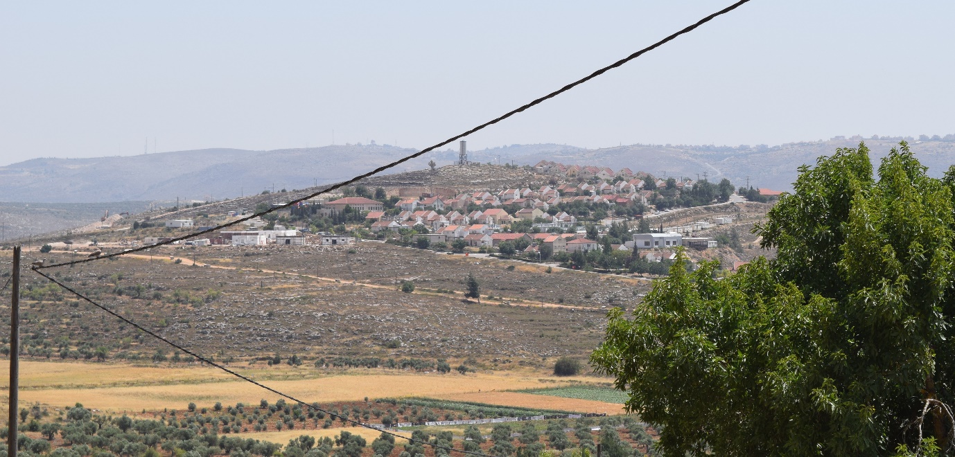
Picture 2. The Achiya settlement seen from the roof of the local council in Jalud. The settlement’s buildings are bordering on the houses in the village.

Picture 3. The Shiloh settlement.

Picture 4. The houses in the Adey Ad settlement can be seen on the mountain ridge.
Jalud
See all reports for this place-
Jalud
A Palestinian village, about 15 km south of Nablus: to the south are the settlements of Shiloh, Shvut-Rachel, and another settlement. Ge'ulat _Zion, is about to be built on its lands. The violent outposts of Esh Kodesh, Kida, Yeshuv Hda'at, Ahaya, and Adei Ad. Some outposts were established on Jalud lands, and are about to receive kosher. The village is planning to fight for its land.
85% of the village's lands are in area C, and its residents are anxious that they may be taken from them. In fact, throughout the years of occupation, thousands of dunams of agricultural land were expropriated from Jalud and the surrounding villages for military and settlement purposes. These are lands that were cultivated for generations by Palestinians and were taken from them without the possibility of resistance.
Since the death of the 16-year-old boy from the hills, Ahuvia Sendak, in December 2020, during a police chase near the settlement of Kochav Hashar, there has been a significant increase in the number of violent attacks by settlers, which have already become routine all over the West Bank. The attacks include breaking into the village mainly at night, setting fire to vehicles, smashing windows and windshields, demolishing construction sites and stealing equipment, shooting with live fire, blocking roads, and more. In recent years, IDF soldiers have been backing and sponsoring these riots. -
Jalud A Palestinian village, about 15 km south of Nablus: to the south are the settlements of Shiloh, Shvut-Rachel, and another settlement. Ge'ulat _Zion, is about to be built on its lands. The violent outposts of Esh Kodesh, Kida, Yeshav Ya'at, Ahaya, and Adei Ad. Some outposts were established on Jalud lands, and are about to receive kosher. The village is planning to fight for its land. 85% of the village's lands are in area C, and its residents are anxious that they may be taken from them. In fact, throughout the years of occupation, thousands of dunams of agricultural land were expropriated from Jalud and the surrounding villages for military and settlement purposes. These are lands that were cultivated for generations by Palestinians and were taken from them without the possibility of resistance. Since the death of the 16-year-old boy from the hills, Ahuvia Sendak, in December 2020, during a police chase near the settlement of Kochav Hashar, there has been a significant increase in the number of violent attacks by settlers, which have already become routine all over the West Bank. The attacks include breaking into the village mainly at night, setting fire to vehicles, smashing windows and windshields, demolishing construction sites and stealing equipment, shooting with live fire, blocking roads, and more. In recent years, IDF soldiers have been backing and sponsoring these riots.
-
Jamma'in*
See all reports for this place-
Jamma'in*
Jamma'in is a small town, with some of the best quarries in the area. The stone is sold all over Palestine and Israel and even outside the country. The city also has an industrial area. Although they are close to the Ariel and Tapuach settlements, Jama'in farmers have no daily problems with settlers. Harassment occurs mainly during the October harvest season - the settlers sometimes try to drive the farmers out of their plots. Jama'in has its own info-icon water reservoir tower. The water is obtained from sources and paid for by the Palestinian Authority. The city has one clinic that opens only 2-3 days a week. The biggest problem is that there is only one hospital in Nablus in an area of about 10,000 residents. This hospital is too small, does not have enough equipment, and not enough doctors.
Zeita / jama'in is a village of about 3000 inhabitants near Jama'in and Ariel. In the 1980s, land was taken from the village and transferred to settlements. Farmers in the village have lost some of their income. The settlements are located on the ridges, further away from Zeita, which is in the valley. The village does not often suffer from harassment.
The water sources for Zeita and Jama'in that have supplied water to the villages for centuries have been confiscated by the Mekorot company and the water is flowed to Ariel. Without a reasonable info-icon water supply the villages cannot develop agriculture or any industry.
The electricity comes from the Israeli Electric Company through Ariel and Jama'in.
The IDF oversees the main roads and entrances to the villages. -
Jama'in is a small town, with some of the best quarries in the area. The stone is sold all over Palestine and Israel and even outside the country. The city also has an industrial area. Although they are close to the Ariel and Tapuach settlements, Jama'in farmers have no daily problems with settlers. Harassment occurs mainly during the October harvest season - the settlers sometimes try to drive the farmers out of their plots. Jama'in has its own info-icon water reservoir tower. The water is obtained from sources and paid for by the Palestinian Authority. The city has one clinic that opens only 2-3 days a week. The biggest problem is that there is only one hospital in Nablus in an area of about 10,000 residents. This hospital is too small, does not have enough equipment, and not enough doctors. Zeita is a village of about 3000 inhabitants near Jama'in and Ariel. In the 1980s, land was taken from the village and transferred to settlements. Farmers in the village have lost some of their income. The settlements are located on the ridges, further away from Zeita, which is in the valley. The village does not often suffer from harassment. The water sources for Zeita and Jama'in that have supplied water to the villages for centuries have been confiscated by the Mekorot company and the water is flowed to Ariel. Without a reasonable info-icon water supply the villages cannot develop agriculture or any industry. The electricity comes from the Israeli Electric Company through Ariel and Jama'in. The IDF oversees the main roads and entrances to the villages.
-
Za'tara (Tapuah)
See all reports for this place-
Za'tara (Tapuah) Za'tara is an internal checkpoint in the heart of the West Bank, at the intersection of Road 60 and Road 505 (Trans-Samaria), east of the Tapuah settlement. This checkpoint is the "border" marked by the IDF between the north and south of the West Bank, in accordance with the policy of separation between the two parts of the West Bank that has been in place since December 2005. At the Za'tara checkpoint, there are separate routes for Israelis and Palestinians. In the route for Israelis, there are no inspections and the route for Palestinians inspects. The queue lengthens and shortens suits. The checkpoint is open 24 hours a day. The checkpoint is partially staffed and the people who pass through it are checked at random.
 Ronit Dahan-RamatiJun-9-2026Za'atara (Tapuach Junction). The Temple Flag Above a Station
-
Zeta South (564)
See all reports for this place-
Zeta South (564) Agricultural checkpoint. Allows passage to farmers whose lands have been imprisoned beyond the Separation Barrier. The crossing is allowed for special permit holders, for three days a week: noon and afternoon for 15 minutes at a time. The Palestinians who need to pass are complaining about the short times and the few days they can work on their land.
-