
Jerusalem, Ras Al Amud: a rare case, a Palestinian developer received a permit for 24 apartments
7:00, Sheikh Sa’ed – Before arriving we received a phone update from N. of the neighborhood committee: only blue card holders from the Jabel Mukaber neighborhood and the adjacent (and blockaded) neighborhood of Sheikh Sa’ed can pass now, with the exception of the students who pass in the mornings without problems. Since the beginning of the war, there is no passage for workers with a Palestinian certificate and valid work permits. Only in the case of an urgent medical appointment does passage to Jerusalem get approved for a Palestinian ID holder. There were house demolitions in Jabel Mukaber during the war, in most cases the people destroyed them themselves so as not to pay dearly for the demolition.
The economic situation in Sheikh Sa’ed is difficult, and there is great concern about the entry bans in Ramadan. The joy of Ramadan was destroyed…
The gray wall serves as a good background for advertising the telephone numbers of taxi services

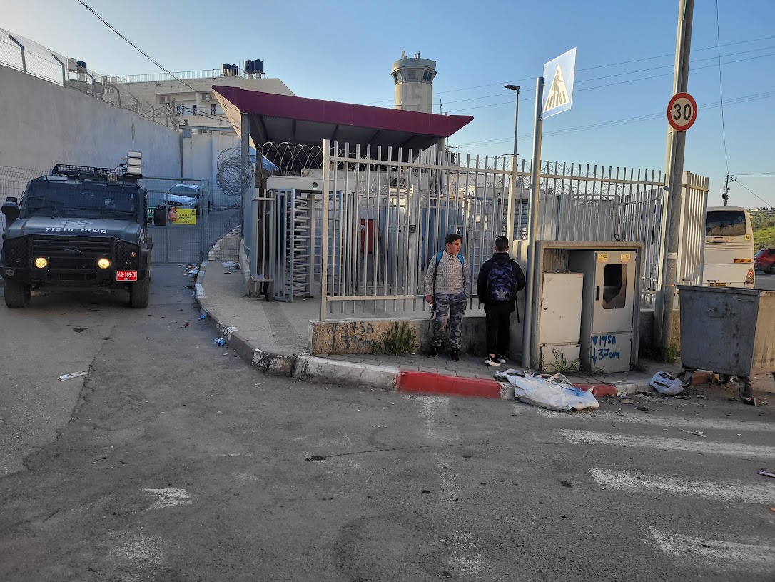
We met some young workers with blue certificates waiting for a contractor to take them to work. They didn’t go to high school, according to them there is no point, because livelihood comes first. They weren’t eager to speak with us. Then a border guard jeep arrived, parked noisily at the checkpoint entrance near the wall, and everyone moved away from it. We later met the same jeep near the wall in Abu Dis. They didn’t have to travel the narrow, winding and congested road to Ras El Amud. The security road could have solved the traffic problems for the residents of the eastern city, but of course, no.

Ras Al Amud and Abu Dis: We photographed excavations for construction from the American road on the slope opposite. Looks like a mirage. Approved construction? We inquired (truth is, we were afraid it was a pirate settlement).
According to Hagit Ofran, it is a rare case that a Palestinian developer received a permit for 24 apartments.

On our way we also saw a school under construction. It is interesting that it has the architectural features of a mosque. The mayor is proud of this little public construction, him who often approves house demolitions even during the war.

We went up to the “Cliff” hotel which has become a pitiful skeleton surrounded by the separation wall. We looked at the hill with the noble pine trees that abuts the Abu Dis wall. Beyond the wall is the building that was planned to be the Palestinian parliament. There will be built “Kidmat Zion”, an initiative of “Ateret Kohanim” which was hastily approved, pending public comment, in an expedited procedure during the war despite previous reservations. 384 housing units that will be stuck in the throat of Al Quds.
A resident of a traditional stone house came out to meet us in front of the Cliff Hotel. He and his wife are alone in the big house. They both have special permission to stay in their home without a blue certificate. The daughter and her children received permits to move between the parents’ home and the educational institutions in Azaria. At some point, the administration decided that it was unnecessary and canceled the transit permits and the daughter’s family moved to Azaria, beyond the wall. Two months ago, the father was hospitalized in Makassed in Jerusalem due to a heart attack. The daughter was not allowed to visit him.

The Olives checkpoint: The clearest sign that there are almost no passers-by at this checkpoint is that the shuttle conductor and buses are absent from the scene. We climbed the hill to overlook the a-Za’im checkpoint, in which the last attack took place near Ma’ale Adumim. In the mornings there are huge queues of Israeli cars from the Dead Sea region, the valley and Ma’ale Adumim. These queues were used by terrorist youths from villages in the Hebron area to shoot at those stuck in traffic jams. They were of course not allowed to cross into Jerusalem through the a-Za’im checkpoint, but right before the checkpoint there is an entrance to the road for Palestinians only towards Anata and from there to a Palestinian area leading to Ramallah. That was enough. Now the crossing to Anata is blocked, and they added one or two checkpoints before A-Za’im (we will go to check soon).
Following the attack – the entire southern area of E1 between Ma’ale Adumim and Keidar settlements was declared within a day as state land – 2,600 dunams from Abu Dis and Al-Ezariya lands – with planning for 1,500 housing units for Jews. There is also an intention to speed up the construction of a road bypassing the E1 area for Palestinians only, which will transport the Palestinians through a tunnel from Za’im to Ezariya and turn the coveted E1 over to Jews only. Is it really possible that divine providence also works in terrorist attacks and everything is for the better?
Anicdote: we noticed a thin and dark water pipe winding between the rocks down the hill towards the separation wall beyond which lies the eastern Abu Dis/Ezariya. We followed it, and wonder of wonders, it pushed through the massive separation wall towards the other side.


Shuafat and Anata refugee camp – the camp is an area without civilian and security supervision, except for night raids by the Security Forces and the demolition of houses. After the heavy rains, the roads are worse than they were. Only blue certificates grant the right of passage. The buses move to Jerusalem, after all their passengers have been unloaded and their IDs checked. Students are checked before boarding buses to schools in Jerusalem.
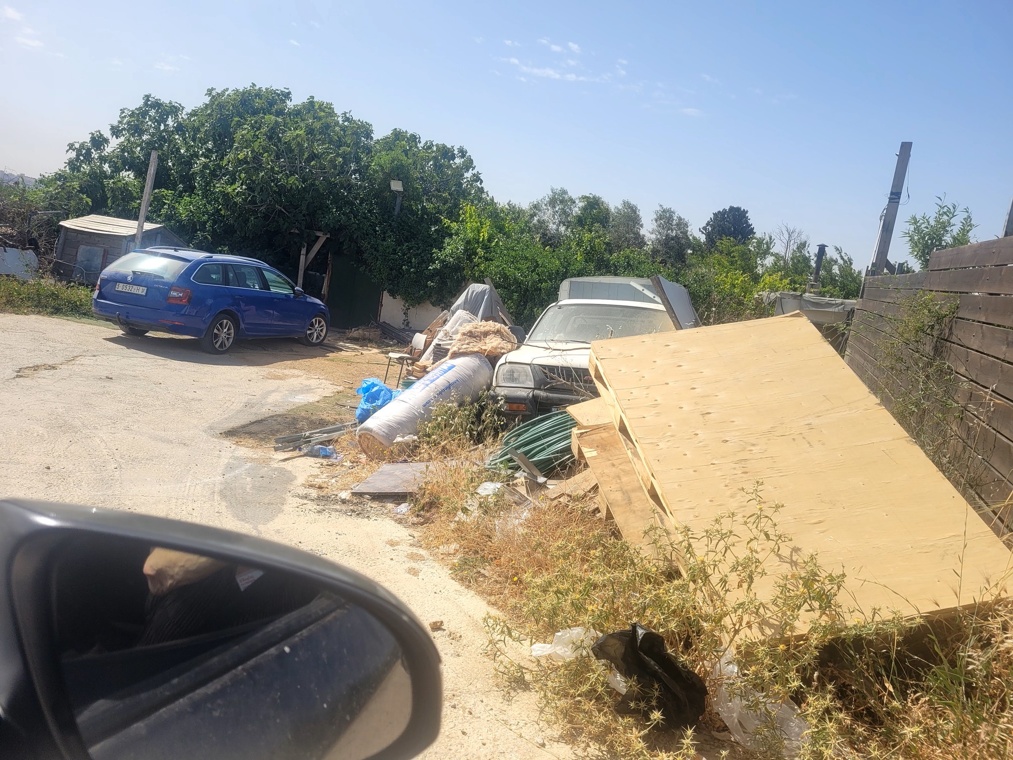
The border between the Shuafat and Anata camps is not marked, although there are rumors of an internal barrier being erected there. After we asked, Kamal took advantage of the trip to jovially identify “Mashtubot” for us (revived Total Loss cars), many of them.
At the exit from Anata, they are working on a huge traffic circle and the extension of access roads to road 437. As always, we don’t know the exact reason for the expansion works – but are quite sure that this was done for the benefit of the settlers who move on these roads and encounter traffic jams.
Abu Dis / Lazarus gate (formerly The Wicket)
See all reports for this place-
Abu Dis / Lazarus Checkpoint/Gate (east of the former “wicket”)
Construction of the wall in the Abu Dis area blocked all the gaps that allowed people to cross from al-Ezariya to the neighbourhoods of Abu Dis and Ras al 'Amud that are located within Jerusalem’s municipal boundary. The Lazarus checkpoint is a gate in the wall adjacent to the Lazarus Monastery. Until 2011 it had a door for pilgrims to al-Ezariya and for the monastery’s kindergarten pupils from al-Ezariya. The crossing is currently closed, but the site has infrastructure for conducting inspections.
-
Checkpoint Shu'afat camp / Anata-Shu'afat (Jerusalem)
See all reports for this place-
The Shu’afat checkpoint is located in the northern part of East Jerusalem at the exit from the village of Anata and the Shu’afat refugee camp, which are located in the area annexed to Jerusalem in 1967. The refugee camp borders the Shu’afat neighborhood to the west, Pisgat Ze’ev to the north, the French Hill neighborhood to the south and the planned expansion of Ma’aleh Adumim to E-1 in the east. It was established in 1966 for 1948 refugees from the West Bank and was populated after the Six Day War by persons who had been expelled from the Jewish Quarter. Today its population comprises some 25,000 people holding blue ID cards and some 15,000 people with Palestinian ID cards. The camp lacks adequate infrastructure and services, and suffers from poverty, neglect and overcrowding. All its buildings are connected to the public electricity and water infrastructure, but not all are connected to the sewer system. The camp’s services are provided by UNRWA, except for those such as health clinics and transportation of pupils to schools in Jerusalem. In 2005, the Israeli High Court of Justice rejected a suit by the residents requesting that the route of the separation fence be drawn such that the camp would remain on the Israeli side, but conditioned its approval of the route on the establishment of a convenient and rapid crossing facility for the inhabitants of the neighborhood, most of whom are residents of Jerusalem.
A temporary checkpoint operated there until December, 2011. It was extremely congested during rush hours, and dangerous for pedestrians (especially children) because of inadequate safety provisions. The new checkpoint was inaugurated south of the old one, for public and private transportation and for pedestrians, intended solely for the residents of the camp – holders of blue ID cards, and those with Palestinian ID cards who possess appropriate permits. There are five vehicle inspection stations at the checkpoint, and two for pedestrians (one of which is currently closed) where scanners have been installed but are not yet operating. According to the army, representatives of government agencies will also be present to provide services to residents of the neighbourhood. The pedestrian lanes are very long, located far from the small parking lots, and accessible through only a single revolving gate. Anat TuegJan-25-2026Anata: A new outpost has been built south of the junction
-
Jabel Mukaber (Jerusalem)
See all reports for this place-
Jabal Mukaber is located on the eastern and northern slopes of Mount Atz (or "Jabal Mukaber" in its Arabic name). It was founded by the Bedouin tribe of Arab a-Sawahra. Today, the village is considered one of East Jerusalem neighborhoods. It numbers about 30,000 residents living on 1,010 dunams. The village has five main clans, numbering several hundred families. During the British Mandate, the tribe moved to live in a huge complex of permanent housing that was named as-Sawahra, with the part east of the Kidron Valley called as-Sawahra a-Sharqiya (Eastern Sawahra) and the western part – Sawahra al-Gharbiyya. The separation fence currently separates Jabal Mukaber from Sawahra a-Sharqiya.
The houses of Jabal Mukaber wrap around the ridge from the north and east, along one of the tributaries of the Kidron River. In the eastern part, the village houses border the Jewish East Talpiot neighborhood. most of the residents of the village are considered residents of Jerusalem, have blue identity cards and enjoy full civil rights in Israel, except for the right to vote for the Knesset and receive an Israeli passport.
The residents of Jabel Mukaber suffer from lack of Outline Plan for the village, overcrowding and a lack of residential and public spaces. Thus, there is a phenomenon of illegal construction in the neighborhood. Demolitions of houses without building permits have been carried out over the years, but since the 7th October War, their rate has increased.
In 2010, a wall was built separating it from its sub-neighborhood A-Sheikh Sa'ed. The wall left many residents with Palestinian IDs without Jerusalem residency and they lost their freedom of movement in Jerusalem.
In the northern part of the neighborhood, construction began in 2005 of a luxury Jewish neighborhood called Nof Zion. The neighborhood was planned to have about 400 housing units, a commercial center and a hotel. However, in April 2025, it was announced that it would be expanded. The apartments were marketed mainly to the religious community in the United States. Alongside the Nof Zion neighborhood, a plan is being promoted to establish the Nof Zahav neighborhood on state land in the Jabal Mukaber neighborhood. This plan also includes residential areas and hotels for tourists, and a place has been allocated for a synagogue, but not for the construction of a mosque.
During and after the Second Intifada, several residents of the neighborhood were involved in terrorist attacks: On March 6, 2008, the attack on Merkaz HaRav Yeshiva in the Kiryat Moshe neighborhood of Jerusalem, in which eight of the yeshiva's students were murdered; On November 18, 2014, an attack on the "Kehilat Bnei Torah" synagogue during morning prayers in the Har Nof neighborhood of Jerusalem; A resident of Jabal Mukaber carried out a car bombing on the Armon Hanatziv promenade. The terrorist drove his truck into a group of cadets. Updated April 2025
-
Ras Abu Sbitan (Olive Terminal)
See all reports for this place-
A large checkpoint/crossing to the area of a-Tur, Abu Dis and the Old City; only for pedestrians. Located on Jerusalem’s municipal boundary.
One of the major crossings in Jerusalem’s central sector. It is located on the separation fence between the northern portion of the al-Ezariya neighborhood and the neighborhood of a-Tur and the rest of East Jerusalem. It is manned by Border Police soldiers and private security companies and operates 24 hours a day. Palestinians are forbidden to go through, other than permanent residents of East Jerusalem (holders of blue ID cards) and holders of work and commercial permits who are allowed through only on foot.
-
Sheikh Sa'ed
See all reports for this place-
A checkpoint limited to pedestrians, located on Jerusalem’s municipal boundary.
The checkpoint sits on the separation fence at the entrance to Sheikh Sa’ad, dividing it from its neighbourhood of Jabel Mukkabar. It’s manned by Border Police soldiers and private security companies and operates 24 hours a day. Palestinians are forbidden to go through, other than residents of Jabel Mukkabar or Sheikh Sa'ad who have permits. Both groups are permitted through only on foot. Residents of East Jerusalem who don’t live in Jabel Mukkabar are also allowed to cross to Sheikh Sa’ad, but not in the opposite direction; they must return through the Sawahira ash Sharqiya checkpoint.
 Anat TuegMay-20-2026Nabi Samwil. This is what living conditions look like in an enclave village without building or renovation permits
-