
Masafer Yatta


Going by Basel’s instructions, we drove from A-Tuwani east on a dirt road, towards the village of Hatat al-Daba’ (“Hyena’s Corner, The Hyena Female”).
On the left, Havat Maon, which is an illegal outpost, and includes an army post.
Photo No. 1: Expansion of Havat Maon to the east, looks like a barn and pen, which will cause the strengthening of the isolation of the village of Tuba, which is almost entirely surrounded by the Maon settlement and Havat Maon.
Passing through a Khirbet Rakiz , which consists of scattered homes. The entire road is marked by the settlers with the usual marking of the Society for the Protection of Nature.
To the right of the hill, Umm Fakara, during the operation of Guarding the Wall, the army put up 8 cement blocks on the road. And one can still see the water pipes which were laid down years ago, coming out of the ground, cut off, of course, by the Civil Administration.
Between Umm Fakara and Havat Maon, the sign of the cave. After the settlers tried to take control of it, the Palestinians arranged plaster and electricity there, and are on guard there.
To the left of the road, private but not cultivated Palestinian land.
Reaching the top of the hill, in front of Hatat al-Daba’, here the road was recently blocked by piles of rocks and dirt, at night the activists arrived and opened the road again. Figure 2.
Beyond the blockade are 10 small Palestinian communities.
The hypocrisy of this policy is clear. If it is a military area, Maon must be evacuated first. But Maon with all its equipment is standing and thriving, and its people are abusing their Palestinian neighbors.
South Hebron Hills
See all reports for this place-
South Hebron Hills
South Hebron Hills is a large area in the West Bank's southern part.
Yatta is a major city in this area: right in the border zone between the fertile region of Hebron and its surroundings and the desert of the Hebron Hills. Yatta has about 64,000 inhabitants.
The surrounding villages are called Masafer Yatta (Yatta's daughter villages). Their inhabitants subsist on livestock and agriculture. Agriculture is possible only in small plots, especially near streams. Most of the area consists of rocky terraces.Since the beginning of the 1980s, many settlements have been established on the agricultural land cultivated by the Palestinians in the South Hebron Hills region: Carmel, Maon, Susia, Masadot Yehuda, Othniel, and more. Since the settlements were established and Palestinians cultivation areas have been reduced; the residents of the South Hebron Hills have been suffering from harassment by the settlers. Attempts to evict and demolish houses have continued, along with withholding water and electricity. The military and police usually refrain from intervening in violent incidents between settlers and Palestinians do not enforce the law when it comes to the investigation of extensive violent Jewish settlers. The harassment in the South Hebron Hills includes attacking and attempting to burn residential tents, harassing dogs, harming herds, and preventing access to pastures.
There are several checkpoints in the South Hebron Hills, on Routes 317 and 60. In most of them, no military presence is apparent, but rather an array of pillboxes monitor the villages. Roadblocks are frequently set up according to the settlers and the army's needs. These are located at the Zif Junction, the Dura-al Fawwar crossing, and the Sheep Junction at the southern entrance to Hebron.
Updated April 2022
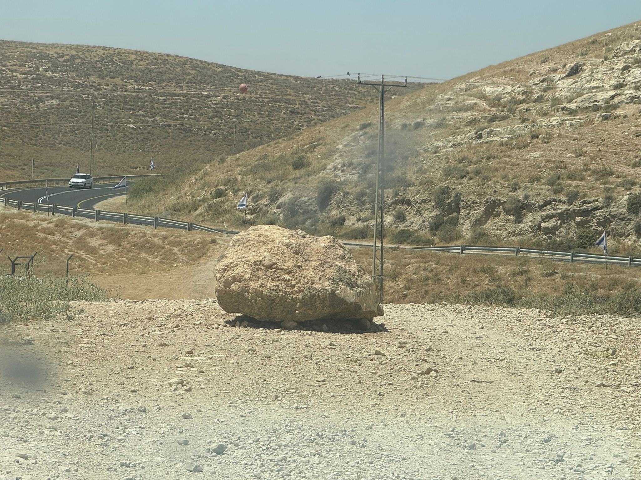 Muhammad D.Jun-7-2026A stone placed by settlers on the road leading to the Thiel family's territory in Rahwa
-