
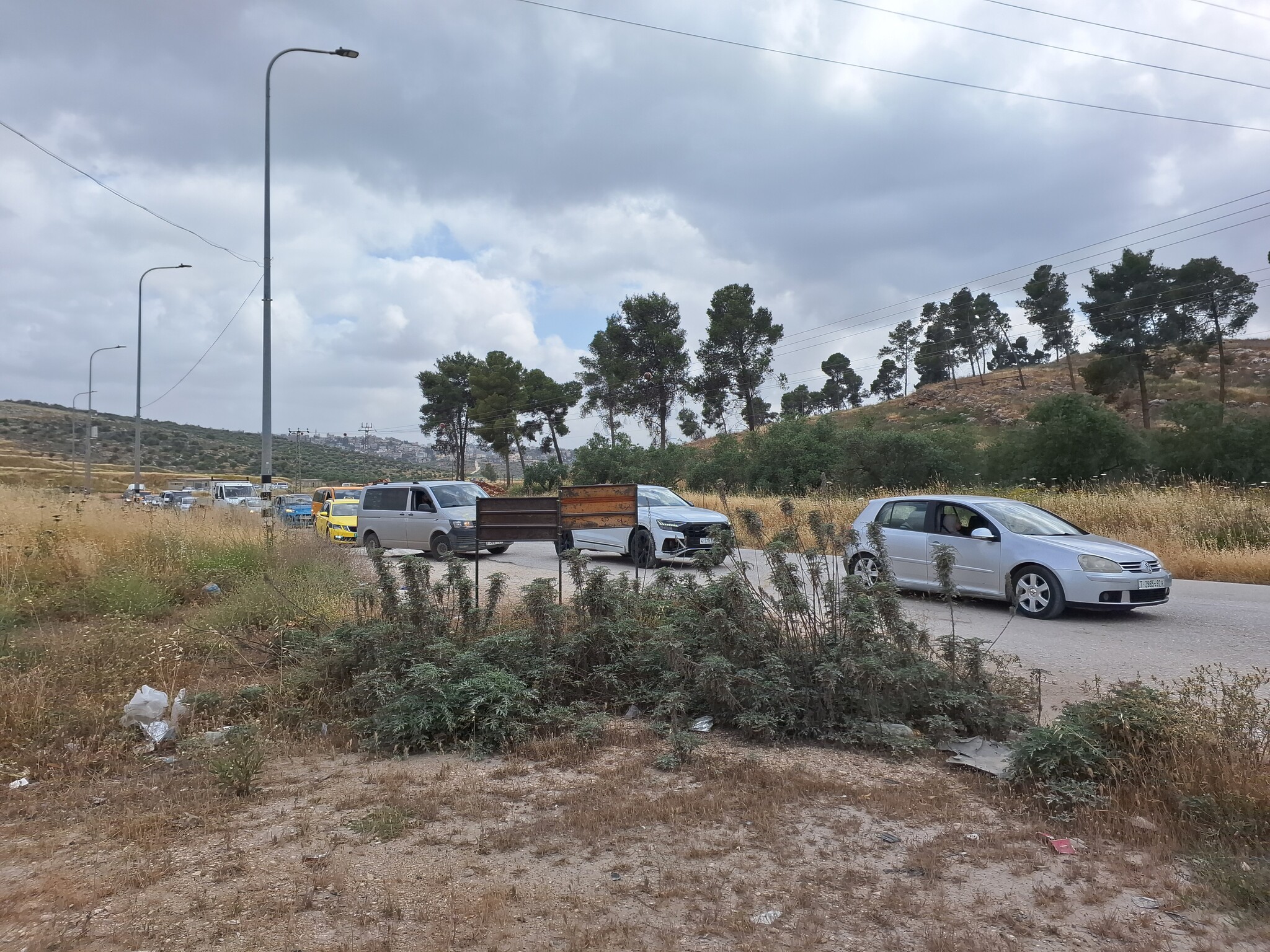
Nablus Governorate: Traffic jams on roads leading to checkpoints

We left at 14:30.
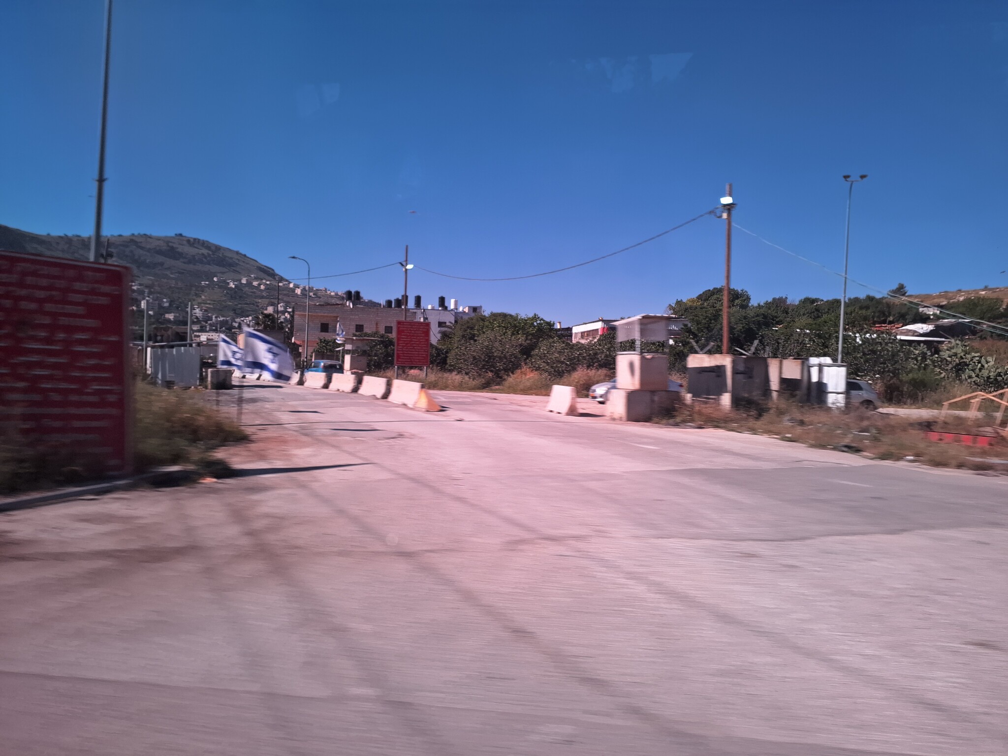
Soldiers patrolling the main street and both military posts are manned.
Awarta Huge traffic jam from Awarta for travelers to Nablus due to the strict checks and also for those returning from Nablus towards Awarta.
Beit Furik Traffic jam for those returning from Nablus towards Beit Furik.
15:30 Sara Junction The checkpoint is open. Huge traffic jams for those leaving Nablus due to the checks.
Deir al-Hatab The village is located near the settlement of Alon Moreh east of Nablus. We drove to Deir al-Hatab for financial clarification.
Location Description
'Awarta
See all reports for this place-
Awarta, an internal checkpoint in the heart of the West Bank, is located east of the Hawara checkpoint, at the junction of Roads 555 (which was forbidden for Palestinian traffic in this area) and the entrance road to Nablus. It was one of the four checkpoints that surrounded Nablus until 2009. We used to watch it at Huwwara shifts because it was the only one where goods could be transferred to and from Nablus, using the back-to-back method. It was operated by the army, from 06:00 to 20:00. Until 2009.
 Ronit Dahan-RamatiApr-23-2026Awarta Checkpoint is empty
-
Beit Furik checkpoint
See all reports for this place-
One of the three internal checkpoints that closed on the city of Nablus - Beit Furik to the east, Hawara to the south, Beit Iba to the west. The checkpoint is located at the junction of Roads 557 (an apartheid road that was forbidden for Palestinians), leading to the Itamar and Alon Morea settlements and Road 5487. The checkpoint was established in 2001 for pedestrians and vehicles; The opening hours were short and the transition was slow and very problematic.Allegedly, the checkpoint is intended to monitor the movement to and from Nablus of the residents of Beit Furik and Beit Dajan, being the only opening outside their villages. Since May 2009 the checkpoint is open 24 hours a day, the military presence is limited, vehicles can pass through it without inspections, except for random inspections. (Updated April 2010)
-
Sarra
See all reports for this place-
Sarra
The checkpoint is installed between the Palestinian village of Sera and the district city of Nablus,
Since 2011, internal barriers Located among the West Bank Israeli settlements have somehow allowed, Palestinian residents to travel and move and reach various Palestinian cities.
After the terrible massacre by the Hammas on October 7 upon Israelis in the communities around Gaza, internal checkpoints manned by the army were installed to prevent free passage for Palestinians.
Many restrictions were imposed on the Palestinians in the West Bank. The prevention of movement shuttered the possibility of making a living in Israel. The number of Palestinian attacks by Israeli extremist settlelers increased along with the radicalization of the army against the Palestinians.
The conduct at the Sera checkpoint is one of the manifestations of the restrictions on all aspects of the Palestinians' lives.
-