
Sansana (Meitar Crossing), South Hebron Hills
Meitar Checkpoint – the Hebron children who go on “Beach Day” today crossed without problems, and immediately followed by 5 buses of prisoners’ families on their way to visit their imprisoned relatives.
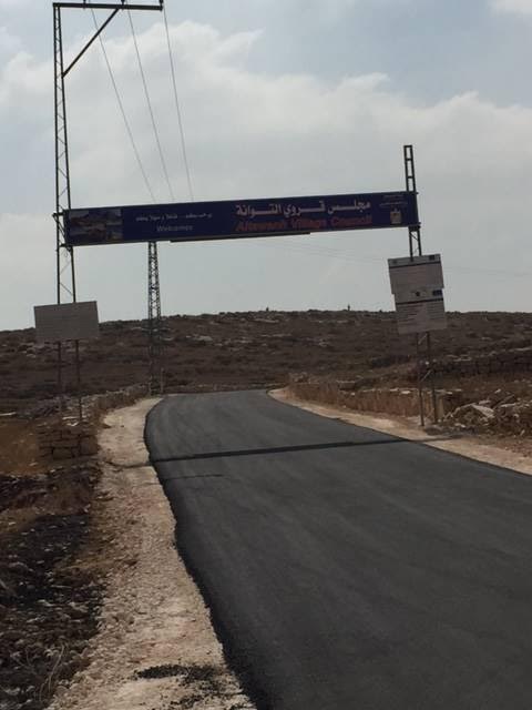
Ever since we began our MW shifts here in 2004 we have maintained close ties with the inhabitants of Khirbet Tuwane. Today we were glad to see the impressive road sign indicating their village name, and the paved road. The barrier that blocked them from proceeding to Yatta town has also been removed.
Some information about Khirbet Tuwane and the neighboring localities:
In the South Hebron Hills Palestinians live without running water and electricity supply, with no legal possibility of constructing and developing their localities, and under constant threat that the structures they did put up without ‘legal’ permission – as no such permission is issued – will be demolished. About one thousand people in this area, half of whom are children, live under tangible threat of expulsion from their homes and destruction of their villages and hamlets, on the claim that they are living inside a firing zone. Background: the Massafer Yatta area, the southern part of the South Hebron Hills, is located in the southern West Bank, close to the ‘green line’, on the edge of the desert. The largest community in the region is the town of Yatta. To the south and east of it, over 30 hamlets are scattered, populated by over 4,000 inhabitants. The area, called Massafer Yatta- Yatta’s offshoot villages – is rich with natural caves. According to a study published by the Ministry of Defense Publications, the first third of the 19th century saw the beginning of a process that lasted until the late 1940s, of Yatta inhabitants leaving the town and living in caves of this area. Some of the caves served as permanent dwellings for families who left Yatta for economic reasons and tilled the land around. Other caves served as seasonal dwellings for shepherds in the grazing season, lasting about 7 months a year. Some caves turned into the shepherd families’ permanent dwellings. At present the inhabitants of the area live mainly in tents and other provisional structures and find meager livelihood in some agricultural crops and sheep- and goat-herding. A field study conducted by B’Tselem and ACRI in autumn 2012 in 12 of the hamlets in the area included within the firing zone shows that most of their inhabitants live there on a permanent basis. Most of their produce is for their own consumption. The Civil Administration does not recognize the Massafer Yatta hamlets and refuses to approve construction plans for them, except for the village of A-Tuwane, inhabited by 350 people, and for which a plan has been prepared. In February 2009 Bimkom organization presented its objections to the proposed plan.
The South-Eastern entrance to Bani Na’im is still closed off.
Meitar checkpoint / Sansana
See all reports for this place-
Meitar Checkpoint / Sansana The checkpoint is located on the Green Line and serves as a border crossing between Israel and the West Bank. It is managed by the Border Crossing Authority of the Defense Ministry. It is comprised of sections for the transfer of goods as well as a vehicle checkpoint (intended for holders of blue identity cards, foreign nationals or diplomats and international organizations). Passing of Palestinians is prohibited, except for those with entry permits to Israel. Palestinians are permitted to cross on foot only. The crossing has a DCO / DCL / DCL / DCL (District Coordination Office), a customs unit, supervision, and a police unit. In the last year, a breach has been opened in the fence, not far from the crossing. This breach is known to all, including the army. There does not appear to be any interest in blocking it, probably as it permits needed Palestinian workers without the bureaucratic permits to get to work in Israel. Food stalls and a parking area economy have been created, but incidents of violent abuse by border police have also been recorded. Updated April 2022
-
South Hebron Hills
See all reports for this place-
South Hebron Hills
South Hebron Hills is a large area in the West Bank's southern part.
Yatta is a major city in this area: right in the border zone between the fertile region of Hebron and its surroundings and the desert of the Hebron Hills. Yatta has about 64,000 inhabitants.
The surrounding villages are called Masafer Yatta (Yatta's daughter villages). Their inhabitants subsist on livestock and agriculture. Agriculture is possible only in small plots, especially near streams. Most of the area consists of rocky terraces.Since the beginning of the 1980s, many settlements have been established on the agricultural land cultivated by the Palestinians in the South Hebron Hills region: Carmel, Maon, Susia, Masadot Yehuda, Othniel, and more. Since the settlements were established and Palestinians cultivation areas have been reduced; the residents of the South Hebron Hills have been suffering from harassment by the settlers. Attempts to evict and demolish houses have continued, along with withholding water and electricity. The military and police usually refrain from intervening in violent incidents between settlers and Palestinians do not enforce the law when it comes to the investigation of extensive violent Jewish settlers. The harassment in the South Hebron Hills includes attacking and attempting to burn residential tents, harassing dogs, harming herds, and preventing access to pastures.
There are several checkpoints in the South Hebron Hills, on Routes 317 and 60. In most of them, no military presence is apparent, but rather an array of pillboxes monitor the villages. Roadblocks are frequently set up according to the settlers and the army's needs. These are located at the Zif Junction, the Dura-al Fawwar crossing, and the Sheep Junction at the southern entrance to Hebron.
Updated April 2022
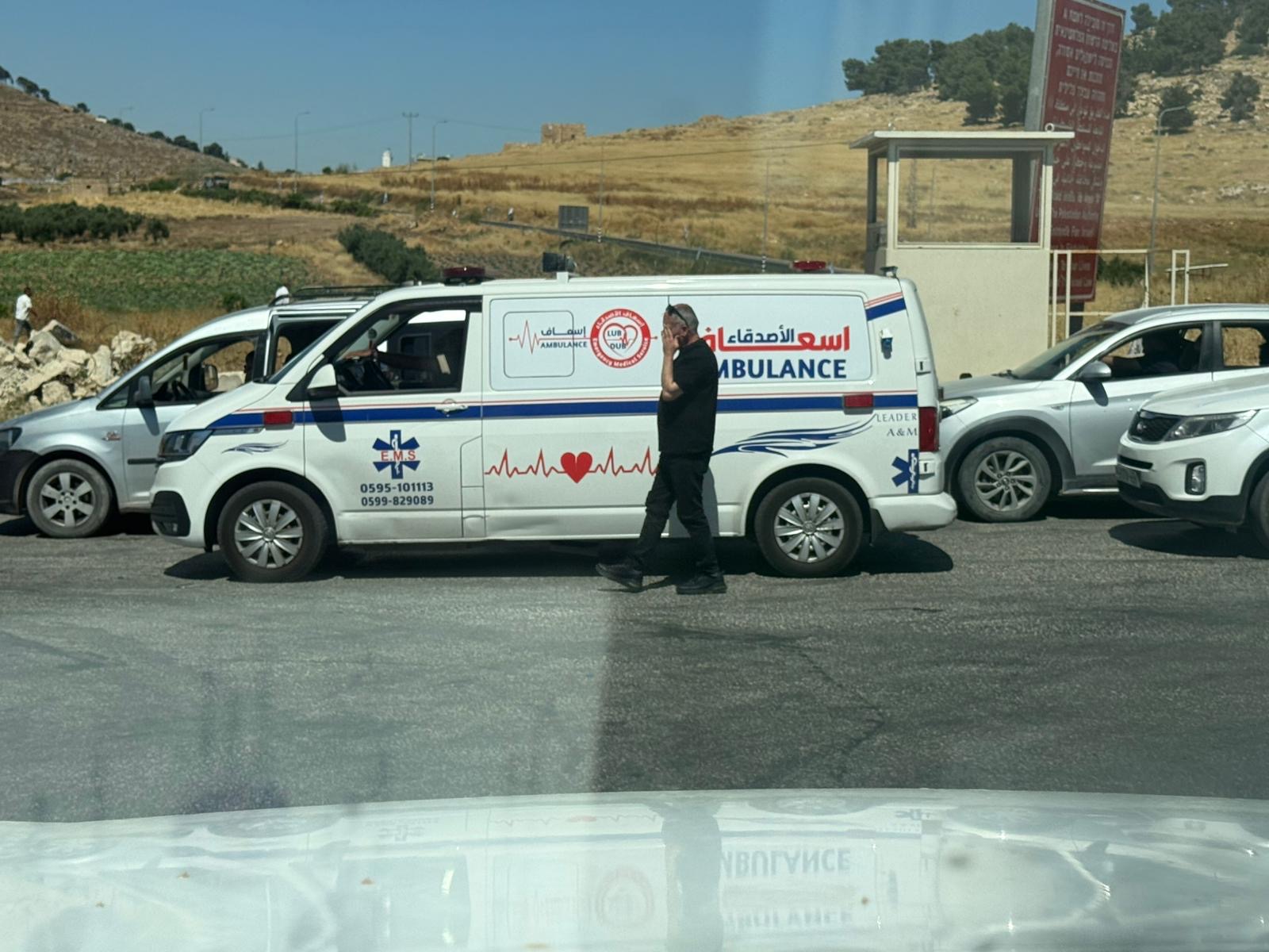 Yael ZoranJun-18-2026An ambulance is waiting in front of the closed checkpoint in El-Fawwar
-