
South Hebron
South Hebron Hills Wednsday 20/12/06Observers: Mira B, Yael Z (English)6.45-10.30Maitar CP: 2 vehicles were waiting for the few workers while quick checking of their documents.Samoa: A taxi was stuck while trying to pass from a dust path to the road. The passengers started walking along the road. On our way back at 9.45 the driver was still in the car. His license and car keys were taken. The soldiers told him they would bring it back at 20.00. We called the Operation unit of the DCO and a very efficient soldier checked and told us that the driver had broken the blockage, though we saw him on a track road open for water tankers. When she heard that, she made the soldiers bring back the keys within an hour. Daharia: Closed, no cars around.Dura – El Pawar – Open on both sides, soldiers on the road watching cars passing.Sheep J. – A long line of pedestrians passing mostly toward Hebron .Shayuch – Sair – The place looks deserted. No sign for army vehicles or people passing.Hebron2 detainees were waiting in the CP facing the Cave. A settler saw our interest in them threw some irritating remarks and went on for his daily prayer.We met 2 CPT volunteers at the empty market. Tarpat CP – was quite, Tel Rumaida – bored soldiers as no one pass by, Phramacy CP – empty as well. We entered the girls’ school near the Pharmacy CP, to ask about the graphity on its wall (Arabs=dirt). We were excepted by the headmistress, given coffee till the English teacher was brought to talk with us. They were not bothered by the graphity but more so by lack of official equipment due to a burglary (the blue police did try to help!).Road 35Humanitarian gate – closed, a military car was waiting.Halhul Hebron bridge – Open for transportation.
Hebron
See all reports for this place-
According to Wye Plantation Accords (1997), Hebron is divided in two: H1 is under Palestinian Authority control, H2 is under Israeli control. In Hebron there are 170,000 Palestinian citizens, 60,000 of them in H2. Between the two areas are permanent checkpoints, manned at all hours, preventing Palestinian movement between them and controlling passage of permit holders such as teachers and schoolchildren. Some 800 Jews live in Avraham Avinu Quarter and Tel Rumeida, on Givat HaAvot and in the wholesale market.
Checkpoints observed in H2:
- Bet Hameriva CP- manned with a pillbox
- Kapisha quarter CP (the northern side of Zion axis) - manned with a pillbox
- The 160 turn CP (the southern side of Zion axis) - manned with a pillbox
- Avraham Avinu quarter - watch station
- The pharmacy CP - checking inside a caravan with a magnometer
- Tarpat (1929) CP - checking inside a caravan with a magnometer
- Tel Rumeida CP - guarding station
- Beit Hadassah CP - guarding station
Three checkpoints around the Tomb of the Patriarchs
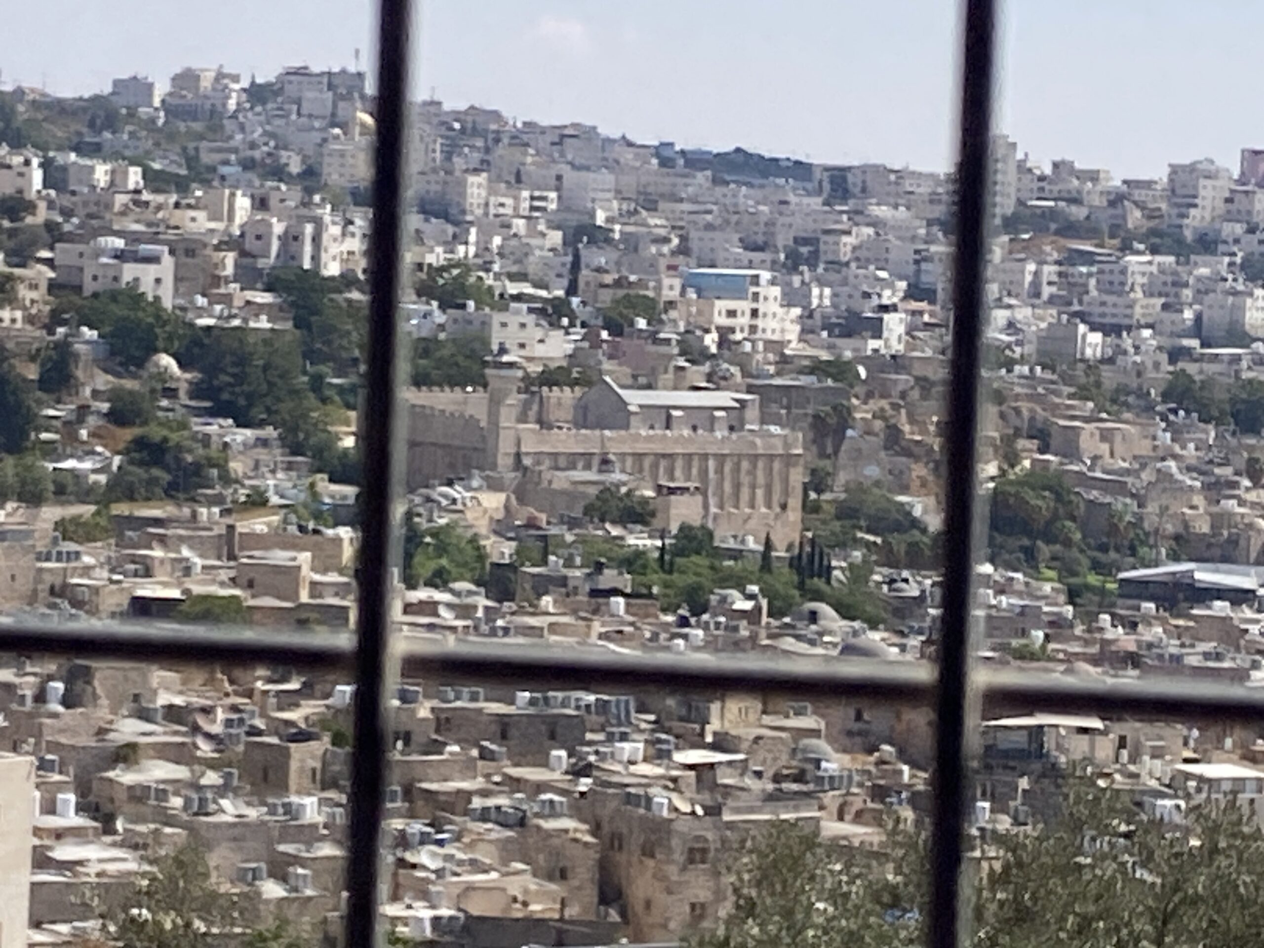 Yael ZoranSep-24-2026Hebron and the Cave of the Patriarchs from Beit Hashalom
-
South Hebron Hills
See all reports for this place-
South Hebron Hills
South Hebron Hills is a large area in the West Bank's southern part.
Yatta is a major city in this area: right in the border zone between the fertile region of Hebron and its surroundings and the desert of the Hebron Hills. Yatta has about 64,000 inhabitants.
The surrounding villages are called Masafer Yatta (Yatta's daughter villages). Their inhabitants subsist on livestock and agriculture. Agriculture is possible only in small plots, especially near streams. Most of the area consists of rocky terraces.Since the beginning of the 1980s, many settlements have been established on the agricultural land cultivated by the Palestinians in the South Hebron Hills region: Carmel, Maon, Susia, Masadot Yehuda, Othniel, and more. Since the settlements were established and Palestinians cultivation areas have been reduced; the residents of the South Hebron Hills have been suffering from harassment by the settlers. Attempts to evict and demolish houses have continued, along with withholding water and electricity. The military and police usually refrain from intervening in violent incidents between settlers and Palestinians do not enforce the law when it comes to the investigation of extensive violent Jewish settlers. The harassment in the South Hebron Hills includes attacking and attempting to burn residential tents, harassing dogs, harming herds, and preventing access to pastures.
There are several checkpoints in the South Hebron Hills, on Routes 317 and 60. In most of them, no military presence is apparent, but rather an array of pillboxes monitor the villages. Roadblocks are frequently set up according to the settlers and the army's needs. These are located at the Zif Junction, the Dura-al Fawwar crossing, and the Sheep Junction at the southern entrance to Hebron.
Updated April 2022
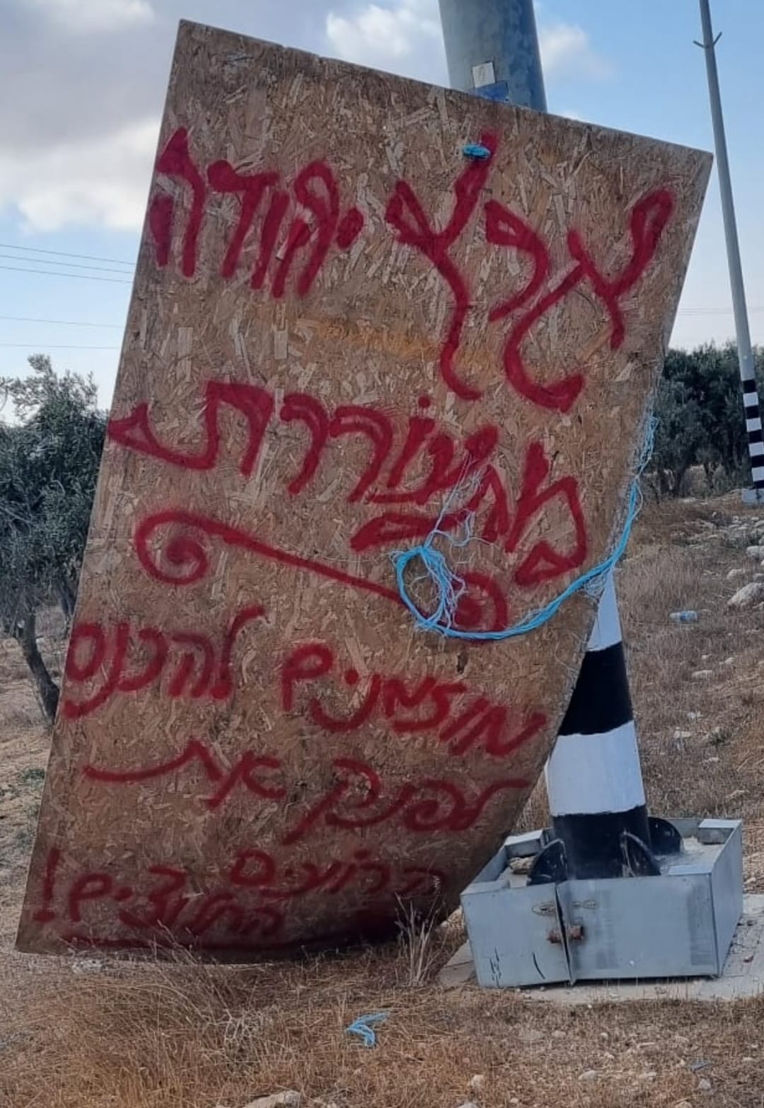 Smadar BeckerOct-17-2026A sign placed by those who call themselves the Pioneer Shepherds, at the outpost adjacent to Qawawis
-
