
South Hebron Hills
South Hebron Hills
This is how Umm Al Kheir’s villagers live in bad close quarters with the Carmel settlers
We went directly to Hashem Al Daraj, to Huda’s kindergarten, to help finish her preparations for the children’s outing on their beach day.
We drive another 20- minutes east from Umm Al Kheir to the Judean desert slopes. Luckily some sort of paved road has been fixed. Now it easier to arrive at this end of the world. It is arid and seething hot. No one’s people live there, scattered, and all that connects them to civilization are structures built by European aid organizations. Not only electricity and water collection installations, but also outhouses and kindergarten and a schoolhouse. The kindergarten and all it contains is a result of Huda’s initiative, with the help of our members and international organizations, and the mediation of our friend ‘Eid.
There is a water trough with faucets in the yard so women and children from the area have come to take water. Rachel Afek is on the phone so we could easily pass on name lists and information. This year, too, these children will see the sea.
We took this opportunity to enter Umm Al Kheir and say hello to ‘Eid whom we met, with his familiar smile, saying “May things stay this way, even this is alright.” We did not take our time there because of the Ramadan. I only photographed once again how close they dwell to the Carmel settlement. How their dwellings look compared to the settlers’ houses.
One should know where to be born…
We hurried on today, because of the holiday and Mohammad’s work, and also my own engagements as grandma at my grandkids’ end of year school celebration. So we did not enter Hebron.

Umm Al Kheir

Carmel settlement
South Hebron Hills
See all reports for this place-
South Hebron Hills
South Hebron Hills is a large area in the West Bank's southern part.
Yatta is a major city in this area: right in the border zone between the fertile region of Hebron and its surroundings and the desert of the Hebron Hills. Yatta has about 64,000 inhabitants.
The surrounding villages are called Masafer Yatta (Yatta's daughter villages). Their inhabitants subsist on livestock and agriculture. Agriculture is possible only in small plots, especially near streams. Most of the area consists of rocky terraces.Since the beginning of the 1980s, many settlements have been established on the agricultural land cultivated by the Palestinians in the South Hebron Hills region: Carmel, Maon, Susia, Masadot Yehuda, Othniel, and more. Since the settlements were established and Palestinians cultivation areas have been reduced; the residents of the South Hebron Hills have been suffering from harassment by the settlers. Attempts to evict and demolish houses have continued, along with withholding water and electricity. The military and police usually refrain from intervening in violent incidents between settlers and Palestinians do not enforce the law when it comes to the investigation of extensive violent Jewish settlers. The harassment in the South Hebron Hills includes attacking and attempting to burn residential tents, harassing dogs, harming herds, and preventing access to pastures.
There are several checkpoints in the South Hebron Hills, on Routes 317 and 60. In most of them, no military presence is apparent, but rather an array of pillboxes monitor the villages. Roadblocks are frequently set up according to the settlers and the army's needs. These are located at the Zif Junction, the Dura-al Fawwar crossing, and the Sheep Junction at the southern entrance to Hebron.
Updated April 2022
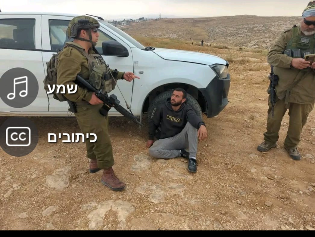 A Palestinian residentJul-6-2026Sha'ab al-Butum - M. and F. Jabarin arrested after settler attack on their home
-