
South Hebron Hills - blockades at the entrances to the villages

The Meitar crossing is almost empty of parked cars. Muhammad reports: only about 200-300 workers pass every day, in addition to the sick or those who have a trial.
1. The settlers ploughed the lands of Zanuta after the Palestinian owners gave up and left as a result of the harassment of the settlers. Most Israelis believe that the reports of ethnic cleansing in the West Bank are false, and if there is any activity by the settlers and/or security forces, it is only to protect against violence by the Palestinians. The reality is that the settlers do not act against strong Palestinians, because they are afraid of them. Only the army deals with real security problems, and the violence of the settlers backed by the security forces is only against Palestinians who have never posed any security threat and are completely helpless, it is just the desire to take over their “cleansed” lands from an ethnic perspective.
2. Eshtamoah settlement has been expanded, including a new ring road to the south. And another caravan neighbourhood to the north, including electricity poles.
3. A van drives slowly ahead of us. Muhammad recognizes that it is the settler, Elyashiv, from Havat Yehuda. The van is not roadworthy and is traveling with a child standing inside. Muhammad comments that such a Palestinian vehicle would have been taken off the road a long time ago.
4. The entrance to Samu’ is closed, so residents are seen traveling on dirt and mud roads around it. It is obvious and they are not stopped, meaning it is clear that the blocking of the main entrance is intended solely to harass them. The entrances to Dura and al-Fawwar are also closed, vehicles are parked on both sides of the checkpoints, people walk on foot through the mud around them. The same goes for Qilqis.
5. On the road – a large sign in Hebrew, an advertisement of a contractor. Written on it, “Avoda Ivrit” (Hebrew Work), meaning it only employs Jews.
6. Entering Hebron from the south. Givat Gal above us, expanded, the impression is that the settlers support the war because it serves them to accelerate the takeover of Area C.
7. The road that goes up towards the checkpoint to the Kiryat Arba industrial zone is full of garages, instead of the garages that were closed in the Qafisha neighbourhood when the army closed the passage to it.
8. The road from Kiryat Arba to the Tomb of the Patriarchs is being rebuilt. All the Palestinian shops on this street are closed.
9. We meet Issa Amro at the police checkpoint to give him 10,000 shekels that Machsomwatch collected from members through Rachel Afek for the benefit of hungry Palestinian families. He says that in the past, this checkpoint was always open for crossing, now only during the day and closed on Saturdays. The checkpoint is also closed during the multiple power outages, people stand helpless in the rain. He claims that Israel sells the Hebron municipality only 95 megawatts of electricity instead of the 150 megawatts it is entitled to.
10. We go up to the grocery store in Tel Rumeida, which has recently only been open from the side. It is operated by Hamed Ides, a wheelchair user, sitting at the cash register near what used to be the main entrance from the main street. On 2.9.2023, an electric car, a silver Toyota, license plate number 46343103, accidentally drove into the front of the store, destroying it and injuring Hamed. The Jew called a Jewish ambulance that evacuated Hamed to Hadassah hospital in Jerusalem. He was in the hospital for 3 days. The police did arrive at the scene, but now they claim that they have no idea who the offending driver was, so Hamed cannot claim his insurance. The hospital filed a claim for payment for the hospitalization and of course he cannot afford to pay, nor should he. This is also what the police tell his Palestinian lawyer, Samah Kilani, tel. 0515172351. A photo is attached.
11. On the road from Shuhada Street to the Cave of the Patriarchs, the settlers placed large flower pots, the “clean of Arabs” settlement area in the West is very well maintained, as usual.
12. At the main exit from Kiryat Arba, in front of the military camp, you can already see the built winery, really beautiful.
Location Description
Dura Al-Fawwar Junction
See all reports for this place-
Junction on Route 60: west - the town of El Dura, east - the Al Fawwar refugee camp. There is a manned pillbox at the junction. From time to time the army sets up flying checkpoints at the entrance to El Fawwar and Al Dura. Al-Fawwar is a large refugee camp (7,000 inhabitants in 2007) established in 1949 to accommodate Palestinian refugees from Be'er Sheva and Beit Jubrin and environs. There are many incidents of stone-throwing. In the vicinity of the pillbox there are excellent agricultural areas, Farmers set up stalls adjacent to the plots close to the road. In recent months the civil administration has set up dirt embankments thereby blocking access to the stalls, and making it impossible for the farmers to sell their vegetables. Updated April 2021, Michal T.
-
Hebron
See all reports for this place-
According to Wye Plantation Accords (1997), Hebron is divided in two: H1 is under Palestinian Authority control, H2 is under Israeli control. In Hebron there are 170,000 Palestinian citizens, 60,000 of them in H2. Between the two areas are permanent checkpoints, manned at all hours, preventing Palestinian movement between them and controlling passage of permit holders such as teachers and schoolchildren. Some 800 Jews live in Avraham Avinu Quarter and Tel Rumeida, on Givat HaAvot and in the wholesale market.
Checkpoints observed in H2:
- Bet Hameriva CP- manned with a pillbox
- Kapisha quarter CP (the northern side of Zion axis) - manned with a pillbox
- The 160 turn CP (the southern side of Zion axis) - manned with a pillbox
- Avraham Avinu quarter - watch station
- The pharmacy CP - checking inside a caravan with a magnometer
- Tarpat (1929) CP - checking inside a caravan with a magnometer
- Tel Rumeida CP - guarding station
- Beit Hadassah CP - guarding station
Three checkpoints around the Tomb of the Patriarchs
 Muhammad D.May-13-2026Hebron - Request for compensation for land expropriation
-
Meitar checkpoint / Sansana
See all reports for this place-
Meitar Checkpoint / Sansana The checkpoint is located on the Green Line and serves as a border crossing between Israel and the West Bank. It is managed by the Border Crossing Authority of the Defense Ministry. It is comprised of sections for the transfer of goods as well as a vehicle checkpoint (intended for holders of blue identity cards, foreign nationals or diplomats and international organizations). Passing of Palestinians is prohibited, except for those with entry permits to Israel. Palestinians are permitted to cross on foot only. The crossing has a DCO / DCL / DCL / DCL (District Coordination Office), a customs unit, supervision, and a police unit. In the last year, a breach has been opened in the fence, not far from the crossing. This breach is known to all, including the army. There does not appear to be any interest in blocking it, probably as it permits needed Palestinian workers without the bureaucratic permits to get to work in Israel. Food stalls and a parking area economy have been created, but incidents of violent abuse by border police have also been recorded. Updated April 2022
-
South Hebron Hills
See all reports for this place-
South Hebron Hills
South Hebron Hills is a large area in the West Bank's southern part.
Yatta is a major city in this area: right in the border zone between the fertile region of Hebron and its surroundings and the desert of the Hebron Hills. Yatta has about 64,000 inhabitants.
The surrounding villages are called Masafer Yatta (Yatta's daughter villages). Their inhabitants subsist on livestock and agriculture. Agriculture is possible only in small plots, especially near streams. Most of the area consists of rocky terraces.Since the beginning of the 1980s, many settlements have been established on the agricultural land cultivated by the Palestinians in the South Hebron Hills region: Carmel, Maon, Susia, Masadot Yehuda, Othniel, and more. Since the settlements were established and Palestinians cultivation areas have been reduced; the residents of the South Hebron Hills have been suffering from harassment by the settlers. Attempts to evict and demolish houses have continued, along with withholding water and electricity. The military and police usually refrain from intervening in violent incidents between settlers and Palestinians do not enforce the law when it comes to the investigation of extensive violent Jewish settlers. The harassment in the South Hebron Hills includes attacking and attempting to burn residential tents, harassing dogs, harming herds, and preventing access to pastures.
There are several checkpoints in the South Hebron Hills, on Routes 317 and 60. In most of them, no military presence is apparent, but rather an array of pillboxes monitor the villages. Roadblocks are frequently set up according to the settlers and the army's needs. These are located at the Zif Junction, the Dura-al Fawwar crossing, and the Sheep Junction at the southern entrance to Hebron.
Updated April 2022
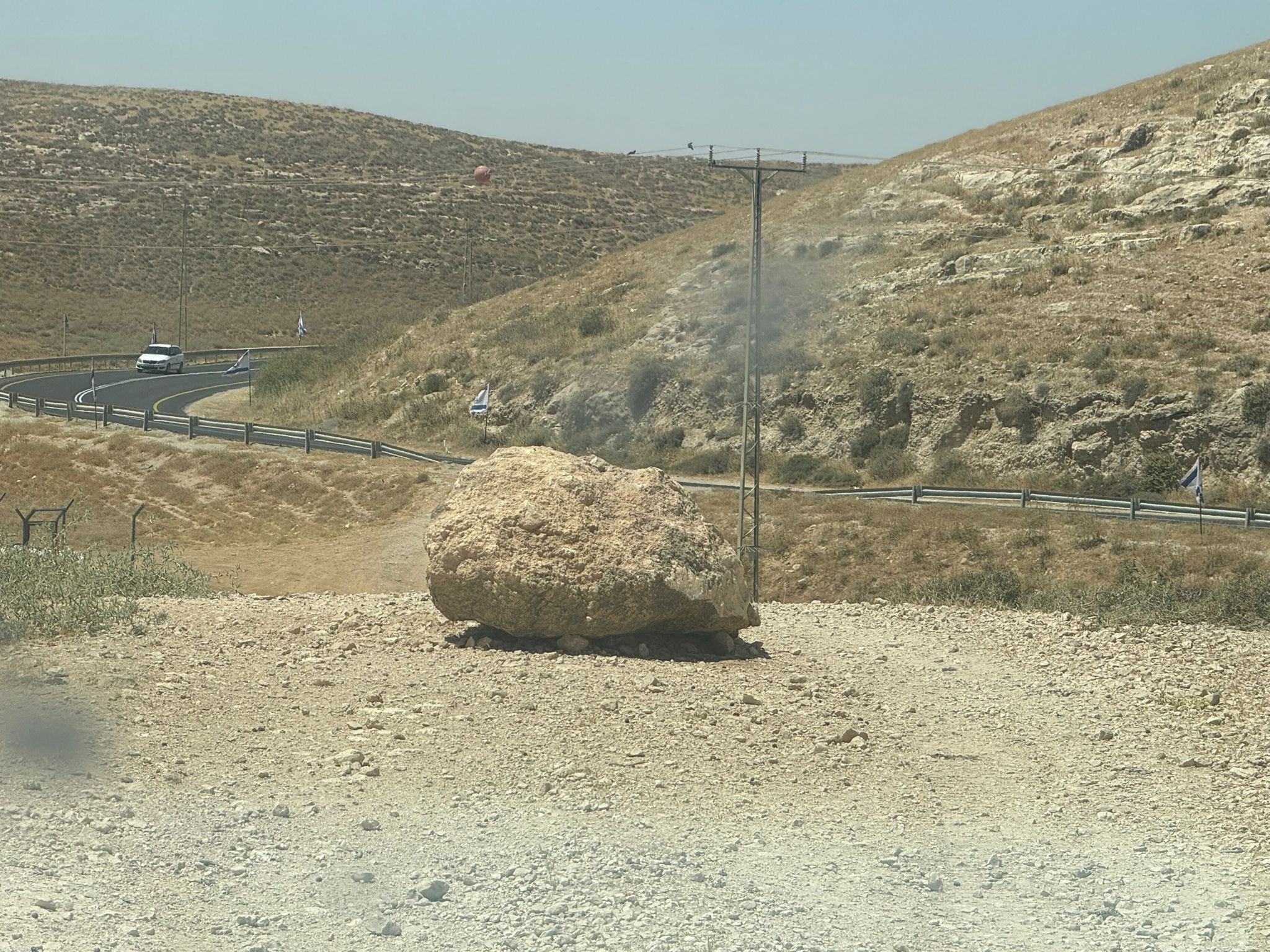 Muhammad D.Jun-7-2026A stone placed by settlers on the road leading to the Thiel family's territory in Rahwa
-
Zanuta
See all reports for this place-
Zanuta was a small rural Palestinian locality until its demolition. It was situated in the space around the town Dahariya in the South Hebron Hills, about a ten-minute ride from Meitar Checkpoint. There are documented remains of a large Byzantine settlement in the area. Since the Ottoman (Turkish Empire) period (1516-1917) Zanuta was documented as a locality of shepherds and farmers who live in the remains of the ancient structures and the residential caves near them.
Two individual ranches of colonists were created next to Zanuta: Meitarim (of the colonist Yinon Levi) to the east, and Yehudah (of the colonist Elyashiv Nachum) to the north. Endless attacks, harassments and attempt to chase away the Zanuta villagers have originated in these two outposts.
Until the expulsion, four families lived in the village: A-Samama, Al-Tel, Al Batat, and Al-Qaisia. Farming constituted their main economic activity and employed most of the villagers. The total area of the village is about 12,000 dunams, of which about 3,000 are tended, mostly with field crops.
This village has never had a master plan that would legitimize construction permits. The Civil Administration claimed it was too small and the distance to the next town, Dahariya, too great. For this reason, the Israeli authorities pressured the villagers to leave. The colonists did the job for them.
-