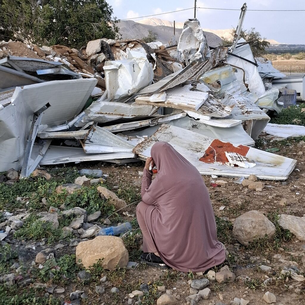
Southern Hebron Hills: Illegal outposts are being expanded and homes in Palestinian villages are being demolished
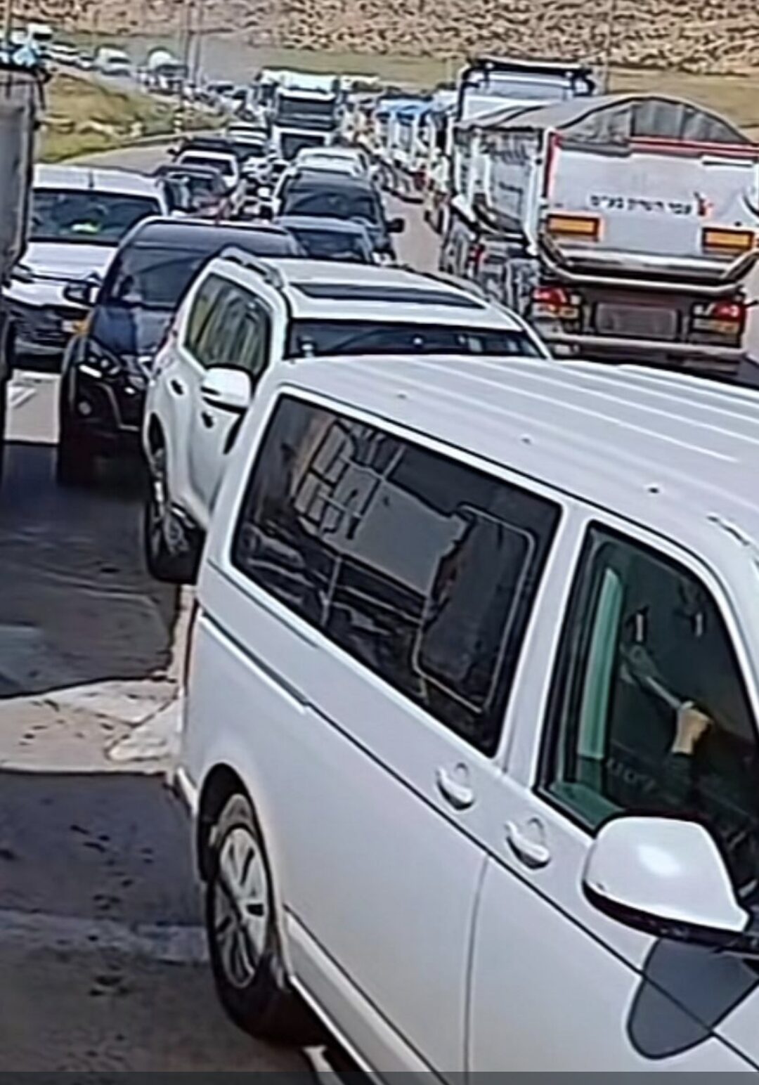
Meitar Checkpoint and the area near Ramadin:
In recent days, there has been a heavy traffic of vehicles belonging to the Bedouin diaspora in the Meitar Checkpoint area. This is an unusual volume of traffic that is causing congestion and traffic jams.
In the Ramadin area, the crossing to Dahariya has been open for three days, but every vehicle that passes through is strictly checked by soldiers, which causes a significant slowdown in traffic and prolonged traffic jams.
The congestion is exacerbated by the presence of many military vehicles on the road, which adds to the general congestion in the area
Highway 60 – Farm Expansion and Conduct within Zanuta:
On Highway 60, there is visible activity to expand a settlers farm located opposite the village of Zanuta.
At the same time, within Zanuta itself, a large herd of about 200 cows roams without visible supervision. This phenomenon may affect road safety and cause difficulties for locals.
Highway 317 – Continued expansion of the Asael outpost:
The illegal Asael outpost, located near Highway 317, continues to expand.
In recent days, new houses have been added, indicating an establishment and deepening of the presence in the area, despite it being an outpost that is not recognized by law.
Demolition of houses in Palestinian villages:
According to Nasser from al-Tawani’s report, Israeli forces demolished three Palestinian houses – two in Ad-Deirat and one in Bani Naim.
These demolitions are part of an enforcement or sanction policy, but they cause tension and distress among the local population.
Location Description
Meitar checkpoint / Sansana
See all reports for this place-
Meitar Checkpoint / Sansana The checkpoint is located on the Green Line and serves as a border crossing between Israel and the West Bank. It is managed by the Border Crossing Authority of the Defense Ministry. It is comprised of sections for the transfer of goods as well as a vehicle checkpoint (intended for holders of blue identity cards, foreign nationals or diplomats and international organizations). Passing of Palestinians is prohibited, except for those with entry permits to Israel. Palestinians are permitted to cross on foot only. The crossing has a DCO / DCL / DCL / DCL (District Coordination Office), a customs unit, supervision, and a police unit. In the last year, a breach has been opened in the fence, not far from the crossing. This breach is known to all, including the army. There does not appear to be any interest in blocking it, probably as it permits needed Palestinian workers without the bureaucratic permits to get to work in Israel. Food stalls and a parking area economy have been created, but incidents of violent abuse by border police have also been recorded. Updated April 2022
-
ramadin
See all reports for this place-
Ramadin and Arab al-Furijat, were established in the suburbs of Dahariya by Bedouins who came from the Be'er Sheva area after 1948. The village of Ramadin, numbers about 6,000 people, is located on the eastern side of the separation barrier. The checkpoint that was established at the entrance to the village (crossing by list only) to prevent passage to Israeli territory was removed in October 2007, and the road to the Meitar checkpoint leading to Israel is open.
-
South Hebron Hills
See all reports for this place-
South Hebron Hills
South Hebron Hills is a large area in the West Bank's southern part.
Yatta is a major city in this area: right in the border zone between the fertile region of Hebron and its surroundings and the desert of the Hebron Hills. Yatta has about 64,000 inhabitants.
The surrounding villages are called Masafer Yatta (Yatta's daughter villages). Their inhabitants subsist on livestock and agriculture. Agriculture is possible only in small plots, especially near streams. Most of the area consists of rocky terraces.Since the beginning of the 1980s, many settlements have been established on the agricultural land cultivated by the Palestinians in the South Hebron Hills region: Carmel, Maon, Susia, Masadot Yehuda, Othniel, and more. Since the settlements were established and Palestinians cultivation areas have been reduced; the residents of the South Hebron Hills have been suffering from harassment by the settlers. Attempts to evict and demolish houses have continued, along with withholding water and electricity. The military and police usually refrain from intervening in violent incidents between settlers and Palestinians do not enforce the law when it comes to the investigation of extensive violent Jewish settlers. The harassment in the South Hebron Hills includes attacking and attempting to burn residential tents, harassing dogs, harming herds, and preventing access to pastures.
There are several checkpoints in the South Hebron Hills, on Routes 317 and 60. In most of them, no military presence is apparent, but rather an array of pillboxes monitor the villages. Roadblocks are frequently set up according to the settlers and the army's needs. These are located at the Zif Junction, the Dura-al Fawwar crossing, and the Sheep Junction at the southern entrance to Hebron.
Updated April 2022
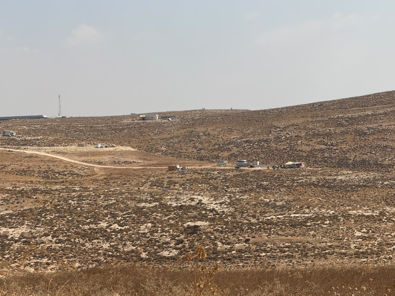 Smadar BeckerAug-17-2026The layout of the outposts from Ma'on Farm eastward
-
Zanuta
See all reports for this place-
Zanuta was a small rural Palestinian locality until its demolition. It was situated in the space around the town Dahariya in the South Hebron Hills, about a ten-minute ride from Meitar Checkpoint. There are documented remains of a large Byzantine settlement in the area. Since the Ottoman (Turkish Empire) period (1516-1917) Zanuta was documented as a locality of shepherds and farmers who live in the remains of the ancient structures and the residential caves near them.
Two individual ranches of colonists were created next to Zanuta: Meitarim (of the colonist Yinon Levi) to the east, and Yehudah (of the colonist Elyashiv Nachum) to the north. Endless attacks, harassments and attempt to chase away the Zanuta villagers have originated in these two outposts.
Until the expulsion, four families lived in the village: A-Samama, Al-Tel, Al Batat, and Al-Qaisia. Farming constituted their main economic activity and employed most of the villagers. The total area of the village is about 12,000 dunams, of which about 3,000 are tended, mostly with field crops.
This village has never had a master plan that would legitimize construction permits. The Civil Administration claimed it was too small and the distance to the next town, Dahariya, too great. For this reason, the Israeli authorities pressured the villagers to leave. The colonists did the job for them.
-