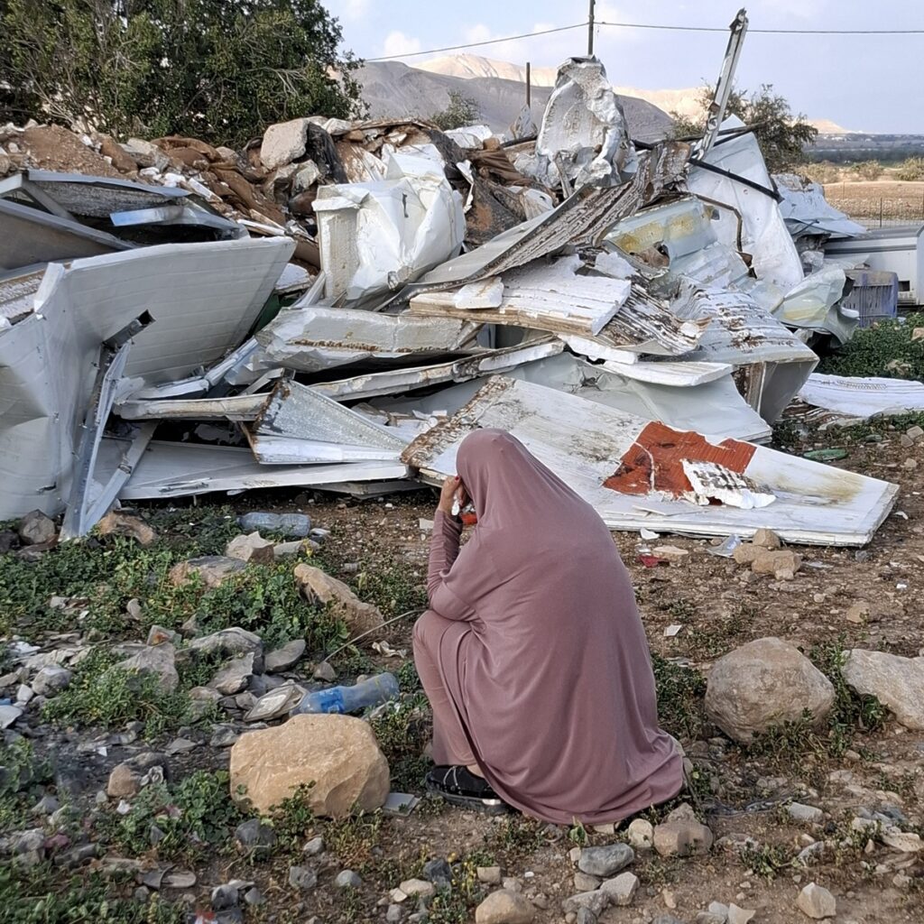
South Hebron Hill - The Israeli flag symbolizes occupation, abuse and ethnic cleansing
As this was Timnah’s first time with us we started out with a “road trip” – driving down Route 60 as far the Beni Naim crossroads and from there onto Route 317.
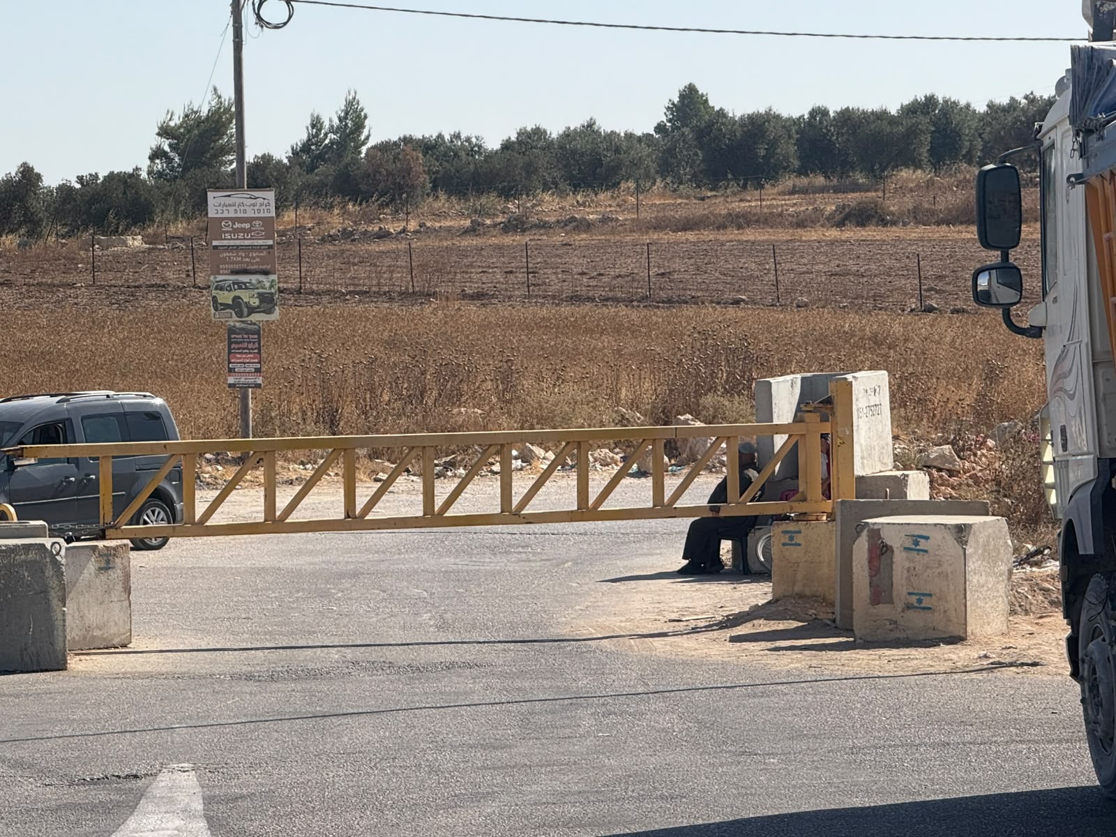
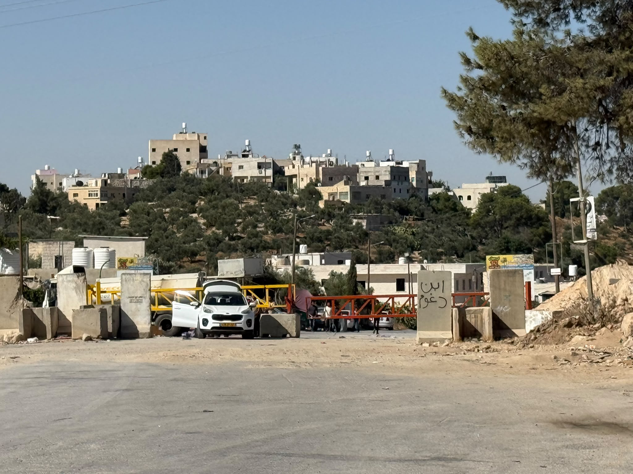
Route 60: not much traffic. Just beyond the Eshtamoa settlement, on a distant hill, a small blue canvas shelter promises yet another hilltop “farm”. At 09.30 the checkpoint at Samu’ is still staffed, as it the Dahariya checkpoint where a car with Israeli plates is being unloaded on the Israel side of the checkpoint. Two or three soldiers were spotted on the Palestinian side. Abda is closed as usual, as are Dura and al-Fawwar. However, further down the road, a back entrance to Dura is open at least for pedestrians. Qilqis crossing is open for pedestrians only, the Sheep crossing is closed.
Imagine an area of some 200,000 Palestinian civilians: farmers, teachers, business people trapped between these military barriers and unable to move freely about their daily business – not to mention in medical emergencies for example. Families, friends and colleagues all separated arbitrarily. The wait to cross a checkpoint can take minutes or hours at the whim of the soldiers and often result in confrontations that prove violent for the Palestinians.
Route 317 Land of the Settlers
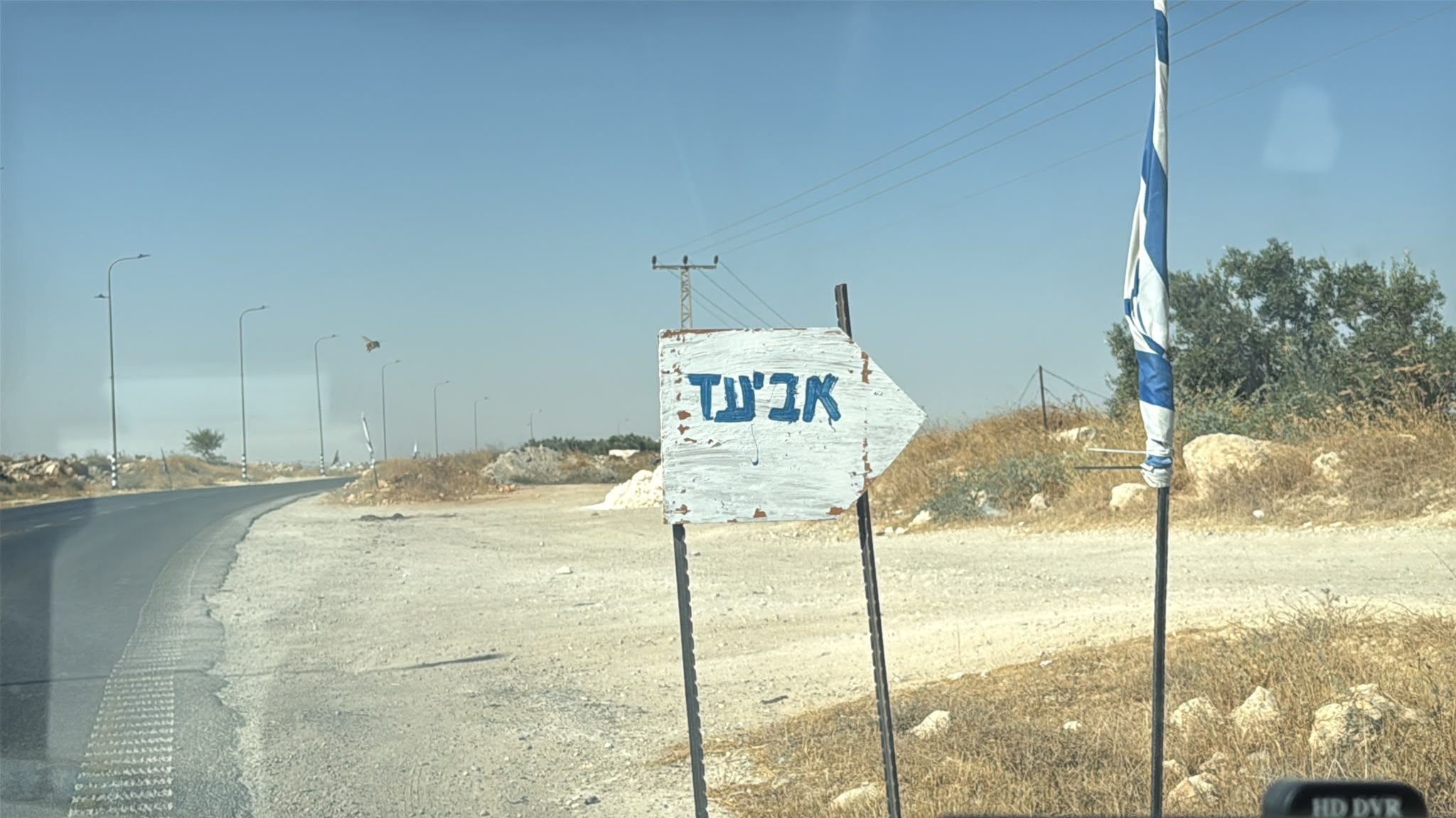
We immediately spot two signs indicating new “hilltop farms”: to the south Aviad, which we noted on a previous shift and just beyond Pnei Hever to the east, a sign pointing to “Mizpeh Ziv”. We drive through the nearby Palestinian township of Zif and continue past the large settlement of Carmel, that encroaches on the village of Umm al-Khair and is the cause of much damage and aggravation to the villagers. A-Tuwani is open as is the road to the Avigail settlement.
The goal of these so-called farms is to take over Palestian lands and flocks by force. Settlers drive their herds into the Palestianian’s flocks and claim that they are searching for “stolen” beasts, cut down trees and crops and replant the area in order to claim it as their own, the pattern adopted since the establishment of the state.
We reach our goal which is to bring donations of clothing and basic supplies to the family of Ahmad and Halima at Susiya; whatever they don’t need they distribute to other villagers. Over a generous breakfast, Ahmad and Halima tell us about their problems with settlers from nearby Jewish Susiya: the usual format of settler forays: damaging crops, threatening the family and preventing pasturing of flocks and herds. For Ahmad this means the expense of buying fodder for his herd of 30 sheep. Halima helps the family finances by making and selling cheese and yoghurt, but this income is precarious at best. Ahmad tells that in March 2026 settlers set fire to a tent in the family compound and it is only sheer luck that no one was hurt. On 02.02.2026 settlers threw bottles into the compound so that the shards would injure the sheep. Now Ahmad keeps his sheep in a closed building to protect them and the family often sleep under a wagon in fear that the settlers will return and set fire to their home. We leave the family with their two lovely daughters, aged 12 and 11. The drive back is uneventful, but we are sad and angry about the ethnic cleansing of the Palestinians in their land which we are powerless to prevent. There is a strong sense that sooner or later the situation must explode.
Timnah adds: The Israeli flags every few meters fill me with shame to be an Israeli oppressing, enthically cleansing and abusing (Palestinians).
Location Description
A-Tuwani
See all reports for this place-
A-Tuwani
The locals came to a-Tuwani during the 20th century from the village of Yatta. They settled in abandoned ruins, utilizing the arable land, pastures for grazing sheep and the abundance of natural caves for habitation. The residents who settled in the caves came from families who could not purchase land for houses in the mother villages, as well as shepherds who did not have enough land to graze. They were joined by clan members who quarreled with other families in the mother locality.
Some of the residents today live in concrete buildings built above the caves. In the area of the village are several water cisterns and an ancient water well called 'Ein a-Tuwani. Local residents are forced to buy water in containers and transport them through many road blocks to the village. With the help of international organizations, an electrical system was installed in the village. In the late 90s of the 20tTh century, an elementary school was established in the serving several small villages in the area.
In 2004, MachsomWatch began visiting and reporting from the Khirbet Tuwani cave village, which suffers badly from the settlers of nearby outposts, and especially from the extremist Ma'on outpost. . The settlers contaminate cisterns, poison the flocks and uproot trees.Particularly notable is the harassment of children from the surrounding villages on their way to school in a-Tuwani, so much so that military escort of children is required to separate them from the attackers (this was arranged following an initiative of the organization's members). In the past year, the escort has been without the vital presence of overseas volunteers.
Near a-Tuwani there are several families who have returned to the caves due to the incessant demolitions of the civil administration (as there is a total construction ban in all of area C). Destroyed are not only residential and agricultural buildings, but also water pipes, machinery. Even water cisterns are clogged up. a-Tuwani residents have created an association for non-violent demolition protests, but in the past year the army’s harsh harassment and settler violence have intensified and escalated. The incident of the small generator confiscation, which left a young man paralyzed, is one of many examples - any legitimate protection of property rights leads to violence and even shootings by the army and the civil administration.
Updated April 2022
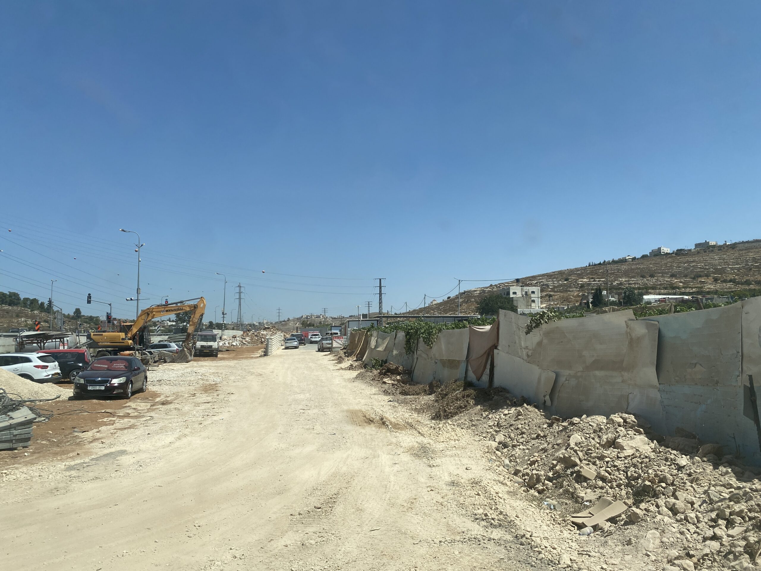 Yael ZoranAug-20-2026Ata's vineyard on the right, cut down to make way for the expansion of Highway 60
-
Dura Al-Fawwar Junction
See all reports for this place-
Junction on Route 60: west - the town of El Dura, east - the Al Fawwar refugee camp. There is a manned pillbox at the junction. From time to time the army sets up flying checkpoints at the entrance to El Fawwar and Al Dura. Al-Fawwar is a large refugee camp (7,000 inhabitants in 2007) established in 1949 to accommodate Palestinian refugees from Be'er Sheva and Beit Jubrin and environs. There are many incidents of stone-throwing. In the vicinity of the pillbox there are excellent agricultural areas, Farmers set up stalls adjacent to the plots close to the road. In recent months the civil administration has set up dirt embankments thereby blocking access to the stalls, and making it impossible for the farmers to sell their vegetables. Updated April 2021, Michal T.
-
Hakvasim (sheep) Junction
See all reports for this place-
One of the roadblocks (earthworks, rocks, concrete blocks or iron gates) that prevent transit of vehicles to Route 60 in the southern West Bank and block the southern entrance to Hebron. A manned pillbox supervises the place.
-
South Hebron Hills
See all reports for this place-
South Hebron Hills
South Hebron Hills is a large area in the West Bank's southern part.
Yatta is a major city in this area: right in the border zone between the fertile region of Hebron and its surroundings and the desert of the Hebron Hills. Yatta has about 64,000 inhabitants.
The surrounding villages are called Masafer Yatta (Yatta's daughter villages). Their inhabitants subsist on livestock and agriculture. Agriculture is possible only in small plots, especially near streams. Most of the area consists of rocky terraces.Since the beginning of the 1980s, many settlements have been established on the agricultural land cultivated by the Palestinians in the South Hebron Hills region: Carmel, Maon, Susia, Masadot Yehuda, Othniel, and more. Since the settlements were established and Palestinians cultivation areas have been reduced; the residents of the South Hebron Hills have been suffering from harassment by the settlers. Attempts to evict and demolish houses have continued, along with withholding water and electricity. The military and police usually refrain from intervening in violent incidents between settlers and Palestinians do not enforce the law when it comes to the investigation of extensive violent Jewish settlers. The harassment in the South Hebron Hills includes attacking and attempting to burn residential tents, harassing dogs, harming herds, and preventing access to pastures.
There are several checkpoints in the South Hebron Hills, on Routes 317 and 60. In most of them, no military presence is apparent, but rather an array of pillboxes monitor the villages. Roadblocks are frequently set up according to the settlers and the army's needs. These are located at the Zif Junction, the Dura-al Fawwar crossing, and the Sheep Junction at the southern entrance to Hebron.
Updated April 2022
Yael ZoranAug-20-2026Ata's vineyard on the right, cut down to make way for the expansion of Highway 60
-
Susiya
See all reports for this place-
Susiya The Palestinian area lies between the settlement of Susya and a military base. The residents began to settle in areas outside the villages in the 1830s and lived in caves, tents and sukkot. To this day they maintain a traditional lifestyle and their livelihood is based on agriculture and herding. Until the 1948 war, the farmers cultivated areas that extended to the Arad area. As a result of the war, a significant portion of their land left on the Israeli side was lost. After the 1967 war and the Israeli occupation, military camps were established in the area, fire zones and nature reserves were declared, and the land area was further reduced. The Jewish settlement in Susya began in 1979. Since then, there has been a stubborn struggle to remove the remains of Palestinian residents who refuse to leave their place of birth and move to nearby town Yatta. With the development of a tourist site in Khirbet Susya in the late 1980s (an ancient synagogue), dozens of families living in caves in its vicinity were deported. In the second half of the 1990s, a new form of settlement developed in the area - shepherds' farms of individual settlers. This phenomenon increased the tension between the settlers and the original, Palestinian residents, and led to repeated harassment of the residents of the farms towards the Palestinians. At the same time, demolition of buildings and crop destruction by security forces continued, as well as water and electricity prevention. In the Palestinian Susya, as in a large part of the villages of the southern Hebron Mountains, there is no running water, but the water pipe that supplies water to the Susya Jewish settlement passes through it. Palestinians have to buy expensive water that comes in tankers. Solar electricity is provided by a collector system, installed with donation funds. But the frequent demolitions in the villages do not spare water cisterns or the solar panels and power poles designed to transfer solar electricity between the villages. Updated April 2021, Anat T.
-
Umm al-Khair
See all reports for this place-
Umm al-Kheir
A Palestinian village in the southern Hebron governorate, populated by five families. The Palestinian residents settled there decades ago, after Israel expelled them from the Arad desert and purchased the land from the residents of the Palestinian village of Yatta. The village suffers from the violence of nearby Carmel settlers, from water shortage and is subject to frequent demolition of buildings by the Civil Administration.
-
Zif Junction
See all reports for this place-
Zif Junction located on the crossroads that directs towards Road 356 to Yata. Yata is the district city of the southern Hebron Mountains. Usually, this junction is open to traffic. The nearby pillbox is unmanned. But the army and police are present occasionally, sometimes setting up a checkpoint and sometimes detaining residents from the big city. Often, the Israeli policemen inspect vehicles and distribute driving reports to Palestinian vehicles. s
-