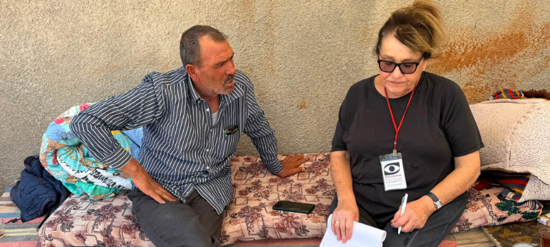
Hebron - The expansion of Route60 robbed the Jaber family of 30 meters of vineyard, and in return - endless clouds of dust
Route 60
At the Meitar checkpoint, we count about twenty cars on the Palestinian side. Could there be a recovery in the issuing of crossing permits?
Samu’ – the checkpoint is closed, including on our return journey. People cross using the “back-to-back” method.
Abda – the checkpoint is closed.
The flags along the road now begin in the Otniel–Dahariya area and continue northward.
At the entrance to Dahariya, a crane is installing another gate on the access road to the town, directly parallel to the existing gate, a few meters farther south, toward Route 60.
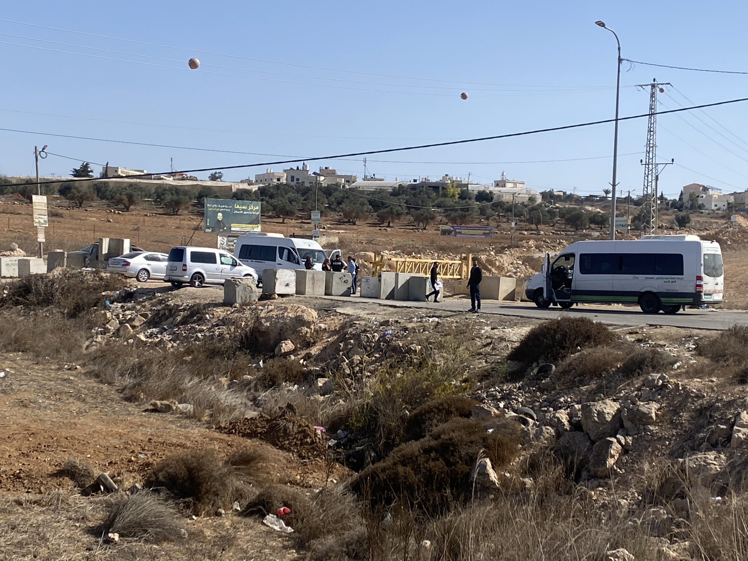
Dura al-Fawwar – the barriers connecting both villages to the road are closed. The gas station at the junction is also blocked off with garbage bins. It is not clear why.
Qilqis – the barriers on both sides of the village are closed.
Sheep Junction – the barrier toward Hebron is open; the one toward Yatta (east) is closed.
The widening of Route 60 on both sides has already reached Bani Naim in the south.
At the junction leading to Kiryat Arba, members of the Jaber family live on both sides of Route 60. They are farmers who grow grapevines and wonderful vegetables in the valley along the road. The widening of Route 60 on both sides has reached them and taken 30 meters of vineyard from each of the brothers. In return, they get endless clouds of dust from the scraping of the limestone soil to level the road.
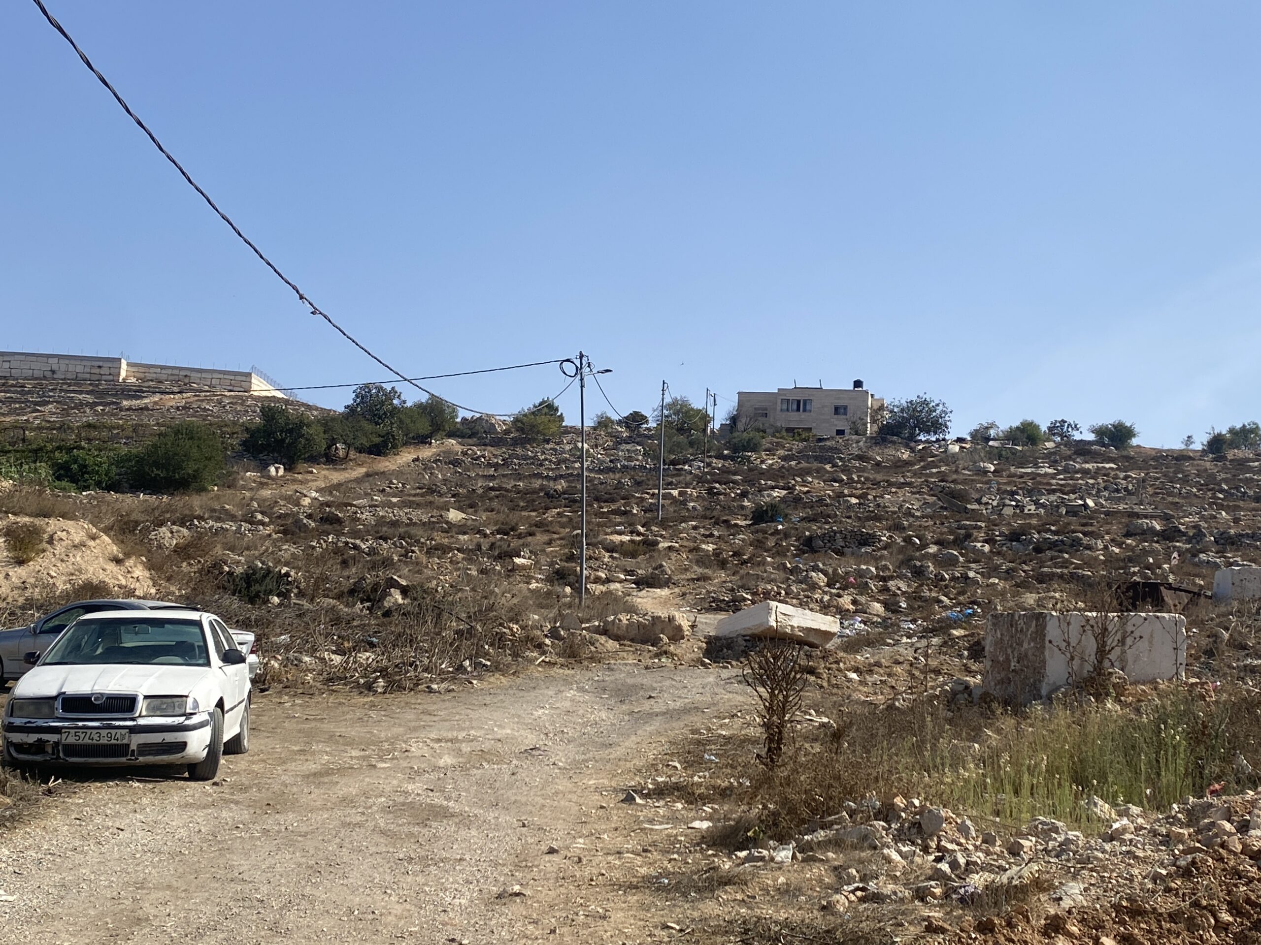
On the eastern side, high on the hill, is the home of Ata Jaber, reached by a steep, difficult dirt track. Recently, settlers accompanied by a military bulldozer arrived and blocked the track with rocks. The family’s cars were left down below.
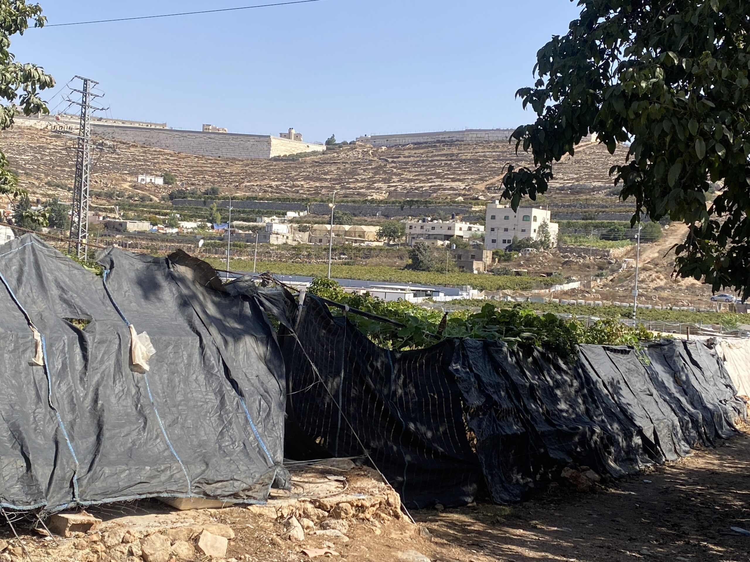
We arrived at the home of Ata’s sister, on the western side of the road, where it is possible to park in her yard. They have placed fabric over the vineyard fence to absorb the dust rising from the road, but this does not prevent the vine leaves and fruit from becoming covered in dust. [Photo attached]
Ata walked over from his home, picking grapes for us from his vineyard on the way. He was covered in dust just from walking down the track. He says the vines are affected by the dust, and there has still been no rain to wash it off. Nor is there a market in which to sell the grapes. We sit in his sister’s home, and Ata rightly accuses us, and our people, of not caring about the Palestinians, who have been suffocating them for so many years.
At the girls’ school junction, we meet Ahmad, who tells us that in Sa’ir, his village, demolition orders have been posted on four houses of more than one story. They have ten days to appeal before the demolitions.
On the way back, a new sign reading “Havat Raveh” points toward several houses on a hill west of Tene Omarim. This time the sign is official – under the auspices of the Jewish National Fund (JNF) and the Council for Conservation of Heritage Sites in Israel.
Location Description
A-Sawiya
See all reports for this place-
A-Sawiya
Located about 18 km south of Nablus.
The population of the village was 2,904 in 2016. In 1983, about 400 dunams, on a hill about a kilometer south of the village, were declared "state lands" and the settlement of Ali was established on them. Over the years, the settlement has expanded to additional lands privately owned by the villagers, and nearby villages in an area of about 1,000 dunams. Only in 2013 was an outline plan prepared for Ali, in which hundreds of illegal structures were approved in its territory. In 2017, a synagogue was built in the Ali settlement, in violation of the law without permits, outside the legal territory of the settlement and on private Palestinian land of a-Sawiya residents.
Over the years, the settlement has expanded to additional lands privately owned by the villagers, and nearby villages in an area of about 1,000 dunams. Only in 2013 was an outline plan prepared for Ali, in which hundreds of illegal structures were approved in its territory. , Outside the legal territory of the settlement and on private Palestinian land of the residents of a-Sawiyah.
Checkpoint Watch companies have been in contact with the village since 2007. They document the checkpoints, the settlers' violence, the sewage problems flowing from the nearby settlements and outposts, and even held knitting and English lessons with women in the village. Even during the Corona we were in telephone contact to help the plight of the residents.
-
Beit Amin South / Abu Salman (1447)
See all reports for this place-
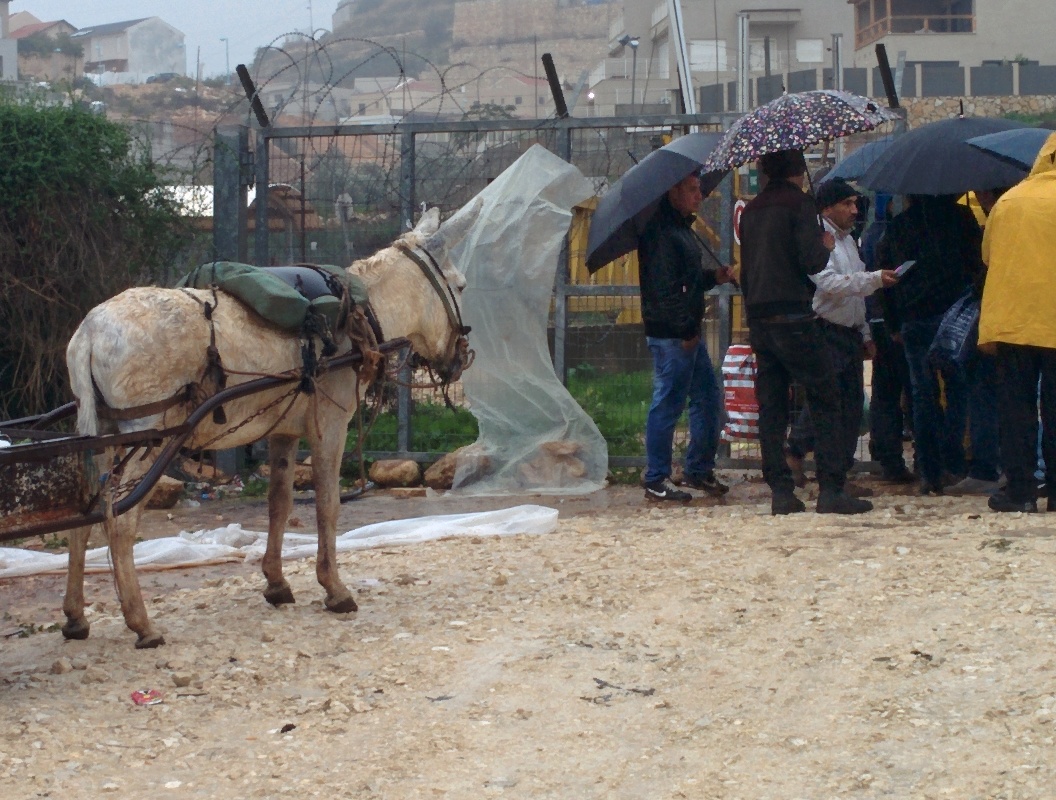
Beit Amin South / Abu Salman (1447) An agricultural checkpoint in the village of Abu Salman, which opens three times a day and is used by the farmers of Beit Amin and Abu Salman, and since the nearby gate has been inactive, also residents of 'Azzun' Atma, to reach their lands in the seamline zone adjacent to the settlement of Oranit.
-
Dura Al-Fawwar Junction
See all reports for this place-
Junction on Route 60: west - the town of El Dura, east - the Al Fawwar refugee camp. There is a manned pillbox at the junction. From time to time the army sets up flying checkpoints at the entrance to El Fawwar and Al Dura. Al-Fawwar is a large refugee camp (7,000 inhabitants in 2007) established in 1949 to accommodate Palestinian refugees from Be'er Sheva and Beit Jubrin and environs. There are many incidents of stone-throwing. In the vicinity of the pillbox there are excellent agricultural areas, Farmers set up stalls adjacent to the plots close to the road. In recent months the civil administration has set up dirt embankments thereby blocking access to the stalls, and making it impossible for the farmers to sell their vegetables. Updated April 2021, Michal T.
-
Hakvasim (sheep) Junction
See all reports for this place-
One of the roadblocks (earthworks, rocks, concrete blocks or iron gates) that prevent transit of vehicles to Route 60 in the southern West Bank and block the southern entrance to Hebron. A manned pillbox supervises the place.
-
Hebron
See all reports for this place-
According to Wye Plantation Accords (1997), Hebron is divided in two: H1 is under Palestinian Authority control, H2 is under Israeli control. In Hebron there are 170,000 Palestinian citizens, 60,000 of them in H2. Between the two areas are permanent checkpoints, manned at all hours, preventing Palestinian movement between them and controlling passage of permit holders such as teachers and schoolchildren. Some 800 Jews live in Avraham Avinu Quarter and Tel Rumeida, on Givat HaAvot and in the wholesale market.
Checkpoints observed in H2:
- Bet Hameriva CP- manned with a pillbox
- Kapisha quarter CP (the northern side of Zion axis) - manned with a pillbox
- The 160 turn CP (the southern side of Zion axis) - manned with a pillbox
- Avraham Avinu quarter - watch station
- The pharmacy CP - checking inside a caravan with a magnometer
- Tarpat (1929) CP - checking inside a caravan with a magnometer
- Tel Rumeida CP - guarding station
- Beit Hadassah CP - guarding station
Three checkpoints around the Tomb of the Patriarchs
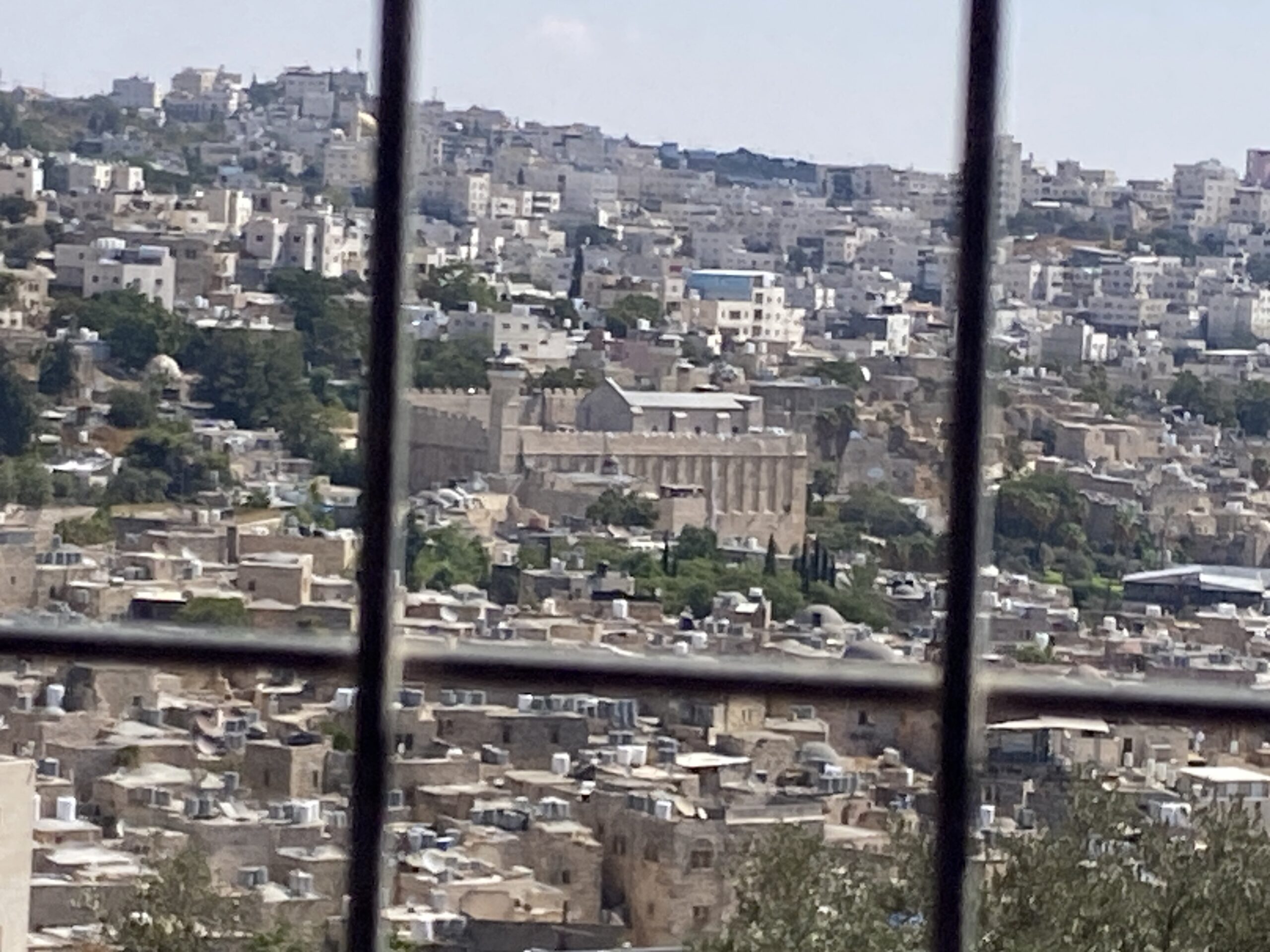 Yael ZoranSep-24-2026Hebron and the Cave of the Patriarchs from Beit Hashalom
-
Meitar checkpoint / Sansana
See all reports for this place-
Meitar Checkpoint / Sansana The checkpoint is located on the Green Line and serves as a border crossing between Israel and the West Bank. It is managed by the Border Crossing Authority of the Defense Ministry. It is comprised of sections for the transfer of goods as well as a vehicle checkpoint (intended for holders of blue identity cards, foreign nationals or diplomats and international organizations). Passing of Palestinians is prohibited, except for those with entry permits to Israel. Palestinians are permitted to cross on foot only. The crossing has a DCO / DCL / DCL / DCL (District Coordination Office), a customs unit, supervision, and a police unit. In the last year, a breach has been opened in the fence, not far from the crossing. This breach is known to all, including the army. There does not appear to be any interest in blocking it, probably as it permits needed Palestinian workers without the bureaucratic permits to get to work in Israel. Food stalls and a parking area economy have been created, but incidents of violent abuse by border police have also been recorded. Updated April 2022
-