Jalud, Jama'in, Za'tara (Tapuah), Zeta
Jalud
12:30 - The checkpoint at the Zeita-Jamain junction is open.
No delays at the Za'atra junction. As usual soldiers are waiting at the hitchhikers' stop.
13:00 – Jalud. Appointment with A., head of the local council, at his office in village council.
A new settlement named "Geulat Zion" is to be built on Jalud farm land. The violent settlements Esh Kodesh, Kida, Yishuv Daat, Ahiya and Adey Ad, some of which were built on Jalud land, are to be ratified. The village intends to launch a legal fight to keep its land. The first step will be their demand to evacuate "Adey Ad".
A., head of the local council, is worried. He describes how the villagers have been robbed of their land in a slowly ongoing but consistent process throughout the years of the occupation. In 1978, land was confiscated for military purposes and also to build the Shiloh settlement. Since then, and especially during the last 15 years, some of the most violent settlements have been built around Shiloh and thousands of dunams of farmland have been confiscated from the surrounding villages. The Palestinians are being robbed of land which they have been working for generations under the pretext that this land belongs to the state.
85 % of Jalud's land is in area C. The villagers are afraid that all this land might be taken from them. A. claims that the authorities confiscate the land due to military needs, or they declare it state land in order to prevent the land owners from opposing the confiscation. He complains about the fact that private land owners are prevented from reaching their land under the pretext of security needs. And when the land is not cultivated the settlers take possession of it for their private needs.
A. is concerned about the massive building projects in the settlements. "This is a very large project", he explains, "5 settlements: Adey Ad, Kida, Esh Kodesh, Yeshuv Hdaat and Ahiya are to be ratified in accordance with the government resolution of 12.10.15."
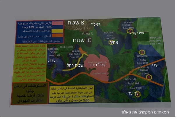
He shows a map illustrating the expansion of the settlements on Jalud's agricultural land in area C. The blue areas have been confiscated under the pretext that they are state land.The green land between them is private land that cannot be reached due to security reasons. These areas are being controlled by the settlers who cultivate approximately 2000 dunams of this land.
Moreover, in accordance with the decision of Israeli authorities the illegal settlement, Gulat Zion, is to be ratified. On the map this settlement is colored pink. The plan is to build 139 housing units. The settlement will extend over a large area and will connect between all the settlements in such a way that at the end of the project the "Seven Hill City" will have been completed, even though the "Ten Hill City" already exists.
Picture 1. Settlement map: The settlements (blue) in the Jalud area. The yellow stripe marks the road. The pink area is intended to be a new settlement named "Geulat Zion" which will connect between the "Shvut-Rachel" settlements and Shiloh.
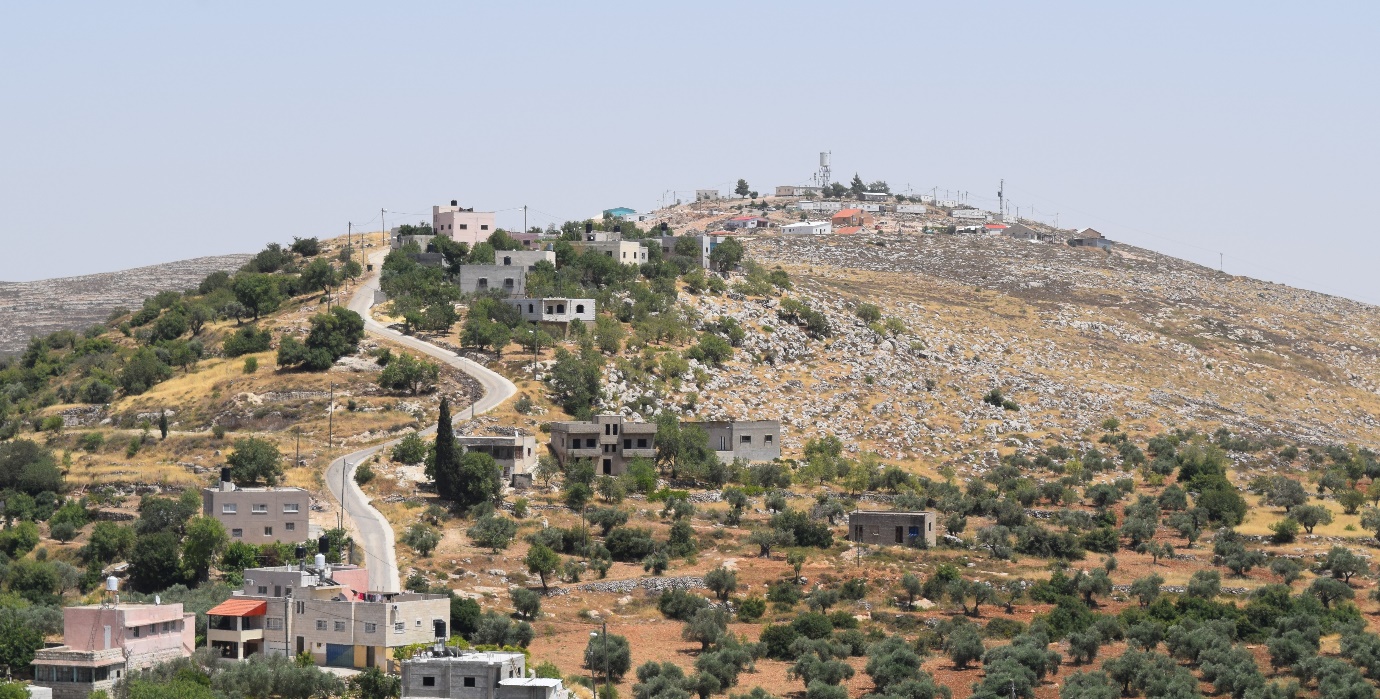
Picture 2. The Achiya settlement seen from the roof of the local council in Jalud. The settlement's buildings are bordering on the houses in the village.
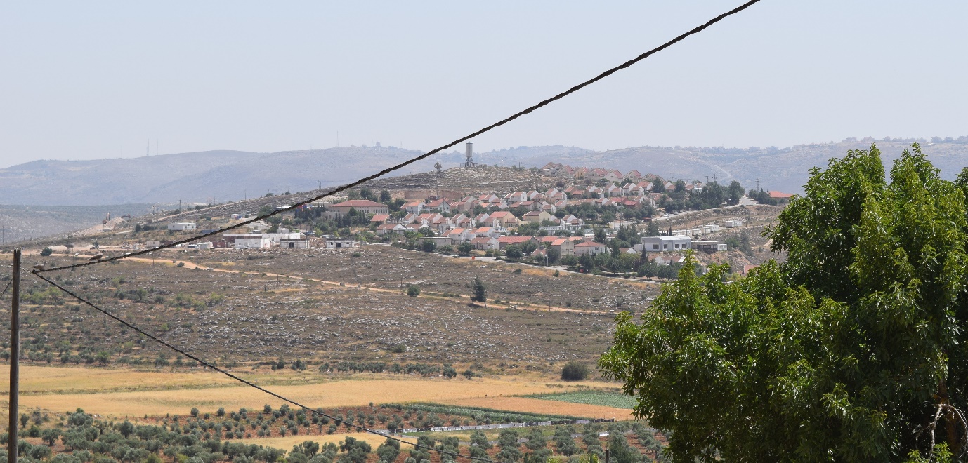
Picture 3. The Shiloh settlement.
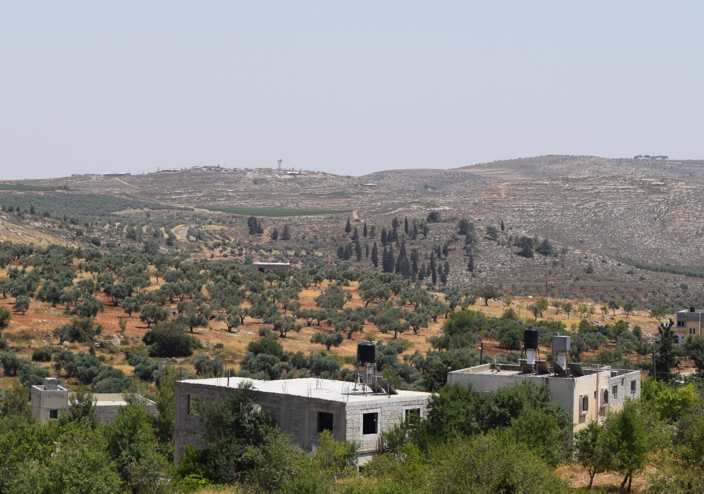
Picture 4. The houses in the Adey Ad settlement can be seen on the mountain ridge.