
סימיא - מתנחלים הכניסו פרות לאדמה פרטית והן אכלו את כל היבול
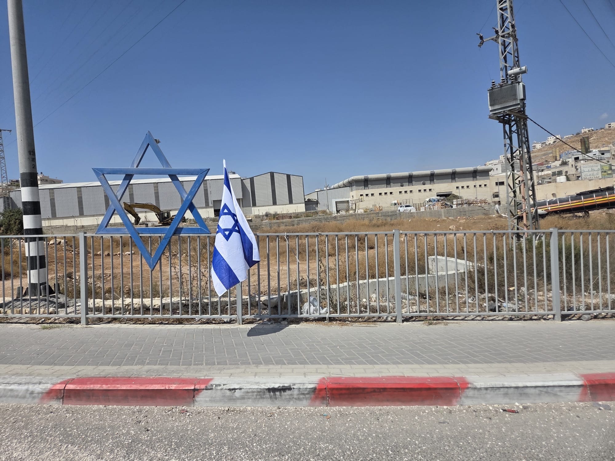
- כביש 60 וגם כביש 317 רצופים דגלי ישראל לאורכם. כך נראה סיפוח דה פקטו (שמלווה בטיהור אתני).
- כניסות חסומות בשערים צהובים: לסמוע, לסימיא, לדהריה, לעבדה. רכבים שמנסים לעקוף חסימות אלו דרך דרכי עפר, נעצרים על ידי הצבא, לוקחים להם מפתחות, מענישים אותם בעמידה שם שעות ארוכות, אולי מחזירים מפתחות ואולי לא, בינתיים הרכב העצור חוסם את הפרצה. מספרים לנו על עצה: תחזיק בכיס מפתח נוסף ותנסה להיחלץ מהשטח עם הרכב…
- בצומת דורא / אל פוואר אנחנו פוגשים את ראניה, מהמשפחה בפוקיקיס שליד התנחלות נגוהות המתחם של המשפחה חסום מכל הצדדים על ידי המתנחלים. כיוון שאי אפשר להגיע אליהם עם אוכל למשפחה, אנחנו נותנים לה כסף מזומן אותו היא שולחת עם אחיה. היא ואחיותיה עובדות בדורא ושוכרות שם דירה. מאז 7.10.23 כמעט לא הייתה בבית. היא הדפיסה בדורא תעודות גמר לגן הילדים של הודא עם עלייתם לכיתה א’. מוחמד יביא לגן את התעודות בשבוע הבא.
- בצומת אדוריים שלט שמפנה למצפה חדש, “מצפה ראובן”, מדרום לאדוריים, מעבר לכביש. גם מול עבדה שלט שמכוון למצפה חדש, “אפקה”. השטח מלא מצפים חדשים שכאלה.
- ביקור אצל פרחאן בסימיא. יש בכפר שני בתי ספר משני צידי כביש 60. אשתו מפעילה קיוסק באחד מהם, הבן שלו עובד שם בתור שרת. הוא אישית מתפרנס בקושי מחקלאות. פעם הייתה לו מונית, אין עבודה עכשיו, לא משתלם להפעיל אותה. יש לו אדמה ליד הכביש שלא כדאי לו לעבד אותה כי אנשים עוברים שם ורומסים. מולנו בצד השני של הכביש, המתחם של ג’מאל. מתנחלים הכניסו פרות שאכלו את כל תפוחי האדמה שגידל. פרחאן מדווח על שני אירועים:
- בערב יום העצמאות שני מתנחלים הציבו דגלי ישראל ליד הכביש, אחד נסע ופיזר אותם, השני נסע אחריו ותקע אותם.
המתנחלים רצו אחרי ילדים בכפר בטענה שהם גנבו דגלים. הם ניסו לפרוץ לבית שלו, הבת הייתה בבית ונעלה את הדלת, אז התנפלו על חביות מי השתייה שהיו בחוץ ושפכו אותם. לשכנים יש משאבה לשאיבת מים מהבור. מתנחל פרק אותה וניסה לגנוב אותה. פרחאן היה באותו זמן בחממות שלו, התקשרו אליו והוא הגיע מיד הביתה. המתנחלים דרשו תעודות זהות, הגיס שלו נתן את התעודה, פרחאן סרב לתת. מתנחלים רדפו אחרי הנכד שלו שהלך לכיוון החנות שליד הכביש. פרחאן הראה להם דגל שאיתו ילדות שיחקו ליד הכביש, לא גנבו כלום. הצבא הוזעק. פרחאן דיווח שלקחו תעודת זהות, הצבא לקח את התעודה מהמתנחל והחזיר אותה. אחד המתנחלים התנצל, ייתכן שפחד מהצבא.
- אתמול, בערך ב-5-6, אחרי הצהריים, אירוע בדיר שמס הסמוכה, שפרחאן יודע עליו מרשת הקשר האזורית שלהם. לאחמד עבד אל-סלאם סמאמרה משוויכה יש שם כרם זיתים. יש מתנחל שכל הזמן מכניס את הרכב שלו לכרם. אחמד בא לגרש את המתנחל, שהזמין תגבורת של מתנחלים נוספים, הם היכו את אחמד ואת בנו. בא הצבא ועצר את אחמד, הבן מאושפז בסורוקה. הם כל כך פחדו שלא צילמו בעת הפשיטה הזאת עליהם. המתנחלים הרסו את כל הזיתים. אגב, אחיו של מוחמד קנה פעם חלקה עם בית בדיר שמס, כשזה היה זול, הוא לא מגיע לשם בעצם.
- במקום זנותא שגורשה, עדר פרות של ינון לוי מחוות מיתרים (זה הרוצח של עודה הדלין מאום אל-ח’יר).
Location Description
Dura Al-Fawwar Junction
See all reports for this place-
Junction on Route 60: west - the town of El Dura, east - the Al Fawwar refugee camp. There is a manned pillbox at the junction. From time to time the army sets up flying checkpoints at the entrance to El Fawwar and Al Dura. Al-Fawwar is a large refugee camp (7,000 inhabitants in 2007) established in 1949 to accommodate Palestinian refugees from Be'er Sheva and Beit Jubrin and environs. There are many incidents of stone-throwing. In the vicinity of the pillbox there are excellent agricultural areas, Farmers set up stalls adjacent to the plots close to the road. In recent months the civil administration has set up dirt embankments thereby blocking access to the stalls, and making it impossible for the farmers to sell their vegetables. Updated April 2021, Michal T.
-
Shweika
See all reports for this place-
Shweika
The checkpoint is located north of the Palestinian city of Shweika. In this area, the separation barrier was built east of the Green Line, for no apparent reason. There is no settlement there that should be in succession with the State of Israel.
But ... there is a single house that belongs to a Palestinian family. The separation barrier cut off the house and its occupants from the Palestinian settlement and left them in the seam area. That is, between the fence and the West Bank.
The residents of the house are supposed to manage their lives in connection with the settlements in the West Bank. They are not allowed to move within the State of Israel. In order to reach the West Bank, they need a permit and soldiers to open the checkpoint for them ...
One more catch...
-
South Hebron Hills
See all reports for this place-
South Hebron Hills
South Hebron Hills is a large area in the West Bank's southern part.
Yatta is a major city in this area: right in the border zone between the fertile region of Hebron and its surroundings and the desert of the Hebron Hills. Yatta has about 64,000 inhabitants.
The surrounding villages are called Masafer Yatta (Yatta's daughter villages). Their inhabitants subsist on livestock and agriculture. Agriculture is possible only in small plots, especially near streams. Most of the area consists of rocky terraces.Since the beginning of the 1980s, many settlements have been established on the agricultural land cultivated by the Palestinians in the South Hebron Hills region: Carmel, Maon, Susia, Masadot Yehuda, Othniel, and more. Since the settlements were established and Palestinians cultivation areas have been reduced; the residents of the South Hebron Hills have been suffering from harassment by the settlers. Attempts to evict and demolish houses have continued, along with withholding water and electricity. The military and police usually refrain from intervening in violent incidents between settlers and Palestinians do not enforce the law when it comes to the investigation of extensive violent Jewish settlers. The harassment in the South Hebron Hills includes attacking and attempting to burn residential tents, harassing dogs, harming herds, and preventing access to pastures.
There are several checkpoints in the South Hebron Hills, on Routes 317 and 60. In most of them, no military presence is apparent, but rather an array of pillboxes monitor the villages. Roadblocks are frequently set up according to the settlers and the army's needs. These are located at the Zif Junction, the Dura-al Fawwar crossing, and the Sheep Junction at the southern entrance to Hebron.
Updated April 2022
 Timna OrevSep-24-2026Replacing flags on Highway 6
-
Umm al-Khair
See all reports for this place-
Umm al-Kheir
A Palestinian village in the southern Hebron governorate, populated by five families. The Palestinian residents settled there decades ago, after Israel expelled them from the Arad desert and purchased the land from the residents of the Palestinian village of Yatta. The village suffers from the violence of nearby Carmel settlers, from water shortage and is subject to frequent demolition of buildings by the Civil Administration.
-
Zanuta
See all reports for this place-
Zanuta was a small rural Palestinian locality until its demolition. It was situated in the space around the town Dahariya in the South Hebron Hills, about a ten-minute ride from Meitar Checkpoint. There are documented remains of a large Byzantine settlement in the area. Since the Ottoman (Turkish Empire) period (1516-1917) Zanuta was documented as a locality of shepherds and farmers who live in the remains of the ancient structures and the residential caves near them.
Two individual ranches of colonists were created next to Zanuta: Meitarim (of the colonist Yinon Levi) to the east, and Yehudah (of the colonist Elyashiv Nachum) to the north. Endless attacks, harassments and attempt to chase away the Zanuta villagers have originated in these two outposts.
Until the expulsion, four families lived in the village: A-Samama, Al-Tel, Al Batat, and Al-Qaisia. Farming constituted their main economic activity and employed most of the villagers. The total area of the village is about 12,000 dunams, of which about 3,000 are tended, mostly with field crops.
This village has never had a master plan that would legitimize construction permits. The Civil Administration claimed it was too small and the distance to the next town, Dahariya, too great. For this reason, the Israeli authorities pressured the villagers to leave. The colonists did the job for them.
-
