
‘Azzun, Habla, Imatin
09:00 We left from the Rosh Ha’ayin train station.
09:30 ‘Azzun women’s club. Sarah began with a yoga class. Nine women participated, a relatively large group. Problems communicating (language). Sarah demonstrates and explains in English; the women try to follow. They have trouble understanding; that’s clear from how they’re performing the exercises. Sarah wants to find an additional yoga teacher to help her. That way they’ll be better able to work with the women individually. The women are pleased with the class. Sarah continues to Imatin with Nadim. Dafna and Saraleh hold an introductory Hebrew class. They laugh enjoyably at words similar in both languages.
10:00 Imatin. A Hebrew class. Nine women participate. Reading and conversation. The women are disappointed that problems obtaining permits may prevent their beach outing. I promised to look into it.
11:30 Sarah arrives for the yoga class. These women understand Sarah’s explanations in English very well and they work impressively. Teacher and students enjoy themselves.
13:00 Back to ‘Azzun and then to Habla gate.
13:15 Habla gate is open; people cross quickly. Laborers wait only a few minutes, are signaled to come through and disappear past the second gate. A convoy of tractors, cars, a donkey cart, a horse cart – all cross without delay.
13:40 Back to the Rosh Ha’ayin train station.
'Azzun
See all reports for this place-
Azoun (updated February 2019)
A Palestinian town situated in Area B (under civil Palestinian control and Israeli security control),
on road 5 between Nablus and Qalqiliya, east of Nabi Elias village. The inhabitants are allowed to construct and improve infrastructures. The Separation Fence has confiscated lands belonging to the town's people. In 2018 olive tree groves owned by one of its inhabitants were confiscated for the sake of paving a road to bypass Nabi Elias. Azoun population numbers 13,000, its economic state dire. Its infrastructures are poor, neglect and poverty rampant. In the meantime, the town council has completed paving an internal road for the inhabitants' welfare.
Because of its proximity to the Jewish settler-colony of Karnei Shomron and its outposts, the town suffers the intense presence of the Israeli army, especially at nighttime: soldiers enter homes, arrest suspects, trash the house and sometimes ruin it, as they do in numerous places in the West Bank. At times a checkpoint closes the entrance to the town, so no one can come in or get out.
-
Habla
See all reports for this place-
Habla CP (1393)
The Habla checkpoint (1393) was established on the lands of the residents of Qalqilya, on the short road that
connected it for centuries to the nearby town of Habla. The separation barrier intersects this road twice and cut off the residents of Qalqilya from their lands in the seam zone.(between the fence and the green line).
There is a passage under Road 55 that connects Qalqilya to the sabotage This agricultural barrier is used by the farmers and nursery owners established along Road 55 from the Green Line and on both sides of the kurkar road leading to the checkpoint.
This agricultural checkpoint serves the residents of Arab a-Ramadin al-Janoubi (detached from the West Bank), who pass through it to the West Bank and back to their homes. The opening hours (3 times a day) of this agricultural checkpoint are longer than usual, about an hour (recently shortened to 45 minutes), and are coordinated with the transportation hours of a-Ramadin children studying in the occupied in the West Bank.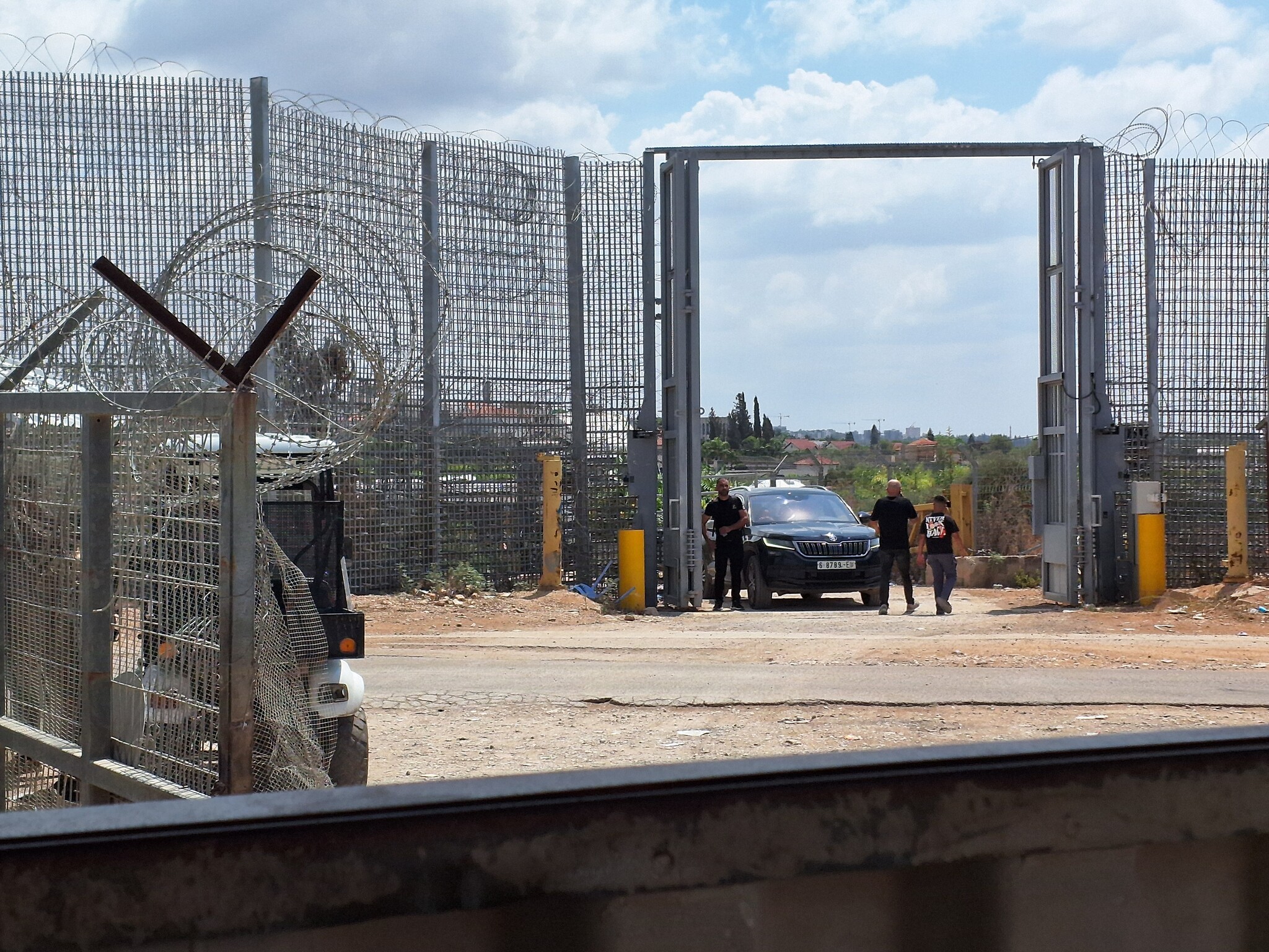 Ronit Dahan-RamatiAug-31-2026Habla. The gate is open
-
Imatin
See all reports for this place-
Imatin This village lies in the West Bank, 19 kilometers southwest of Nablus city and 23 kilometers east of the city of Qalqiliya. Its inhabitants' number 799, all members of four families from the neighboring village of Imatin. Far’ata is identified with the Biblical Far’atoun, and an archeological survey has identified findings on a timeline from the Second Iron Age until the days of the Ottoman Empire. After the Oslo Accords, the built-up area of the village was categorized as Area B, but 80% of its farmlands were classified as Area C. In 2002, settlers founded the outpost of Havat Gil’ad, which they claim is located on privately-owned land purchased by the Zar family. The Palestinians claim they own the land. The Civil Administration has issued demolition orders for all the structures in this outpost and they were declared illegal, but nothing was done about it. On February 4, 2018, the Israeli government unanimously ruled to regulate this outpost by defining it as a new settlement or by erecting a new settlement next to it. Beginning in 2012, the Palestinian Authority ruled to include Far’ata in the local council of Imatin, a larger community. For further information: http://vprofile.arij.org/qalqiliya/pdfs/vprofile/immatin_vp_en.pdf

 +-
+-
-
