
Dura-Al Fawwar Junction, South Hebron Hills

Just before the Dura crossroad, there were two guard posts with 2 soldiers in each one located across from a well. Their duty was to prevent demonstrations and stone throwing from occurring there. Our first stop was at Khursa to meet with Tawfiq, a local resident. We met at his store which is located near an army lookout station. Road barriers have been built in front of the army station preventing villagers from gaining easy access to other parts of the village.
Tawfiq told us that the sewage container constructed for the use of the soldiers often overflows with their waste running onto the street. The smell is intolerable. What particularly worries the citizens is that when it rains, the waste flows down the street approaching a local spring. If it reaches the spring, the waste will contaminate the spring and make the water unusable. The army has been asked several time to fix the problem but has yet to do so.
From Khursa we drove in the direction of Negohot settlement. Negohot A is on a hill on the right side of the road; Negohot B is in a hilly valley on the left side of the road. One of the settlers owns a sheep farm.
An isolated Palestinian house sits across the road from Negohot B. Down the hill, there is a family grave (I am assuming it is a family grave).
On the hill above the house, another road being constructed to Negohot A (not sure if this is so. It may be going elsewhere). How long can this house and its occupants remain in this location?
Dura Al-Fawwar Junction
See all reports for this place-
Junction on Route 60: west - the town of El Dura, east - the Al Fawwar refugee camp. There is a manned pillbox at the junction. From time to time the army sets up flying checkpoints at the entrance to El Fawwar and Al Dura. Al-Fawwar is a large refugee camp (7,000 inhabitants in 2007) established in 1949 to accommodate Palestinian refugees from Be'er Sheva and Beit Jubrin and environs. There are many incidents of stone-throwing. In the vicinity of the pillbox there are excellent agricultural areas, Farmers set up stalls adjacent to the plots close to the road. In recent months the civil administration has set up dirt embankments thereby blocking access to the stalls, and making it impossible for the farmers to sell their vegetables. Updated April 2021, Michal T.
-
South Hebron Hills
See all reports for this place-
South Hebron Hills
South Hebron Hills is a large area in the West Bank's southern part.
Yatta is a major city in this area: right in the border zone between the fertile region of Hebron and its surroundings and the desert of the Hebron Hills. Yatta has about 64,000 inhabitants.
The surrounding villages are called Masafer Yatta (Yatta's daughter villages). Their inhabitants subsist on livestock and agriculture. Agriculture is possible only in small plots, especially near streams. Most of the area consists of rocky terraces.Since the beginning of the 1980s, many settlements have been established on the agricultural land cultivated by the Palestinians in the South Hebron Hills region: Carmel, Maon, Susia, Masadot Yehuda, Othniel, and more. Since the settlements were established and Palestinians cultivation areas have been reduced; the residents of the South Hebron Hills have been suffering from harassment by the settlers. Attempts to evict and demolish houses have continued, along with withholding water and electricity. The military and police usually refrain from intervening in violent incidents between settlers and Palestinians do not enforce the law when it comes to the investigation of extensive violent Jewish settlers. The harassment in the South Hebron Hills includes attacking and attempting to burn residential tents, harassing dogs, harming herds, and preventing access to pastures.
There are several checkpoints in the South Hebron Hills, on Routes 317 and 60. In most of them, no military presence is apparent, but rather an array of pillboxes monitor the villages. Roadblocks are frequently set up according to the settlers and the army's needs. These are located at the Zif Junction, the Dura-al Fawwar crossing, and the Sheep Junction at the southern entrance to Hebron.
Updated April 2022
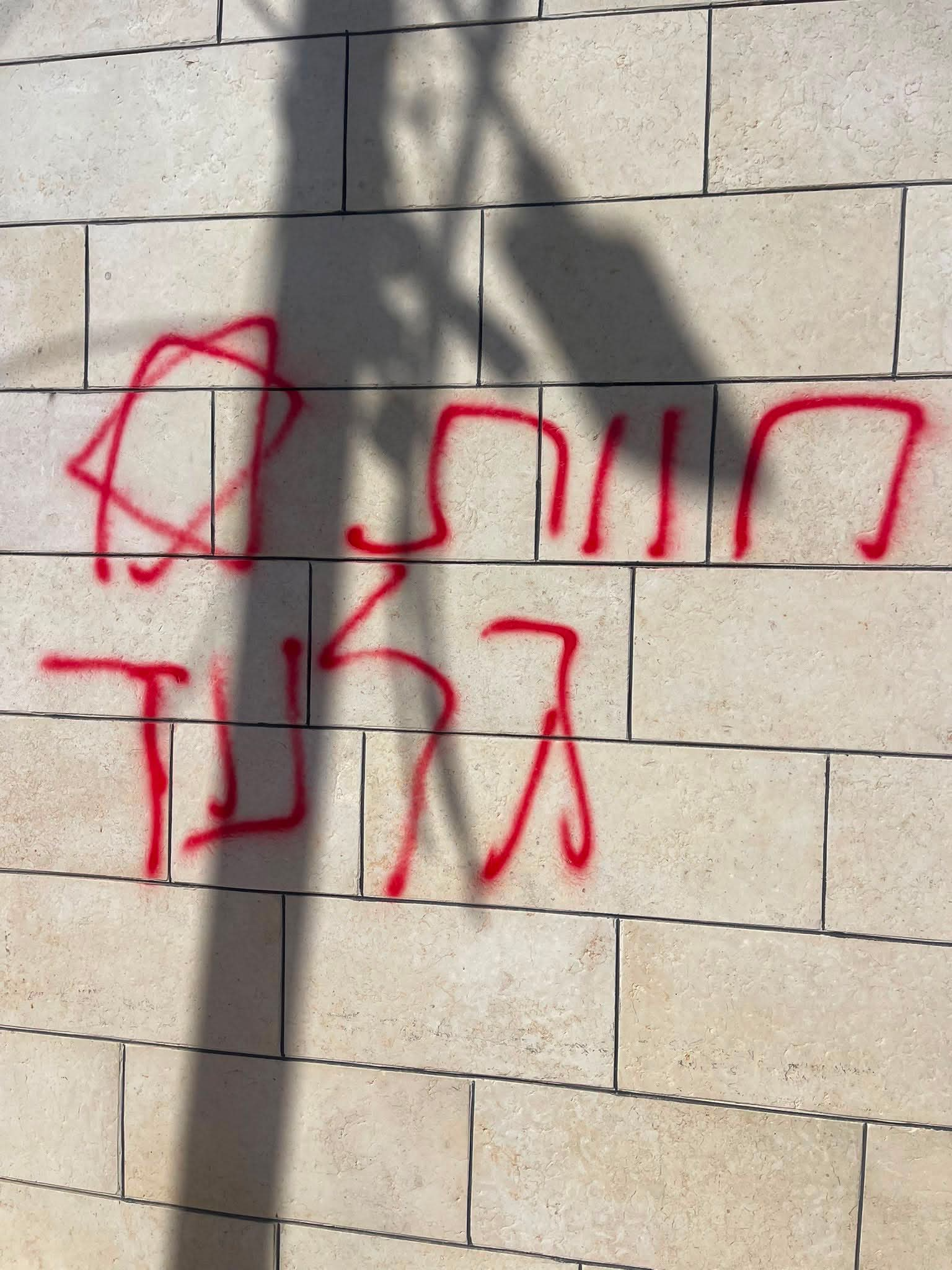 A Palestinian residentJul-19-2026Graffiti sprayed in A-Tuwani
-