
Hebron, South Hebron Hills, Mon 24.11.08, Afternoon
Road 35
Western entrance to Hebron suburbs: Gate is locked, a Pelephone technician (Israeli cellular phone company) awaits the keys together with a group of reserve paratroopers.
Second entrance – past the Olive Gate bridge — is open, private cars moving through.
Humanitarian CP – shut.
Road 60
Few cars. Shiuyukh Hebron – several passers-by.
Hebron
Many children walking back from school. In the vicinity of the Patriarchs' Tomb Cave it is quiet, and so too, at the Pharmacy CP – a few soldiers and several children.
Everywhere, signs announcing the march scheduled for tomorrow – Tuesday – from Jerusalem and the Masmiyeh junction (down south) to Hebron – to support and strengthen the "Peace House" (as the "Disputed House" is referred to by sympathizers).
Shuhaida St., the hill going up to Tel Rumeida – many children walking back from school.
Tel Rumeida CP: open, two Give'ati soldiers check for the n-th time whoever walks past, one of them tries to persuade us how good it is that the settlers live in Hebron….
The place is practically covered with military vehicles – jeeps, command-cars, some police cars too – everyone is apparently preparing for the pull-out/evacuation of the Disputed House.
Downhill, we stop at Basm's store/shoe factory, where he proudly shows us photos he's taken: five cars have had their wheels punctured tonight. He dispatches these photos to 'Betzelem'. Some Israeli flags are still proudly flying on top of the Disputed House.
We climb the stairs up to the Disputed House: there are many soldiers and policemen, as well as military vehicles (especially border-control). Outside the house, there are many settlers, hanging signs, extremely active. All of a sudden, a policeman announces that we're not allowed there by force of a "closed military zone" (never presented to us).
Next to the mosque – the cemetery. A Magen David is drawn in black on one of the tombstones, while the mosque's walls are white-washed – testifying to the erased graffitiof the settlers. And still more signs: "Marching to Hebron", "Emergency convention for the House of Peace."
Hebron
See all reports for this place-
According to Wye Plantation Accords (1997), Hebron is divided in two: H1 is under Palestinian Authority control, H2 is under Israeli control. In Hebron there are 170,000 Palestinian citizens, 60,000 of them in H2. Between the two areas are permanent checkpoints, manned at all hours, preventing Palestinian movement between them and controlling passage of permit holders such as teachers and schoolchildren. Some 800 Jews live in Avraham Avinu Quarter and Tel Rumeida, on Givat HaAvot and in the wholesale market.
Checkpoints observed in H2:
- Bet Hameriva CP- manned with a pillbox
- Kapisha quarter CP (the northern side of Zion axis) - manned with a pillbox
- The 160 turn CP (the southern side of Zion axis) - manned with a pillbox
- Avraham Avinu quarter - watch station
- The pharmacy CP - checking inside a caravan with a magnometer
- Tarpat (1929) CP - checking inside a caravan with a magnometer
- Tel Rumeida CP - guarding station
- Beit Hadassah CP - guarding station
Three checkpoints around the Tomb of the Patriarchs
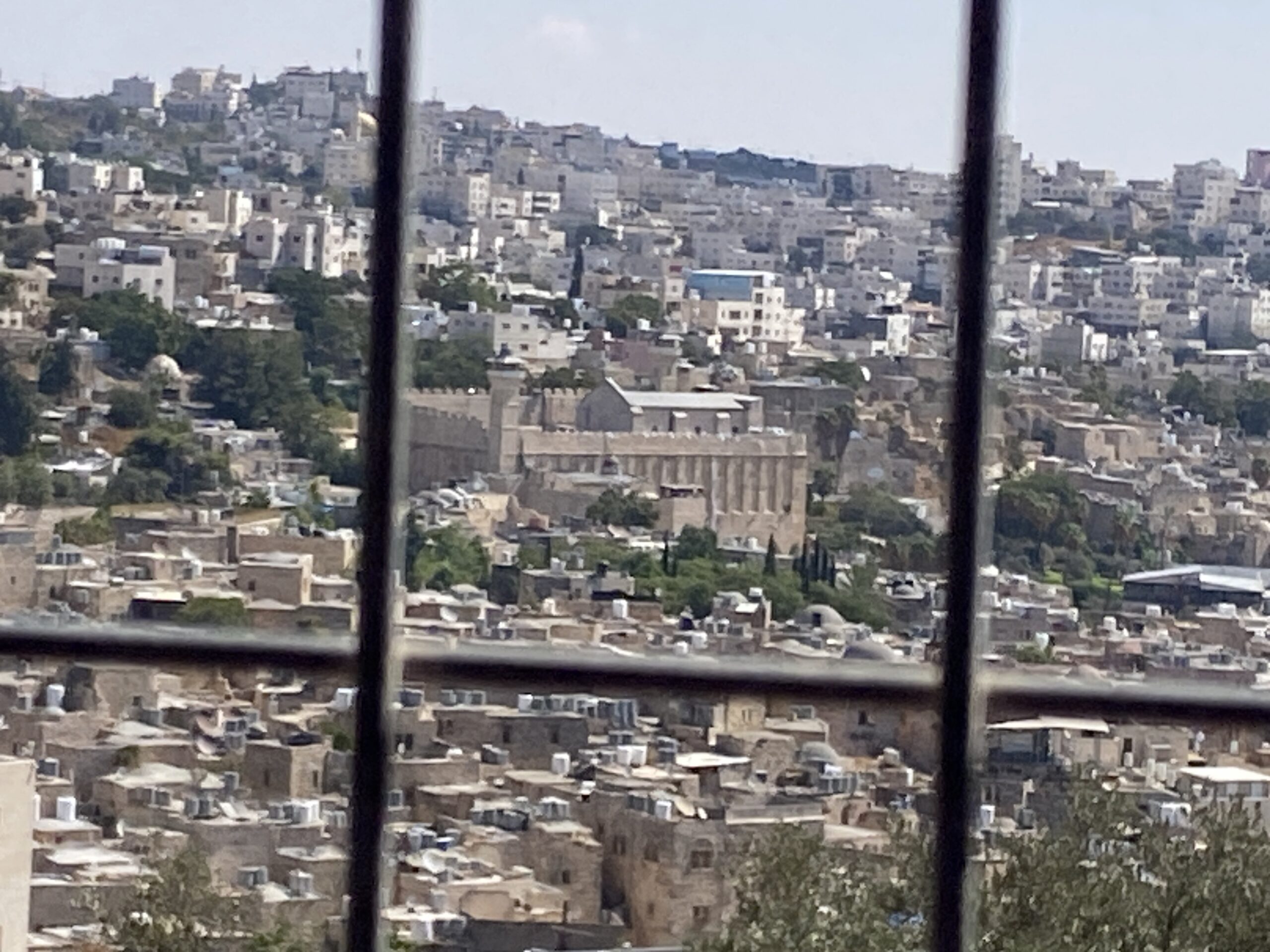 Yael ZoranSep-24-2026Hebron and the Cave of the Patriarchs from Beit Hashalom
-
South Hebron Hills
See all reports for this place-
South Hebron Hills
South Hebron Hills is a large area in the West Bank's southern part.
Yatta is a major city in this area: right in the border zone between the fertile region of Hebron and its surroundings and the desert of the Hebron Hills. Yatta has about 64,000 inhabitants.
The surrounding villages are called Masafer Yatta (Yatta's daughter villages). Their inhabitants subsist on livestock and agriculture. Agriculture is possible only in small plots, especially near streams. Most of the area consists of rocky terraces.Since the beginning of the 1980s, many settlements have been established on the agricultural land cultivated by the Palestinians in the South Hebron Hills region: Carmel, Maon, Susia, Masadot Yehuda, Othniel, and more. Since the settlements were established and Palestinians cultivation areas have been reduced; the residents of the South Hebron Hills have been suffering from harassment by the settlers. Attempts to evict and demolish houses have continued, along with withholding water and electricity. The military and police usually refrain from intervening in violent incidents between settlers and Palestinians do not enforce the law when it comes to the investigation of extensive violent Jewish settlers. The harassment in the South Hebron Hills includes attacking and attempting to burn residential tents, harassing dogs, harming herds, and preventing access to pastures.
There are several checkpoints in the South Hebron Hills, on Routes 317 and 60. In most of them, no military presence is apparent, but rather an array of pillboxes monitor the villages. Roadblocks are frequently set up according to the settlers and the army's needs. These are located at the Zif Junction, the Dura-al Fawwar crossing, and the Sheep Junction at the southern entrance to Hebron.
Updated April 2022
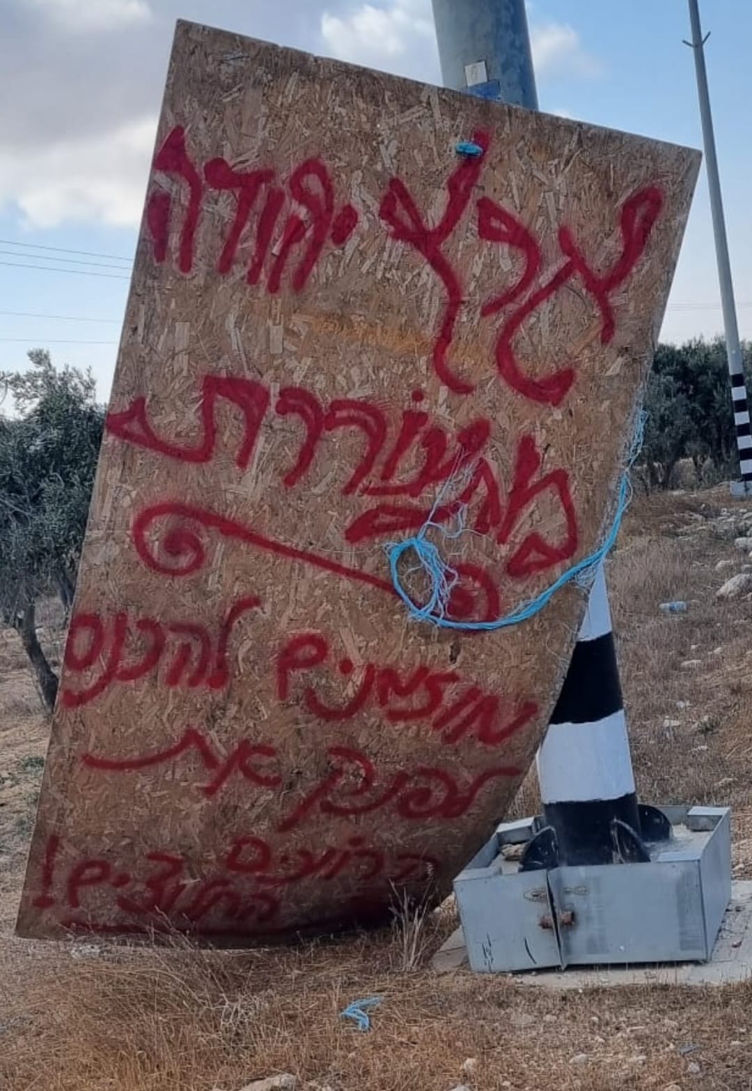 Smadar BeckerOct-17-2026A sign placed by those who call themselves the Pioneer Shepherds, at the outpost adjacent to Qawawis
-
