
Sheikh Sa’ed and Qalandiya, Monday 21.2.2011, PM
We drove to Qalandiya through Jebel Mukaber and Sheikh Sa'ed (a section of Jebel Mukaber that has been designated as not in Jerusalem although Jebel Mukaber itself is). In the beginning we followed the signs to Nof Zion (an Israeli settlement), which was the only place signed although the Palestinian neighborhoods are much larger. At the bottom of the hill, where the road turns off to Sheikh Sa'ed, we saw heavy earth moving equipment eating away at the scenery. Our immediate reaction was that Moskowitz was building another settlement, so we got out of the car and went to ask. It was relief to be told that the equipment was actually there to build a soccer/football field.
We arrived at Sheikh Sa'ed at about 14:00 and entered the neighborhood on foot, as do the residents with permits or Jerusalem IDs, passing through the turnstile in the separation fence. Several taxis were parked just beyond the fence and one of the drivers offered to take us to see the road that "connects" the neighborhood to other Palestinian villages that have been fenced out of Jerusalem. This, the only road in and out of Sheikh Sa'ed open to Palestinians without permits (and also the only road via which groceries and produce can be delivered and ambulances arrive), had been closed the previous day because of the heavy rains which caused flooding of the open sewage ditch that is the Stream of Kidron which drains the sewage of such Jerusalem neighborhoods as Silwan (City of David) and Jebel Mukaber into the Dead Sea. Residents had phoned the municipality only to be told that it did not deal with such problems on the West Bank. Eventually the force of the accumulated water was enough to clear the blockage and the road. Our driver told us that deliveries of basics such as bread and milk only get through two or three times a week. When we asked if the Palestinian Authority had been approached about improving the road, we were told that a lawyer had advised against this as in that case the IDF might close the checkpoint (through which we had entered) and everyone, including those with blue IDs, would then have to take the "Palestinian" road which of course means a very long detour.
We drove on to Qalandiya, arriving at 15:40. The CP was cold and depressingly dirty as usual. Two passageways were open and each generally had about 20 people waiting in line during our shift. The lines moved fairly quickly.
We remained at Qalandiya until 5 PM and returned to Jerusalem via Lil/Jabba and Hizmeh CPs. At Lil a BP car was checking the papers of cars travelling from A-Ram towards Adam junction. The regular soldiers on duty were responsible for traffic in the other direction.
Qalandiya Checkpoint / Atarot Pass (Jerusalem)
See all reports for this place-
Click here to watch a video from Qalandiya checkpoint up to mid 2019 Three kilometers south of Ramallah, in the heart of Palestinian population. Integrates into "Jerusalem Envelope" as part of Wall that separates between northern suburbs that were annexed to Jerusalem in 1967: Kafr Aqab, Semiramis and Qalandiya, and the villages of Ar-Ram and Bir Nabala, also north of Jerusalem, and the city itself. Some residents of Kafr Aqab, Semiramis and Qalandiya have Jerusalem ID cards. A terminal operated by Israel Police has functioned since early 2006. As of August 2006, northbound pedestrians are not checked. Southbound Palestinians must carry Jerusalem IDs; holders of Palestinian Authority IDs cannot pass without special permits. Vehicular traffic from Ramallah to other West Bank areas runs to the north of Qalandiya. In February 2019, the new facility of the checkpoint was inaugurated aiming to make it like a "border crossing". The bars and barbed wire fences were replaced with walls of perforated metal panels. The check is now performed at multiple stations for face recognition and the transfer of an e-card. The rate of passage has improved and its density has generally decreased, but lack of manpower and malfunctions cause periods of stress. The development and paving of the roads has not yet been completed, the traffic of cars and pedestrians is dangerous, and t the entire vicinity of the checkpoint is filthy. In 2020 a huge pedestrian bridge was built over the vehicle crossing with severe mobility restrictions (steep stairs, long and winding route). The pedestrian access from public transport to the checkpoint from the north (Ramallah direction) is unclear, and there have been cases of people, especially people with disabilities, who accidentally reached the vehicle crossing and were shot by the soldiers at the checkpoint. In the summer of 2021, work began on a new, sunken entrance road from Qalandiya that will lead directly to Road 443 towards Jerusalem and Tel Aviv. At the same time, the runways of the old Atarot airport were demolished and infrastructure was prepared for a large bus terminal. (updated October 2021)
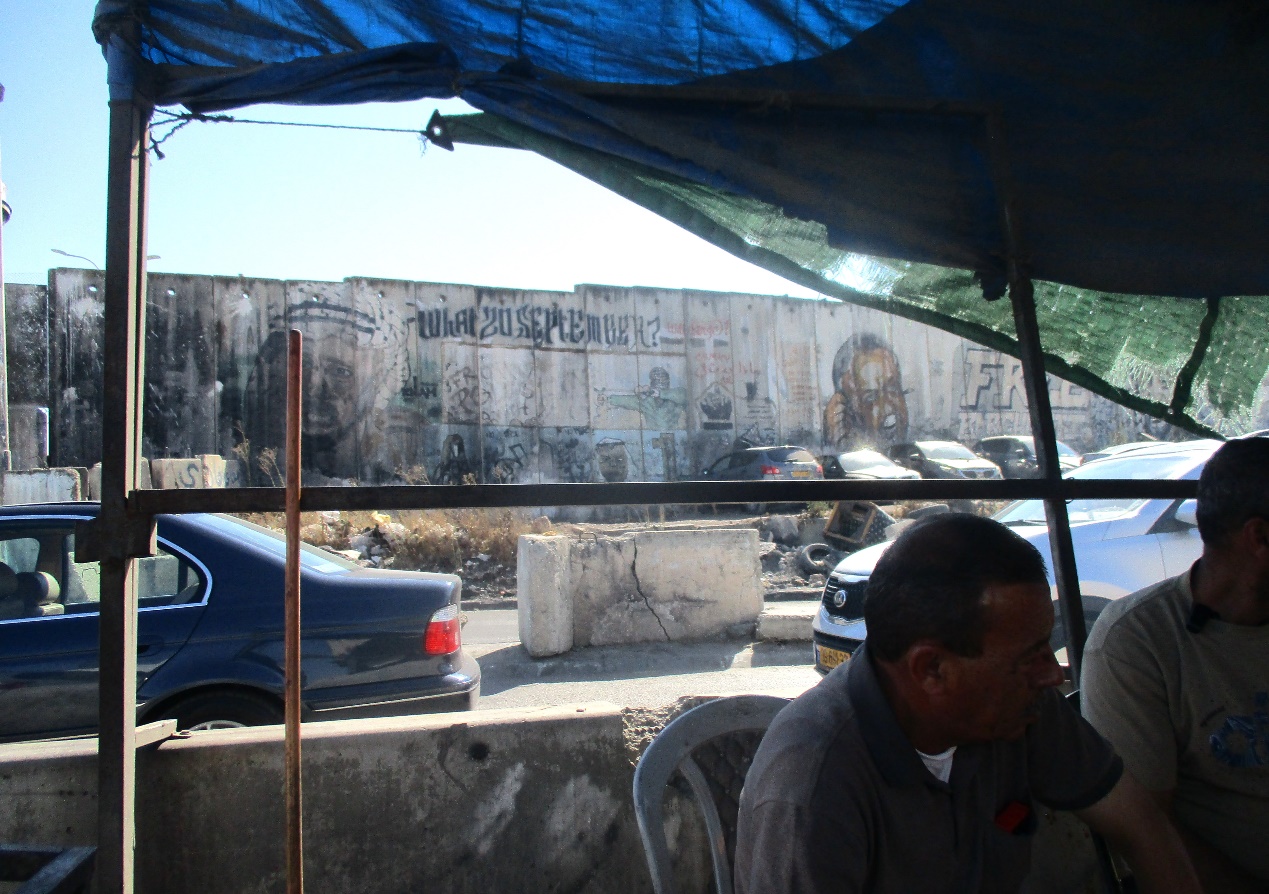 Tamar FleishmanJul-21-2026Qalandiya. Conversation in the shadow of the wall
-
Sheikh Sa'ed
See all reports for this place-
A checkpoint limited to pedestrians, located on Jerusalem’s municipal boundary.
The checkpoint sits on the separation fence at the entrance to Sheikh Sa’ad, dividing it from its neighbourhood of Jabel Mukkabar. It’s manned by Border Police soldiers and private security companies and operates 24 hours a day. Palestinians are forbidden to go through, other than residents of Jabel Mukkabar or Sheikh Sa'ad who have permits. Both groups are permitted through only on foot. Residents of East Jerusalem who don’t live in Jabel Mukkabar are also allowed to cross to Sheikh Sa’ad, but not in the opposite direction; they must return through the Sawahira ash Sharqiya checkpoint.
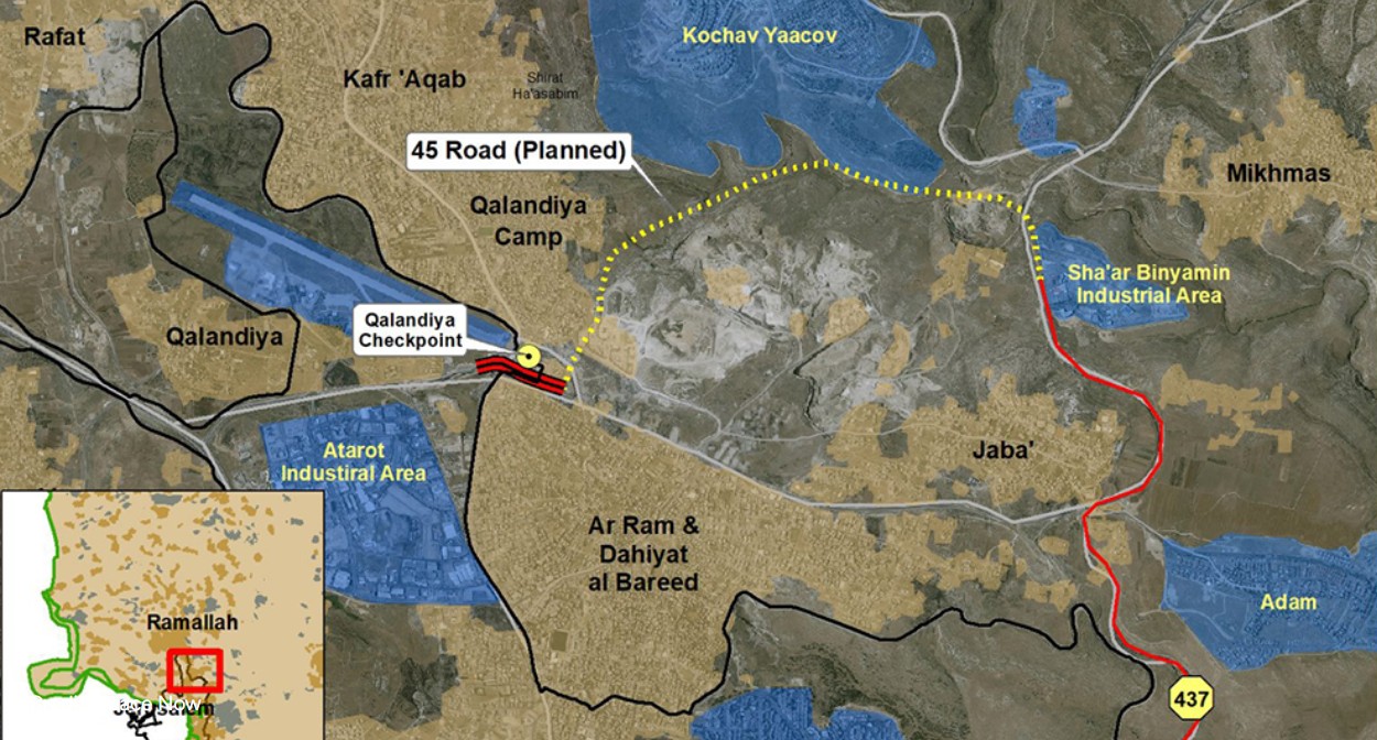 Anat TuegSep-9-2026Road 45. For Israelis only, from Road 60 near Kochav Ya'akov to the Qalandiya underpass
-
