Circling Jerusalem: Settlement expantions, home demolitions and a choke ring of checkpoints
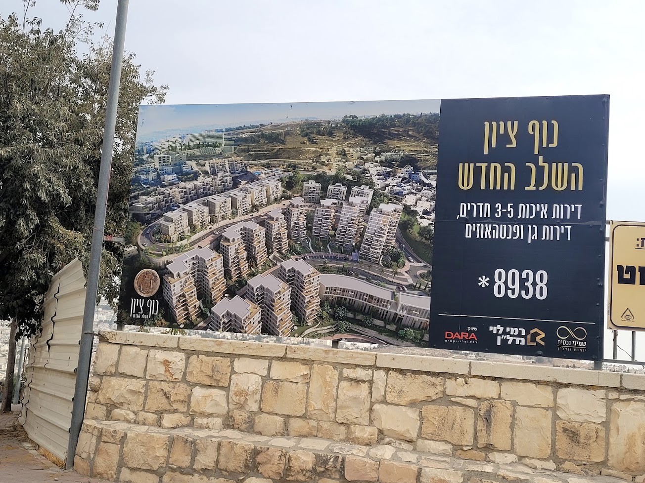
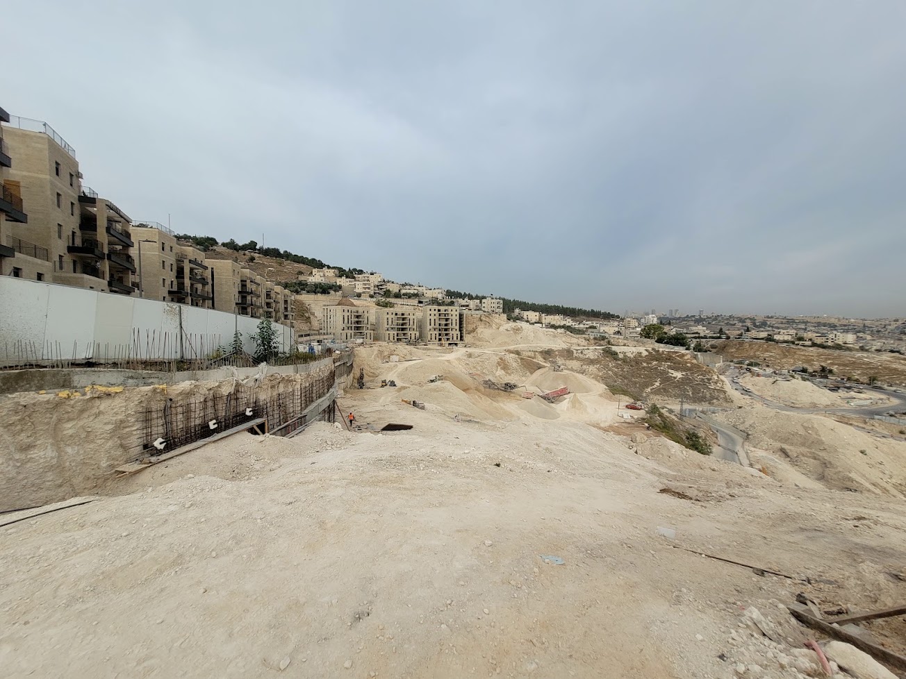
We began our “Circling Jerusalem” tour with a visit to the Nof Zion neighborhood, which we have reported on in the past. The neighborhood was established in the heart of Jabal Mukaber, south of the Old City and a short distance from the historic British High Commissioner’s Palace, which now serves as an administrative center for the United Nations. The new neighborhood, which overlooks the entire Old City, can also be seen from distant Abu Dis.
Since our last visit, the neighborhood has expanded considerably, and further expansion is planned. Initially, the project was marketed as a luxury residential development, with spacious apartments and views of the Old City, intended in part for affluent Jews living outside Israel. However, its location in the heart of a Palestinian neighborhood did not make the apartments sufficiently attractive to the original target market, and the development company ran into financial trouble.
The emphasis subsequently shifted, and the project was marketed to the national-religious public, and its construction acquired a significance extending beyond an ordinary real estate transaction: it became part of a plan to establish Israeli enclaves in the heart of Palestinian neighborhoods in East Jerusalem and the Old City.
Construction is proceeding at full speed, but there still appear to be quite a few unoccupied apartments, which may not have been sold. Another 133 apartments are planned for the religious public. This year, a plan was approved for a further expansion of the neighborhood over an area of approximately 46 dunams (about 11.4 acres), including residential units, commercial space, and public buildings. The aim of this plan is to add approximately 400 housing units.
The East Jerusalem construction workers we spoke with at length during our last visit have disappeared. In their place, one project employs Indian workers and the other Sri Lankan workers. The contractor identified on the sign is “Rami Levy Holdings.” The political octopus extends its tentacles everywhere.
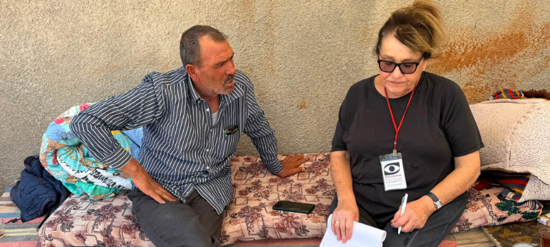
The reality in the neighboring Palestinian community: In Jabal Mukaber, it is impossible to build a pergola for a balcony, install an entrance gate, or put a door on a storage shed without municipal workers immediately arriving to demolish everything.
Al-Bustan, Silwan: Home Demolitions, Families Facing Eviction, and the Implications for the Future of East Jerusalem
We visited the neighborhood south of the Old City (see map), where two parallel processes are taking place: the demolition of Palestinian homes by the municipality on the grounds that they were built without permits, and the eviction of families from their homes following legal proceedings that allow settler organizations to take control of properties.
According to figures from B’Tselem and Human Rights Watch, approximately 2,000 Palestinians face an immediate risk of having their homes demolished and being forcibly displaced.
This is one of the main arenas in which the struggle over the character and future of East Jerusalem is being fought. The fabric of Palestinian life is being severely damaged in several neighborhoods, particularly Al-Bustan and Batn al-Hawa, but also in Wadi Qaddum and Wadi Hilweh. All these areas are affected by the extensive activities of the Elad Association, which oversees the City of David archaeological sites and the Pool of Siloam, and of the “Ateret Cohanim” trust.
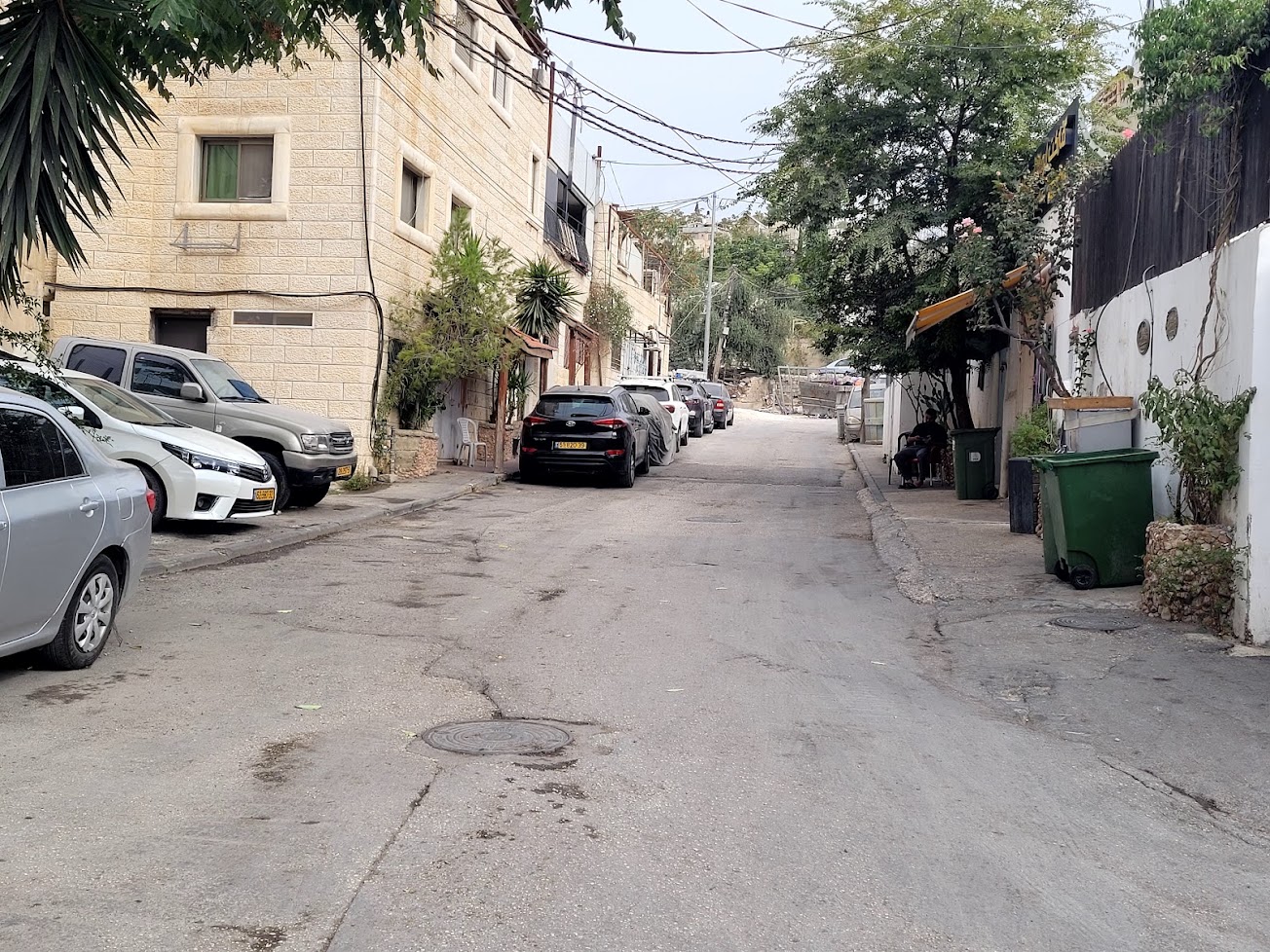
A resident of Al-Bustan Street told us that only one side of the street is being demolished; the properties on the other side have ownership documents. He showed us houses that had been demolished farther up the street, which climbs toward the slopes of the City of David complex.
Residents do not know when the demolition crews will arrive to destroy their homes. It could happen tonight, or on any day from now on.
At a street corner, an ultra-Orthodox yeshiva student approached us for a conversation. He lives in Ramot, in northern Jerusalem, and had come to support the synagogue and Torah study center in Silwan. He said he knew nothing about the demolitions, making it clear without actually saying so that the whole thing was a figment of our imagination.
“Here is our yeshiva—come in, have some tea, and let’s talk. You’ll listen and understand the truth, and it isn’t what you think…”
What has already been demolished, what is facing demolition or eviction and what do these processes mean.
Al-Bustan: Demolitions under the “King’s Garden” plan
Al-Bustan is a densely populated Palestinian neighborhood in Silwan, home to approximately 1,500 residents. It is close to the Old City and the area known as the City of David.
The King’s Garden is a Jerusalem Municipality project to establish an archaeological and tourist park. The site is traditionally associated with the biblical royal gardens, particularly those of King Solomon, although the historical and archaeological identification of the site has not been conclusively established.
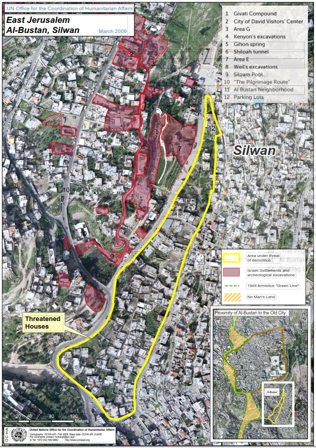
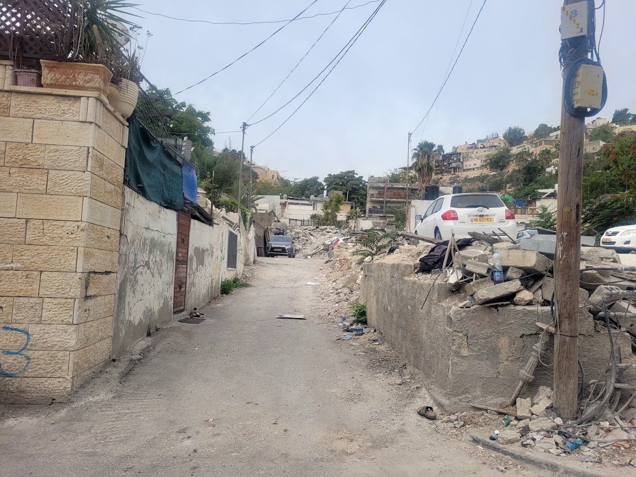
What has already been demolished? (Figures compiled by various organizations)
- From October 2023 through April 2026: according to B’Tselem, 48 homes were demolished in Al-Bustan. Fourteen of these were demolished in March and April 2026 alone, leaving 56 residents homeless, among them 20 children.
- How many more homes are at risk of demolition? According to B’Tselem, as of April 2026, another 123 families in Al-Bustan were at risk of losing their homes. This amounts to approximately 1,450 people, including around 900 children.The official justification for the demolitions is construction without permits. However, as is well known, building permits are rarely granted to Palestinians. In practice, this means that residents may lose their homes not only because demolition orders have been issued against them, but also because they have no realistic way to legalize their construction retroactively.
- Batn al-Hawa: Evictions through legal proceedings: In Batn al-Hawa, another neighborhood in Silwan, the principal threat is not the demolition of homes for lack of permits, but the eviction of residents following ownership claims and court proceedings. The main organization operating here is the settler group Ateret Cohanim. In these cases, the house itself is not necessarily demolished. Sometimes the building remains standing, but the Palestinian family that has lived there for generations is expelled and settlers move in. This is how the demographic composition of neighborhoods, including areas within the Old City, is gradually changed.
- Ein Hilweh / Wadi Hilweh – City of David: Wadi Hilweh is a Palestinian neighborhood in Silwan, close to the walls of the Old City and the City of David area. Its residents face overcrowding, a housing shortage, eviction proceedings, and home demolitions, against the backdrop of efforts by settler organizations to expand their presence in the area. The City of David is located in the area where ancient Jerusalem stood during the reign of King David. The site is managed by the Elad Association, which also works to establish Jewish residential communities in Silwan. The development of the archaeological site and the expansion of settlement activity affect the living environment of Palestinian residents and the future of the neighborhood.
Kedmat Zion: We have visited Kedmat Zion several times in the past. It is being developed in Abu Dis, immediately beyond an abandoned hotel that was confiscated by the occupation authorities and later returned to its owners, but remains vacant.
The land was purchased by Jews in 1925 with the intention of establishing a garden suburb there. However, the plan never materialized because of the events of 1929 and the security situation.
In 2004, activists from the Ateret Cohanim association moved into two houses in the compound that had been purchased with the assistance of businessman Irving Moskowitz. This marked the beginning of Jewish settlement at the site.
A plan for approximately 220 housing units was approved, and initiatives to expand the neighborhood were subsequently advanced. The aim is to establish a substantial Jewish enclave in the elevated part of Abu Dis, where the majority of the population is Palestinian.
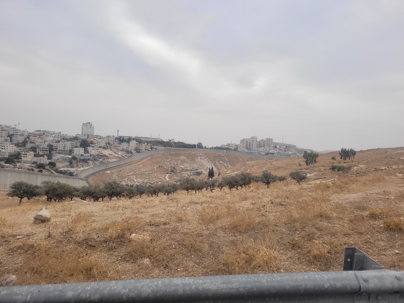
The Olive Checkpoint (Ras Abu Sbitan): For pedestrians only. The checkpoint is located on a high hill along the separation barrier, between northern Al-Eizariya, a Palestinian town, and the Jerusalem neighborhood of At-Tur. It lies on Jerusalem’s municipal boundary, far from the Green Line. It is one of the principal crossings between the West Bank and Jerusalem. The crossing is intended primarily for East Jerusalem residents holding Israeli-issued blue identity cards and for Palestinians with the appropriate entry permits.
Opening hours have been drastically reduced since the checkpoint reopened after being closed during the Gaza war. It now operates from 6:30 a.m. to 2:00 p.m. on weekdays, and from 6:30 a.m. to noon on Fridays and Saturdays.
Most people crossing are school pupils and university students, church employees, and patients on their way to hospitals in West Jerusalem.
The many reports we’ve written about this checkpoint over the years layout in detail the hardships people face, such as standing in long queues with no means of communicating with checkpoint personnel.
The Civil Administration coordination office that operated here and served the Jericho area and the Jordan Valley has been dismantled.
It’s hard to say what is worse: the events of the past or the emptiness we see today, except in the morning.
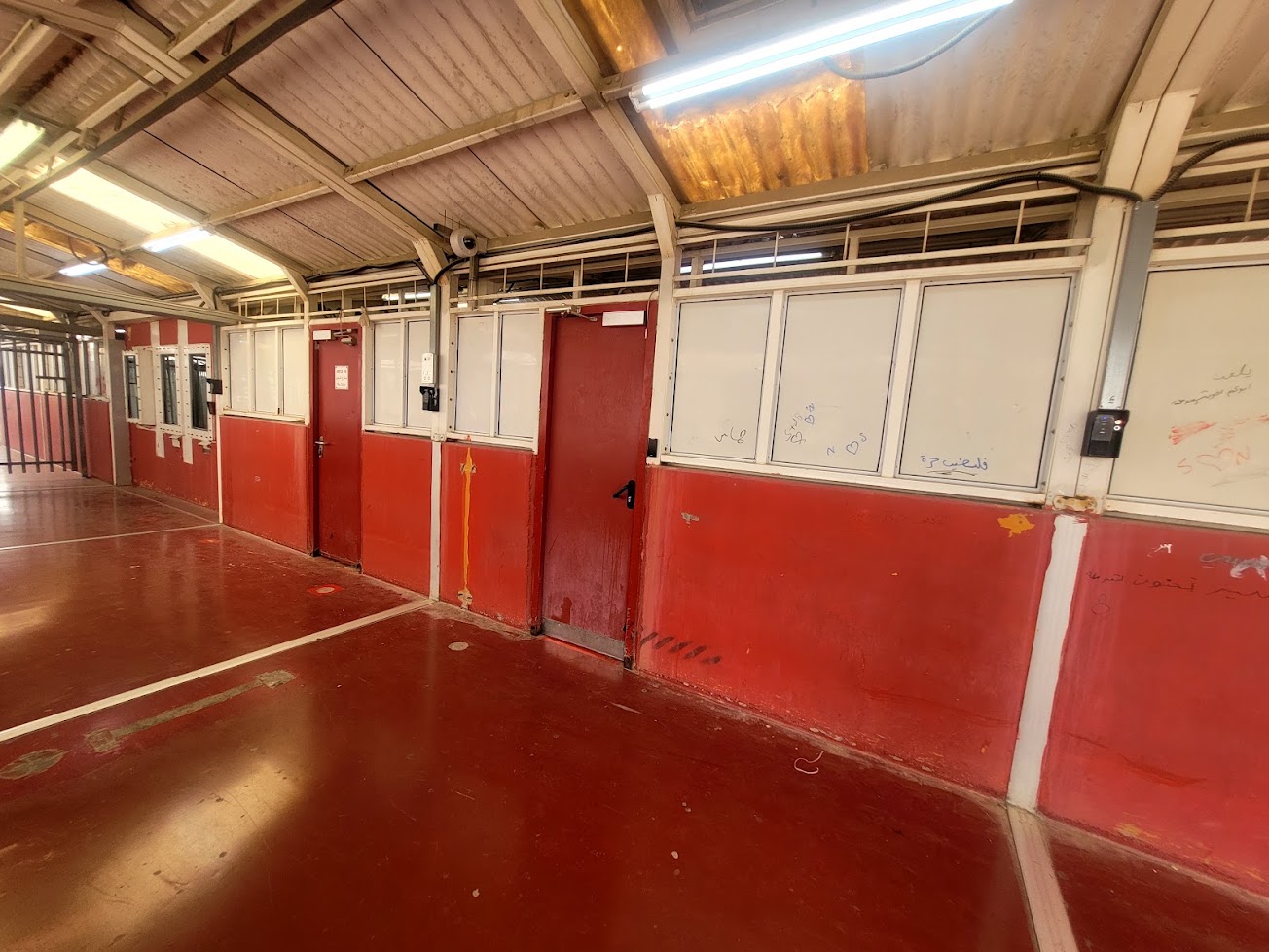
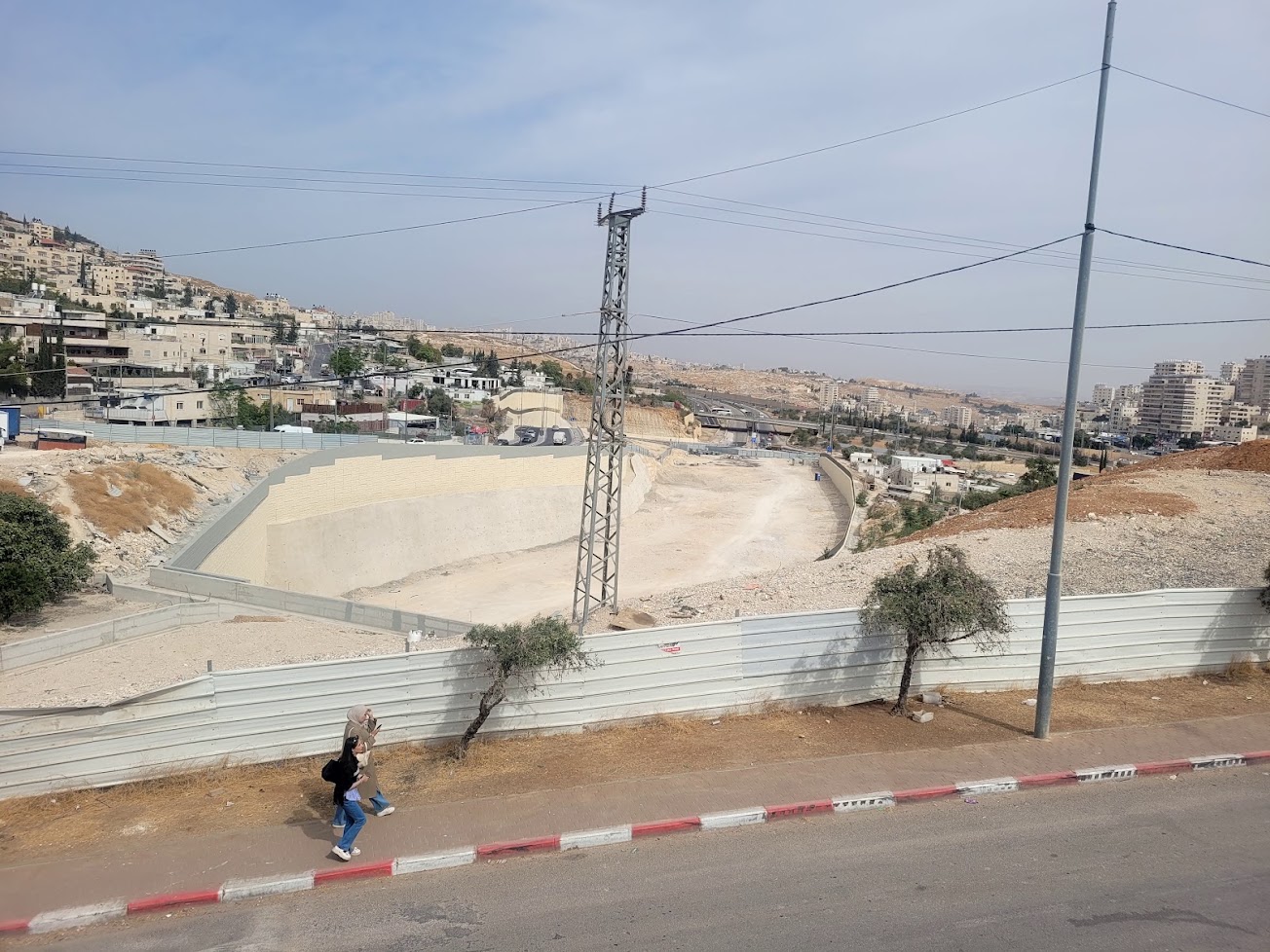
From the Olive Checkpoint, we observed the nearly completed road infrastructure leading to the Sheikh Inbar Tunnel, which will connect Jerusalem’s southern ring road to its northern ring road in the area of At-Tur, the Olive Interchange, and A-Za’ayyem.
This is a major transportation project with implications for accessibility between the southern and northern parts of the West Bank.
It will be an apartheid road, accessible only to holders of blue identity cards. In addition to the tunnel, the project will include roads and bridges.
Why is it being built? We must distinguish between the stated transportation objective—connecting Jerusalem’s neighborhoods so that East Jerusalem neighborhoods can be linked to one another without having to pass through central Jerusalem—and the project’s broader political and territorial implications.
Organizations monitoring Jerusalem’s planning policies point out that the road is not merely a transportation solution. It is part of a network of roads and infrastructure that is reshaping East Jerusalem, affecting the development of Palestinian neighborhoods, and strengthening connections between Jerusalem and the settlement areas to its east.
We spoke with a team representing the Moriah contractors, who explained that “the tunnel is being built for the benefit of East Jerusalem residents, who will be able to travel easily to the city center without traffic jams.”
Wish we could believe it…
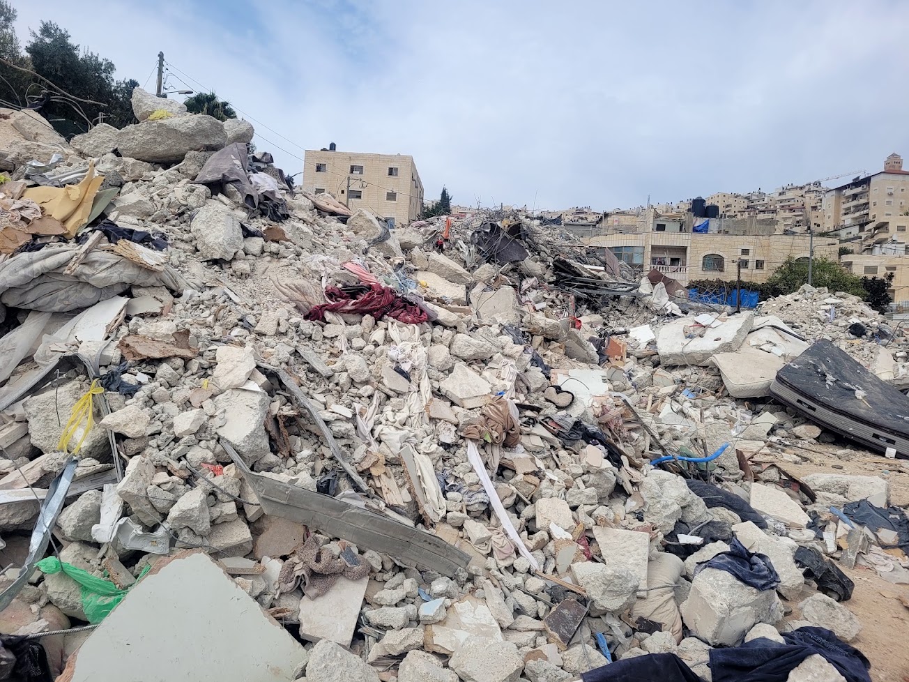
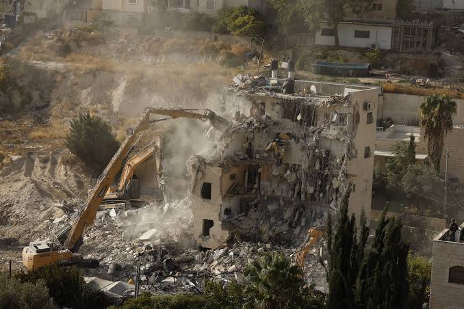
From there, we drove to see, with heavy hearts, the remains of a four-story building on the slopes of At-Tur. It had been demolished a week earlier in the presence of National Security Minister Itamar Ben-Gvir.
We had visited the building in 2021, during one of the earlier stages of the threats to demolish it. The story is familiar: there is no building permit because obtaining one is not permitted in practice. 70 people were left homeless and, as is customary, were forced to pay for the demolition themselves.
Sheikh Sa’ad Checkpoint: We have been visiting this checkpoint for years. Our trusted local contact was unavailable, but reported that the neighborhood had not been placed under a closure during the week of September 7, and that everyone was able to cross as usual. This meant, however, that passage was permitted only to pupils and students, people with urgent medical authorizations, and holders of blue identity cards indicating Jerusalem residency.:
Workers have not been allowed to enter since the beginning of the Gaza war.
A reminder of the situation: Sheikh Sa’ad lies on the southeastern outskirts of Jerusalem and is part of a continuous urban area with the Jabal al-Mukaber neighborhood, with which it has historically maintained close social and economic ties.
The separation barrier construction and the establishment of the checkpoint in 2006 effectively severed Sheikh Sa’ad from the fabric of life in East Jerusalem, even though the area is associated with the city’s municipal boundary.
The checkpoint cuts through the neighborhood. It is for pedestrians only and is staffed by Border Police officers and private security personnel. It operates around the clock.
Passage is restricted, and the ability to cross depends on a person’s place of residence and the permits they are required to hold. Even residents who are authorized to cross cannot do so by car.
Goods must be unloaded and transferred between vehicles on either side of the checkpoint—a system known as “back-to-back” transfer.
In this way, a single checkpoint becomes a daily obstacle to accessing services, earning a living, and maintaining family ties.
The situation is paradoxical: a neighborhood that falls within Jerusalem’s municipal boundaries and has close historical ties to its surroundings is physically separated from them and struggles to maintain a normal daily life.
The checkpoint turns geographical separation into a mechanism of social and economic isolation.
Location Description
Abu Dis / Lazarus gate (formerly The Wicket)
See all reports for this place-
Abu Dis / Lazarus Checkpoint/Gate (east of the former “wicket”)
Construction of the wall in the Abu Dis area blocked all the gaps that allowed people to cross from al-Ezariya to the neighbourhoods of Abu Dis and Ras al 'Amud that are located within Jerusalem’s municipal boundary. The Lazarus checkpoint is a gate in the wall adjacent to the Lazarus Monastery. Until 2011 it had a door for pilgrims to al-Ezariya and for the monastery’s kindergarten pupils from al-Ezariya. The crossing is currently closed, but the site has infrastructure for conducting inspections.
-
Jabel Mukaber (Jerusalem)
See all reports for this place-
Jabal Mukaber is located on the eastern and northern slopes of Mount Atz (or "Jabal Mukaber" in its Arabic name). It was founded by the Bedouin tribe of Arab a-Sawahra. Today, the village is considered one of East Jerusalem neighborhoods. It numbers about 30,000 residents living on 1,010 dunams. The village has five main clans, numbering several hundred families. During the British Mandate, the tribe moved to live in a huge complex of permanent housing that was named as-Sawahra, with the part east of the Kidron Valley called as-Sawahra a-Sharqiya (Eastern Sawahra) and the western part – Sawahra al-Gharbiyya. The separation fence currently separates Jabal Mukaber from Sawahra a-Sharqiya.
The houses of Jabal Mukaber wrap around the ridge from the north and east, along one of the tributaries of the Kidron River. In the eastern part, the village houses border the Jewish East Talpiot neighborhood. most of the residents of the village are considered residents of Jerusalem, have blue identity cards and enjoy full civil rights in Israel, except for the right to vote for the Knesset and receive an Israeli passport.
The residents of Jabel Mukaber suffer from lack of Outline Plan for the village, overcrowding and a lack of residential and public spaces. Thus, there is a phenomenon of illegal construction in the neighborhood. Demolitions of houses without building permits have been carried out over the years, but since the 7th October War, their rate has increased.
In 2010, a wall was built separating it from its sub-neighborhood A-Sheikh Sa'ed. The wall left many residents with Palestinian IDs without Jerusalem residency and they lost their freedom of movement in Jerusalem.
In the northern part of the neighborhood, construction began in 2005 of a luxury Jewish neighborhood called Nof Zion. The neighborhood was planned to have about 400 housing units, a commercial center and a hotel. However, in April 2025, it was announced that it would be expanded. The apartments were marketed mainly to the religious community in the United States. Alongside the Nof Zion neighborhood, a plan is being promoted to establish the Nof Zahav neighborhood on state land in the Jabal Mukaber neighborhood. This plan also includes residential areas and hotels for tourists, and a place has been allocated for a synagogue, but not for the construction of a mosque.
During and after the Second Intifada, several residents of the neighborhood were involved in terrorist attacks: On March 6, 2008, the attack on Merkaz HaRav Yeshiva in the Kiryat Moshe neighborhood of Jerusalem, in which eight of the yeshiva's students were murdered; On November 18, 2014, an attack on the "Kehilat Bnei Torah" synagogue during morning prayers in the Har Nof neighborhood of Jerusalem; A resident of Jabal Mukaber carried out a car bombing on the Armon Hanatziv promenade. The terrorist drove his truck into a group of cadets. Updated April 2025
-
Jerusalem
See all reports for this place-
The places in East Jerusalem which are visited routinely by MachsomWatch women are Silwan and Sheikh Jarrah. During the month of Ramadan, also the Old City and its environs are monitored.
-
Ras Abu Sbitan (Olive Terminal)
See all reports for this place-
A large checkpoint/crossing to the area of a-Tur, Abu Dis and the Old City; only for pedestrians. Located on Jerusalem’s municipal boundary.
One of the major crossings in Jerusalem’s central sector. It is located on the separation fence between the northern portion of the al-Ezariya neighborhood and the neighborhood of a-Tur and the rest of East Jerusalem. It is manned by Border Police soldiers and private security companies and operates 24 hours a day. Palestinians are forbidden to go through, other than permanent residents of East Jerusalem (holders of blue ID cards) and holders of work and commercial permits who are allowed through only on foot.
-
Silwan
See all reports for this place-
Silwan is south of the Old City of Jerusalem and has become one of the main confrontation areas with settlers.
-